


How do property developers use aerial mapping for site acquisition?
Before acquiring a site, property developers want to understand as much as they about its address, its value, and its planning history. They need to understand the land itself: how it sits, what surrounds it, how it is accessed, and whether anything visible from above could affect viability. In short, complete property intelligence.
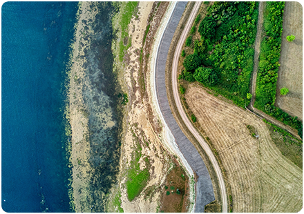
Aerial mapping offers a recent overhead view of a site and its surroundings – and that raises a vital point. It’s vital to use the most up to date mapping possible.
Alongside Ordnance Survey mapping though – as well as planning data, environmental reports, title information, and local knowledge – it can build a clearer early picture before money is committed.
Some risks are easier to understand visually than they are to absorb from a detailed report, or a granular document. At the acquisition stage, aerial imagery is often used to assess:
Site boundaries and neighbouring land
Existing buildings, hardstanding and access points
Nearby roads, tracks, paths and constraints
Vegetation, tree cover and possible habitat issues
Watercourses, drainage features or low-lying land
Evidence of previous use, storage, disturbance or informal access
The relationship between the site and surrounding development
For developers, the value is in that early insight. Aerial mapping helps to identify issues that need more checking before acquisition: planning constraints, abnormal costs, access concerns, drainage questions, ecology, contamination risk, rights of way or possible conflicts with neighbouring land.
It is also useful for comparing sites. When several opportunities are being considered, aerial imagery can help teams screen them quickly. That can save time, especially where a site looks promising on paper but presents obvious practical challenges once viewed in context.
That said, aerial mapping does have its limits. From a wider property data viewpoint, it can’t confirm ownership, replace a legal title check, prove ground conditions or provide the same certainty as a site survey. It may also show the site at a particular point in time, so recent changes may need to be checked. Its strength is that it helps developers ask better questions earlier.
In practical terms, aerial mapping supports better site acquisition by improving the quality of early due diligence. It helps developers understand the setting, spot visible constraints, test assumptions and decide whether a site is worth taking forward.
If you need aerial imagery, OS mapping or location data to support site appraisal and acquisition, we can help you choose the right property datasets and reports. The aim is to give you a clearer view of the land before the decision becomes expensive.
For further property ownership and other location intelligence, see our PDF guides.
How Emapsite can help
If you can't find exactly what you need, we can help you choose the right mapping data solution for your project via email, chat or over the phone.
For more information, reach out to our Customer Support team.
Need help with another topic? Learn more in our Knowledge Hub.
Latest News

OS NGD Explained: A beginner’s guide to Ordnance Survey’s National Geographic Database
Learn what the OS National Geographic Database (OS NGD) is, how it works, and why it matters. A simple guide to Britain’s next-generation geospatial data platform.
Read Full Article-
UK geospatial data licensing - A practical guide | OS Mastermap licensing explained
Read Full Article -
Six Location Data Challenges for Consultancies | Emapsite
Read Full Article