


How Utility Searches reduce project risk
In short, utility searches reduce project risk by turning hidden utility constraints into visible project information. Utility mapping data helps teams ask better questions earlier, before utility issues become expensive, disruptive or unsafe.
How do utilities impact a project?
For property, development and infrastructure projects, buried or overhead utilities can affect cost, design, safety and programme. Gas pipes, electricity cables, water mains, sewers, telecoms and fibre networks may all influence what can happen on a site, and where.
What does a utility search do?
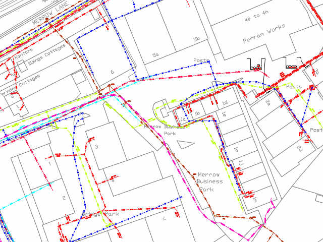
A utility search gives you an early view of those possible constraints. It is usually based on existing records from utility companies and network operators, helping you understand which services may be present in and around the land you are assessing. That can reduce risk in several practical ways:
It can support better due diligence before a site is acquired. If major services cross the land, or if diversion work may be needed, that information can affect viability, cost and negotiation.
It can help design teams avoid avoidable changes. Knowing where utilities are recorded early can influence layouts, access, drainage, foundations, service routes and construction planning.
It can reduce the chance of programme delays. Utility issues discovered late can hold up design, procurement, enabling works or excavation. A search helps flag those issues while there is still time to respond.
Utility mapping can also improve safety planning – but it doesn’t replace a physical utility survey or safe digging procedures. It can help identify which network operators and asset types need closer attention before intrusive work begins.
The key point is timing. Utility searches are most valuable when ordered early enough to influence decisions, as they help show where further investigation is needed. A search report may be enough for an early-stage review. If the project moves towards groundworks or excavation, a PAS 128 utility survey may be needed to locate and verify services on site.
If you need to understand utility risks for a site, emapsite can help you order the right utility search report. The aim is to give you practical utility intelligence early enough to protect your project from avoidable surprises.
How Emapsite can help
If you can't find exactly what you need, we can help you choose the right mapping data solution for your project via email, chat or over the phone.
For more information, reach out to our Customer Support team.
Need help with another topic? Learn more in our Knowledge Hub.
Latest News

OS NGD Explained: A beginner’s guide to Ordnance Survey’s National Geographic Database
Learn what the OS National Geographic Database (OS NGD) is, how it works, and why it matters. A simple guide to Britain’s next-generation geospatial data platform.
Read Full Article-
UK geospatial data licensing - A practical guide | OS Mastermap licensing explained
Read Full Article -
Six Location Data Challenges for Consultancies | Emapsite
Read Full Article