


Planning map requirements for house extensions
If you’re applying for planning permission for a house extension, then you’ll usually need two maps: a location plan and, in many cases, a site plan or block plan. Householder application guidance commonly states that most planning applications need both, along with drawings that properly describe the proposal.
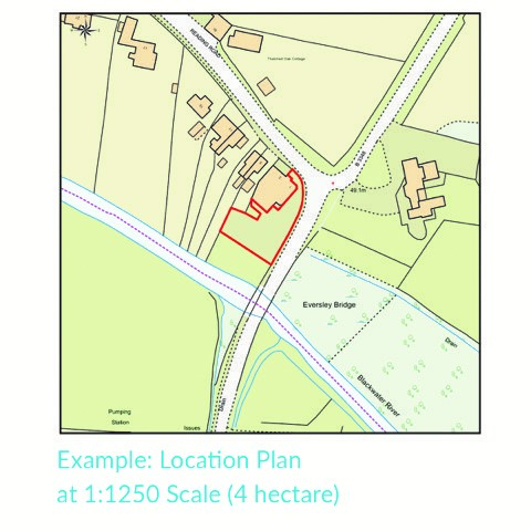
The location plan shows the property in its wider surroundings. It’s usually based on up-to-date Ordnance Survey mapping at 1:1250 or 1:2500 scale, and should show the application site edged clearly in red, with any other nearby land you own edged in blue. It should also include a north point and enough surrounding detail to identify the site easily.
The site plan or block plan is more detailed. For an extension, it helps the planning authority see boundaries, access, existing buildings and how the proposed works relate to the site. These plans are often provided at 1:100, 1:200 or 1:500 scale.
If you’re unsure, it’s always worth checking with your local authority first. But if you need to get the right planning map quickly, that is where our MapShop can help.
We can help you access the correct location plan, block plan, or both – using the right OS mapping from the outset, so your application has the best chance of starting on solid ground.
How Emapsite can help
If you can't find exactly what you need, we can also help you choose the right mapping data solution for your project via email, chat or over the phone.
For more information, reach out to our Customer Support team.
Need help with another topic? Learn more in our Knowledge Hub.
Latest News

OS NGD Explained: A beginner’s guide to Ordnance Survey’s National Geographic Database
Learn what the OS National Geographic Database (OS NGD) is, how it works, and why it matters. A simple guide to Britain’s next-generation geospatial data platform.
Read Full Article-
UK geospatial data licensing - A practical guide | OS Mastermap licensing explained
Read Full Article -
Six Location Data Challenges for Consultancies | Emapsite
Read Full Article