


What data does Idox Geospatial provide to Utility companies?
Utility companies depend on many different types of location data. Network assets need to be positioned against an accurate geographic base; new infrastructure has to be planned around land, buildings and environmental constraints; addresses need to be matched to customers and properties; and risks such as flooding increasingly need to be understood spatially.
Idox Geospatial provides access to data and services covering all of these requirements, with products for use in existing GIS and CAD systems as well as through managed and online services.
Ordnance Survey mapping and OS NGD
As an Ordnance Survey Strategic Partner, Idox Geospatial supplies authoritative OS mapping, including established OS MasterMap products and data from the OS National Geographic Database.
OS NGD is particularly relevant to utilities because it provides access to individual geographic features and their attributes rather than simply supplying a conventional digital map. Depending on the collection being used, organisations can interrogate information covering buildings, land, transport, water, addresses and other features.
This can support applications ranging from network and asset planning to risk analysis, customer profiling and management of land estates.
Address and property data
Accurate addresses provide a link between customers, properties and the networks serving them.
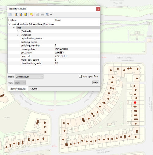
Idox supplies address datasets including OS NGD Address, incorporating Unique Property Reference Numbers (UPRNs), property classifications and lifecycle information. Managed services can also keep NGD address information updated automatically rather than requiring utilities to repeatedly download and process new releases.
Alongside address information, organisations can access land ownership and title intelligence derived from HM Land Registry data, helping teams investigate property interests and understand the land affected by proposed infrastructure or existing assets.
Terrain, elevation and 3D data
The shape and height of the land can directly affect infrastructure design. Idox Geospatial supplies terrain and elevation products including OS Terrain data and LiDAR-derived digital terrain and surface models. These can be used for tasks such as route and site assessment, flood modelling, environmental analysis, line-of-sight studies and 3D visualisation.
For utilities planning new infrastructure, combining elevation data with network and topographic information can reveal constraints that wouldn’t be apparent from conventional mapping alone.
Environmental and risk data
Utilities increasingly need to understand the environmental conditions surrounding their networks.
Available datasets cover areas such as land cover, flooding and other environmental risks, allowing spatial analysis to identify assets, properties or proposed works that may be exposed to particular conditions. This can contribute to environmental assessment and compliance as well as longer-term resilience and climate adaptation planning.
Planning and development intelligence
Networks have to respond to places as they change. Idox Geospatial’s planning application data brings together information from UK local authorities, enabling utilities and infrastructure organisations to identify proposed development and analyse changing demand or activity geographically.
Combined with address and property data, this can help organisations understand where new homes and developments are emerging and where future network capacity may be required.
How can utilities access the data?
Buying a dataset isn’t the only option. Data can be supplied in standard GIS and CAD formats for use within an organisation’s existing systems. Idox Geospatial also provides web services and APIs, allowing information to be integrated into operational applications and kept current without repeatedly managing individual data deliveries.
That choice of delivery method becomes important for utilities using the same geographic information across multiple teams or enterprise systems.
Choosing the right combination
There isn’t a standard geospatial dataset stack that every utility should buy. A network-planning team, an environmental team and a land team may all require different information, even when they’re examining the same project.
The better starting point is the operational question: what does the organisation need to understand about a location, which information will answer that question, and how does it need to reach the people or systems using it?
Idox Geospatial can help utilities identify and combine the appropriate authoritative mapping, OS NGD, address, property, terrain, environmental and specialist datasets, then determine whether those datasets are best supplied directly, through web services or as part of a managed geospatial service.
How we can help
If you can't find exactly what you need, we can help you choose the right mapping data solution for your project via email, chat or over the phone.
For more information, reach out to our Customer Support team.
Need help with another topic? Learn more in our Knowledge Hub.
Latest News

OS NGD Explained: A beginner’s guide to Ordnance Survey’s National Geographic Database
Learn what the OS National Geographic Database (OS NGD) is, how it works, and why it matters. A simple guide to Britain’s next-generation geospatial data platform.
Read Full Article-
UK geospatial data licensing - A practical guide | OS Mastermap licensing explained
Read Full Article -
Six Location Data Challenges for Consultancies | Emapsite
Read Full Article