


What map scale is required for Planning Applications?
The short answer is:
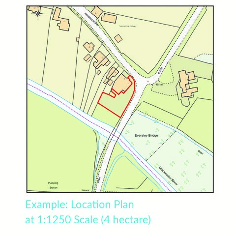
Location plan: usually 1:1250 or 1:2500
Site / block plan: usually 1:100, 1:200, or 1:500
When you’re preparing a planning application, the right map scale matters. In most cases, you’ll need a location plan and, depending on the application, a site plan too - also known as a block plan.
Location plans
For a location plan, the standard scale is usually 1:1250. If it’s a large site, then 1:2,500 is also commonly accepted. The idea is simple: the plan needs to show the property clearly in its wider surroundings, with enough nearby roads and buildings to make the location obvious. Planning Portal guidance says location plans should be based on an up-to-date map at an identified standard metric scale, typically 1:1250 or 1:2500.
Site plans/block plans
For a site plan/block plan, the scale is usually more detailed - typically 1:100, 1:200, or 1:500. This is the plan that shows what is happening on the site itself, including boundaries, buildings, access, trees, hard surfacing, and other features that may be affected by the proposal.
Planning Portal guidance describes site plans as typically being submitted at 1:200 or 1:500, while its wider maps-and-plans guidance also includes 1:100 among the standard options.
There are a few other things councils usually want, too. A location plan should normally include a north point, show the site outlined in red, and mark any nearby land in the applicant’s ownership in blue. Site plans should also show a north point and enough detail to explain the proposal properly.
In practice, that means you’ll need an up-to-date OS-based location plan at the right standard scale, and often a more detailed site/block plan too – and you can order both online through our MapShop in just a few steps.
How Emapsite can help
If you can't find exactly what you need, we can also help you choose the right mapping data solution for your project via email, chat or over the phone.
For more information, reach out to our Customer Support team.
Need help with another topic? Learn more in our Knowledge Hub.
Latest News

OS NGD Explained: A beginner’s guide to Ordnance Survey’s National Geographic Database
Learn what the OS National Geographic Database (OS NGD) is, how it works, and why it matters. A simple guide to Britain’s next-generation geospatial data platform.
Read Full Article-
UK geospatial data licensing - A practical guide | OS Mastermap licensing explained
Read Full Article -
Six Location Data Challenges for Consultancies | Emapsite
Read Full Article