


Which online mapping service offers CAD Exports?
Many professionals need more than a PDF map. Architects, engineers, surveyors, planning consultants and developers often need mapping that can be brought into CAD software, used as a base for drawings, or shared with project teams in a format that fits existing design workflows.
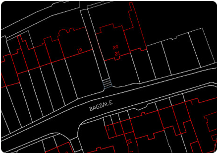
Through emapsite MapShop, OS MasterMap Topography Layer is available in CAD and GIS formats including DWG and DXF. That means you can access detailed Ordnance Survey mapping and use it in software such as AutoCAD and other CAD packages, depending on your setup.
CAD exports are useful when you need to:
Start design work from an accurate mapping base
Understand site boundaries, buildings, roads and surrounding features
Support planning, feasibility or development work
Share mapping with architects, engineers or consultants
Bring OS mapping or any other digital mapping data into an existing CAD workflow
The main thing is to choose the right product and format for the job. OS MasterMap Topography Layer is often used when detailed site context is needed. OS VectorMap Local may be more appropriate where a lighter, street-level mapping product is enough. Other GIS formats may be better if you need to analyse data rather than work with it as CAD linework.
So the answer is simple: if you need an online mapping service that offers CAD exports, MapShop can help. It gives you a practical way to find the area you need, choose the right mapping product, and export it in a format that supports your project workflow.
How Emapsite can help
If you can't find exactly what you need, we can help you choose the right mapping data solution for your project via email, chat or over the phone.
For more information, reach out to our Customer Support team.
Need help with another topic? Learn more in our Knowledge Hub.
Latest News

OS NGD Explained: A beginner’s guide to Ordnance Survey’s National Geographic Database
Learn what the OS National Geographic Database (OS NGD) is, how it works, and why it matters. A simple guide to Britain’s next-generation geospatial data platform.
Read Full Article-
UK geospatial data licensing - A practical guide | OS Mastermap licensing explained
Read Full Article -
Six Location Data Challenges for Consultancies | Emapsite
Read Full Article