


WMS vs WFS vs WMTS: Which is best for mapping?
WMS, WFS and WMTS all deliver geospatial data over the web, but they each do different jobs. For utilities, choosing between them depends on how the mapping will actually be used.
WMS: best for viewing mapping
A Web Map Service (WMS) generates map images from geographic data. Users display the mapping in compatible GIS or other applications without downloading and maintaining the underlying dataset.
For a utility that needs authoritative mapping as context for its own network or asset information, WMS can be a straightforward option. The user sees the map rather than working directly with the individual features behind it.
WMTS: best for fast map display
A Web Map Tile Service (WMTS) also delivers map imagery, but uses pre-rendered tiles at defined scales. Because those tiles can be retrieved quickly, WMTS is particularly useful where performance matters – for example, when mapping needs to be displayed rapidly to many users.
WFS: best for working with geographic features
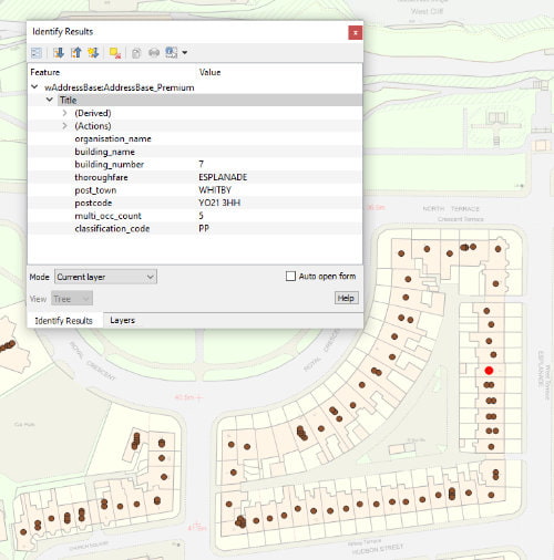
A Web Feature Service (WFS) provides access to the actual geographic features and their attributes. Instead of simply viewing a road, building or other feature on a map, users can query and analyse the underlying information.
That makes WFS useful for utility workflows where spatial data needs to form part of analysis rather than simply provide geographic context. So, which should a utility choose?
If the requirement is to view authoritative mapping, WMS may be enough. If fast map display is the priority, WMTS may be preferable. If teams need feature-level data that can be queried and analysed, WFS is likely to be the better fit.
In practice, utilities may use more than one. A system could use WMTS for a fast basemap while WFS supplies particular features required for analysis. The question isn’t therefore which technology wins, but which combination best supports the workflow.
Idox Geospatial provides managed OGC-compliant WMS, WMTS and WFS services across a wide range of authoritative geospatial datasets. We can help utilities choose the appropriate service – or combination of services – so data arrives in the form that best suits the people and systems using it.
How Emapsite can help
If you can't find exactly what you need, we can help you choose the right mapping data solution for your project via email, chat or over the phone.
For more information, reach out to our Customer Support team.
Need help with another topic? Learn more in our Knowledge Hub.
Latest News

OS NGD Explained: A beginner’s guide to Ordnance Survey’s National Geographic Database
Learn what the OS National Geographic Database (OS NGD) is, how it works, and why it matters. A simple guide to Britain’s next-generation geospatial data platform.
Read Full Article-
UK geospatial data licensing - A practical guide | OS Mastermap licensing explained
Read Full Article -
Six Location Data Challenges for Consultancies | Emapsite
Read Full Article