
OS MasterMap 3D Building Heights
Ordnance Survey MasterMap Topography Layer® with built in 3D building height attributes and OS Terrain 5, creating a complete product saving time and money.
OS MasterMap Topography Layer® with built in building height attributes and OS Terrain 5 offers 3 products in one. Suitable for CAD and GIS users alike, with an optional PDF at no extra cost, this popular combination is saving time and money for many.
Search and select your site and extract your OS MasterMap plus any other data you need in a range of CAD or GIS formats.
About OS MasterMap 3D Building Heights & Terrain 5
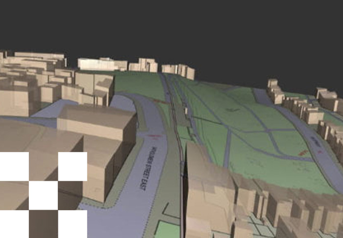
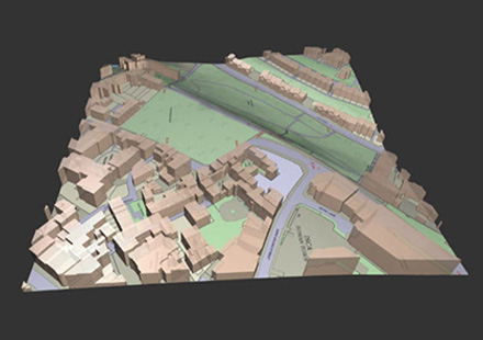
OS MasterMap 3D Building Heights & Terrain 5 combines Ordnance Survey MasterMap Topography Layer® and its building height data with OS Terrain 5 for a time saving cost effective solution.
OS MasterMap Topography Layer® is the Ordnance Survey's most detailed, current and comprehensive map dataset of Great Britain. emapsite have created a single product that builds in the OS MasterMap Topography Layer building heights data and OS Terrain 5 height data into a single file (in DWG form), offering a product that has proved incredibly popular.
Download Samples:
CAD: DWG Standard with Building Heights, DWG Colour Plan with Building Heights, DWG Design with Building Heights
GIS: SHP
PDF: PDF

Unrivalled resources
We simplify the supply and management of mapping products, plans and reports. Blending diverse datasets to uncover hidden commercial insights.

Business intelligence
Our spatial intelligence enables our clients to pinpoint areas of risk and reward, and to make better business decisions faster.

Proven partnership
We work in partnership, we're supportive, and we're committed to reducing our own and our clients' impact on the environment.