Emapsite News and Views
Filter
Categories:
Year:
-
![]()
The Hidden Data Issues Holding Back Consultancy Projects
Location data is critical to consultancy work, yet common issues like outdated datasets, licensing uncertainty, and incompatible formats can slow projects down and increase risk. This infographic explores six of the most frequent location data challenges faced by consultancies today — and how teams are overcoming them with reliable, compliant, and easy-to-use spatial data.
-
![]()
Rising waters, rising stakes: Why futureproofing assets against flooding is critical for Britain
A recent investigation by The Guardian has revealed a sobering reality: millions more properties across Britain are now at risk of flooding as climate change intensifies. This makes it more crucial than ever to act - and to ensure those actions are guided by reliable, high-quality data.
-
![]()
Why address data is the unsung hero in the UK’s new-build recovery
Based on insights from our latest whitepaper, New Builds, New Advantages, we explore how early access to accurate address data can unlock commercial gains. Read on for the highlights – or dive deeper by downloading the full report.
-
![]()
Decoding the OS National Geographic Database - the opportunity for Utilities
The OS National Geographic Database (OS NGD) offers utility companies powerful, up-to-date geographic data to improve asset management, risk planning, and sustainability efforts. While adoption has been slow, partners like Idox Geospatial make access and integration easier than ever.
-
![]()
Geospatial Expertise For Greater Returns On Greener Insurance
This blog explores how geospatial insights can cut through the noise, helping insurers find, assess, and manage renewable projects with greater accuracy and confidence. The result? Smarter strategies, greener portfolios, and stronger returns.
-
![]()
-
![]()
Data Currency
Discover why up-to-date location data is essential for risk management, compliance, and future-proofing your projects. Learn how accurate data helps industries navigate climate change, infrastructure challenges, and regulatory shifts.
-
![]()
Merry Christmas 2024 from Emapsite
The Emapsite team would like to wish you a very Merry Christmas and all the best for the New Year. Please read on to see our opening hours over the Festive period.
-
![]()
Fibre Challenges 2024
Emapsite’s Natalie Stevens considers fibre’s hottest topics – and offers her expert take on each.
-
![The Challenges Affecting Social Housing article title with a photo of houses, streets, gardens and cars in a UK town.]()
Talking Points: Housing Community Summit
Idox Geospatial’s Fiona Frost considers social housing’s hot property topics – and offers her expert take on each.
-
![]()
Data can be powerful...
But does your data pose a risk to analysing risk? The three things stop you from being competitive, we share three simple solutions.
-
![]()
Planning for the Future
As the State Opening of Parliament confirms expected reforms to planning, streamlining processes, leveraging location analysis, and prioritising sustainability are essential to meet future housing and infrastructure challenges.
-
![]()
Women in geospatial at Idox
For International Women's Day Fiona Frost (UK Account Manager, Emapsite) and Alison Moon (Head of Geospatial Projects, Idox), to share some of their thoughts on 'women in geospatial'.
-
![]()
Future-proofing fibre
Location data enables fibre builders and alternative network providers to reach more customers and drive growth by future-proofing fibre networks. Emapsite is at Connected Britain 2023 to explain how.
-
![]()
Unlocking the Power of OS MasterMap®: A Comprehensive Guide
Discover more about OS MasterMap® features, applications and benefits for professionals.
-
![]()
Emapsite.com is now part of Idox plc
Emapsite is delighted to confirm its acquisition by Idox plc, a leading provider of specialist information management software and solutions to the public and asset-intensive sectors.
-
![]()
Mapping the future of business
How location data can identify land and property risks and opportunities.
-
![]()
Ask Emapsite about Licensing
How do you navigate the licensing labyrinth? We know map licensing inside and out, and we want to help you to get outstanding results from the data you’ve licenced. Check out our essential overview.
-
![]()
Empower Your Sustainability Strategy
More and more organisations are discovering that location is where the answers to their sustainability challenges lie.
-
![]()
Emapsite flood risk mapping and data
The BBC recently published details of a detailed "future flood map" of Britain. Having access to accurate and detailed flood data is essential for understanding the extent, frequency, and intensity of flooding events in a particular area.
-
![]()
Know your Geospatial Data Services
WMTS (Web Map Tile Service), WFS (Web Feature Service), and WMS (Web Map Service) are all web-based geospatial data services that allow for the delivery of geographic data over the internet. This week we explain the difference.
-
![]()
Emapsite announces LandPack GreenAccess
Responding quickly to good news for the environment this week, Emapsite’s LandPack GreenAccess dataset is being released to help teams who’ll now be hard at work to help meet the UK government’s new open spaces target.
-
![]()
How do I create a location plan?
A location plan helps to show wider impact on the location. If your planning authority requests this they will need more detail of the area. Create your location plan now.
-
![]()
Quick Guide to Site Plans for Planning Applications
Site / Block Plans and Location Plans available from our new Plans Platform. Here we explain what a site plan is and why it's sometimes referred to as a block plan.
-
![]()
Last Mile to Fast Mile
In e-commerce and logistics, the final stage of customer delivery – the last mile – can be the most inefficient, expensive and challenging. But it needn’t be that way. Here, we examine the intricacies of reaching the ultimate delivery point at speed and consider proven strategies for success.
-
![]()
Subsidence Risk analysis
Many organisations are now looking at recent weather patterns to work out how subsidence might affect property owners over the longer term. We're asking, "why aren't more teams analysing subsidence risk right now?"
-
![]()
Emapsite is carbon neutral
Since March 2022 Emapsite has been carbon neutral, find out more.
-
![]()
AddressPollution - New Product
Identify air pollution at individual property levels
-
![]()
Celebrating 21 years in Business - Emapsite's geospatial journey
As we look back on 2021, we reflect on the past and focus on the future
-
![]()
Meet the Team: Liz Scott
Next in the spotlight of our ‘meet the team’ series is Head of Data and Insights, and author of our recent blog post on net zero and sustainability, Liz Scott.
-
![]()
The Role of the Geospatial Sector in Driving ‘Net Zero’
At emapsite, we believe that the geospatial sector can be pivotal in unlocking invaluable insights that can also help tackle climate change and drive to ‘net zero’ emissions. Head of Data and Insights, Liz Scott, explores how.
-
![]()
Meet the Team: Rich Pawlyn, Managing Director
People are at the heart of emapsite, we are proud of our flexibility and commitment to go the extra mile for our customers. Over the next few months, we will be running a series of blogs introducing our team. First-up is our MD, Rich Pawlyn.
-
![]()
Understanding the Role of Geospatial Insight in Digital Transformation
As we see more and more businesses create competitive value from detailed geospatial insight, emapsite MD, Rich Pawlyn discusses how innovative leveraging of geospatial data can support an organisation's digital transformation strategy.
-
![]()
Connecting to tidal power.
Tidal turbines and hydropower are an important part of the Renewables mix, but connecting offshore to onshore is an ongoing challenge.
-
![]()
What's next for housebuilders?
The government has announced a new, ‘computer-based’ formula to identify sites for new-builds, but the goal posts are shifting as we look to a post-pandemic development landscape.
-
![]()
A little bit of Christmas
A quick thank you and an update on our opening hours over the festive period
-
![]()
Locating your location data - survey
Ordnance Survey are keen to further understand what influences purchase decisions when buying location data. To better understand this, OS and Locatum have designed a short survey, and have requested the views of emapsite customers.
-
![]()
Insurance bombshell needs evasive action
As the consultancy period over the FCA’s recommendation to eradicate the practice of price walking of insurance premiums nears completion, we look at how location data can help remodel risk profiles.
-
![]()
Emapsite is expanding its range of flood modelling data
emapsite is expanding its range of flood modelling data for specialists through its new partnership with Ambiental Risk Analytics.
-
![]()
Introducing some new faces
emapsite is expanding. Many clients are looking for very specific support at the moment, as core teams are handling their customers’ quickly changing needs due to Covid. Our new team members are here to help at a moment’s notice:
-
![]()
Emapsite on the G-Cloud 12 Digital Marketplace
Emapsite is proud to be listed once again as a solution-provider for location data services via the Government’s online procurement portal, G-Cloud 12.
-
![]()
Access to mapping made easy, through LSBUD searches
It’s now become second nature to run a search on the LineSearchB4UDig (LSBUD) portal, in most projects. We provide instant access to the mapping options that enable LSBUD users to tie their search results to the right mapping for their site.
-
![]()
Enterprise brain damage and the data wonks
Companies want a competitive advantage and they’re looking at their data for intelligent answers that will make sense right across a portfolio. Why is the enterprise finding it so hard to manipulate and present business intelligence well?
-
![]()
New Spatial Insights division launches at Emapsite
emapsite has launched ‘Spatialise’, a service that draws on the team’s geospatial data expertise to reveal hidden insights, manage spatial data, and enrich customers’ own data by giving it unique added value.
-
![]()
Emapsite supplements Technics Group offering with mapping and data services
emapsite and Technics are building on a long-standing relationship to deliver mapping and data services to Technics clients.
-
![]()
New top team at emapsite
emapsite announces Richard Pawlyn as Managing Director with Susan Harvey joining the leadership team as Finance Director.
-
![]()
emapsite - response to PSGA announcement
Location data has the potential to improve everyone’s lives. We are pleased to hear that a new, 10-year Public Sector Geospatial Agreement (PSGA) has been commissioned.
-
![]()
Update for Emapsite customers regarding Coronavirus (Covid-19)
In response to the current and ongoing impact of Coronavirus, we would like to reassure customers that our website and other services will continue to operate without disruption to our customers.
-
![]()
An increase in rainfall, an increase in insight
A flood may cause hardship and mental anguish for families, and a loss of business – current and future – for commercial enterprises. There’s never been a greater need to make sure we’re using flood data properly, with as many stakeholders as possible factoring it into their analysis
-
![]()
Data, data, data...value
For professionals, the new Groundsure Insight reports really do set a new standard in landscape discovery and detailed insights about a specific environment. We look at what these new reports bring to our customers.
-
![]()
The ownership data challenge for Housing Associations
How can Housing Associations avoid paying too much for the data they need? emapsite's Social Housing sector expert, Lee Williams, tells us how.
-
![]()
Mapping the journey to a greener world
Cymru wants to lead the way to a greener world – but will all of their stakeholders be mapping the journey as well as they could be?
-
![]()
Understanding Empty Homes
Last week was National Empty Homes week, but homelessness doesn’t use a calendar. The information detailing our nation’s empty home portfolio is easily accessible, and there are many different types of agency that would benefit from using it more effectively.
-
![]()
Taking care of the natural world
It was good to hear the recent government announcement advocating more consideration for wildlife protection across in Britain. Our natural habitats and the biodiversity they support will always be national, capital assets – but our developer community should capitalise on them for their own benefit, as well as the greater good.
-
![]()
Dig deep? Yes! And at a lower cost…
We’ve partnered with LinesearchbeforeUdig to create a ‘One Click’ service that helps you save time and reduces the costs of finding and understanding the location of sub-surface assets, across the UK.
-
![]()
Keener insights, greener energy
The renewables’ sector needs to capture more-tangible value in its supply chain. How can businesses make better-informed decisions? With location data insights…
-
![]()
Who Owns What Today – and Tomorrow?
Keeping on top of who owns what is a full time job, which is why we work so hard on relationships with key data suppliers, so we can give you whole picture.
-
![]()
And the winner of emapsite Fantasy Football Manager 2018/2019 is......
emapsite is delighted to announce the winner of its popular Fantasy Football League. With the 2018/19 season attracting another great batch of wannabe Football Managers, participants from emapsite and many of our clients await the announcement with baited breath...
-
![]()
New mapshop now live
The Beta version of our all new mapshop application is now live.
-
![]()
Taking on the Brownfield Challenge
Land Consultants and Agents are under pressure to reappraise their thinking and search for suitable alternatives to open land for development - by taking on the Brownfield challenge.
-
![]()
Open Data - Under Surveillance
Can Open Data ever really be open? Be careful what you wish for, warns emapsite's James Cutler.
-
![]()
Expanding on Wind Sector Investment
The government’s new deal for the offshore wind sector aims to ensure production of up to one third of the UK’s electricity needs using wind power by 2030. emapsite’s Natalie Stevens considers the welcome challenge for the renewables sector.
-
![]()
Join us at the Cadcorp Local Govt Conference 2019
We're looking forward to the annual Cadcorp event at which emapsite's Lee Williams will be sharing our expertise on navigating HM Land Registry Data.
-
![]()
Time's been called on OS ITN
Ordnance Survey is withdrawing its Integrated Transport Network product from 31st March 2019, but OS MasterMap Highways is more than up to the job.
-
![]()
It's a thank you from us...
2018, what a year! We just wanted say “thank you” to all of our customers, it’s been an exciting 12 months of mapping (and moving!), and we’d like to wish you all a Happy Christmas. This year, we’re supporting the Bone Cancer Research Trust (#bcrt) and the Oxford Hospitals Charity, with very good reason. Throughout 2018, our CEO, James Cutler, has put himself through the mill, fundraising in memory of a young family friend: Tom Stead.
-
![]()
Christmas Opening Hours
Our website continues to be available for standard orders and downloads throughout the holiday period. Our support team will be available until 2pm on 24th December and return on 2nd Jan 2019.
-
![]()
Emapsite CEO James Cutler gets our vote!
We're delighted to say that James Cutler, our CEO, has once again been elected to Ordnance Survey's Partner Advisory Council - and will also be taking forward his role with the Association for Geographic Information into 2019.
-
![]()
Subsidence claims have gone up, but insurers could be bringing those risks down
Reports by the Association of British Insurers show the impact of this year’s heatwave, with subsidence claims reaching their highest levels for 12 years. Yet many insurers still aren’t using the tools available to help reduce these risks.
-
![]()
We're recruiting!
emapsite continues to grow and we're looking for talented people to join our team.
-
![]()
When is innovation, useful innovation?
emapsite solves big problems with simple solutions as Director of Sales, Daniel Slater, explains
-
![]()
Emapsite selected for TechMarketView's ‘Great British ScaleUp’ programme
We’re delighted to say emapsite has been included in the prestigious TechMarketView Great British Scaleup programme, in association with ScaleUp Group.
-
![]()
UPRNs - not new but in the news
We're seeing UPRNs being referenced more frequently in the mainstream media. Lee Williams discusses the value of the Unique Property Reference Number
-
![]()
Subsidence claims are up - so what can insurers do?
Subsidence still represents around 4% of all claims per annum, which in real terms is between £110 million and £120 million every year – so the question is, can insurers do anything to help combat this problem?
-
![]()
Coldplay, the kings of geo?
It’s the X&Y of things that connects people, places and processes. CEO James Cutler ponders whether there's more to it than that...
-
![]()
emapsite on the move....
Hi-ho, hi-ho it's off to Farnborough we go...
-
![]()
Emapsite approved for Government's Digital Marketplace
Emapsite has been selected as an approved supplier on the latest version of the Government's G-Cloud services framework
-
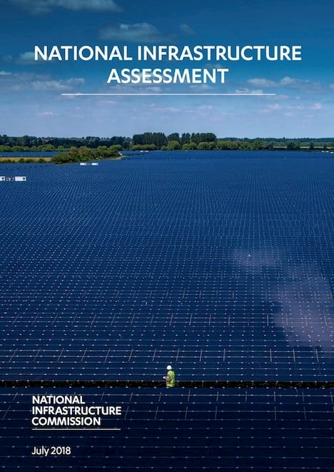
![]()
Where is the where in the NIA?
emapsite CEO James Cutler looks at the 'geo' (or lack of) in the National Infrastructure Assessment published today.
-
![]()
OS MasterMap Announcement
At Emapsite, we always welcome better access to information that can help our customers drive the economy forward. Today’s announcement by the Geospatial Commission on the opening up of OS MasterMap signals a long-term commitment to helping everyone get more value from mapping and location data.
-
![]()
Changing the landscape of insurance
Insurers: imagine discovering there’s a more cost-effective way to increase your competitive edge, while at the same time reducing your exposure to risk. Forget the advent of innovative fintech; don’t worry about pay-as-you-go pricing; just think what your bottom line would look like if actuarial teams’ insights were, say, 2% more accurate in predicting the likelihood of claims across a multi-billion pound book of insurance.
-
![]()
New data product adds clarity to Plus Dane's management of housing stock
Plus Dane Housing Association has been working together with data provider emapsite to assist in the creation of an innovative data product to use for asset management of their housing stock.
-
![]()
Emapsite team takes on the Windsor Half-Marathon
A visit to the Emapsite offices will confirm a number of things - we know an awful lot about location data, we like having fun and we have a serious cake habit!
-
![]()
Emapsite celebrates listing on Government's Digital Marketplace
We're pleased to announce that the UK Government has approved emapsite in the latest version of the G-Cloud services framework.
-
![]()
Leica Geosystems and Emapsite announce new strategic partnership
Leica Geosystems and Emapsite announced today a strategic partnership which launches an industry-first subscription service to Ordnance Survey flagship product, OS MasterMap, available exclusively on the Leica Zeno 20 high accuracy field data collector.