
How do I create a Location Plan?
What is a location plan?
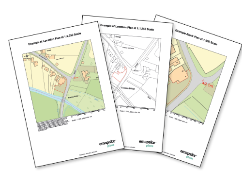
A location plan is the “WHERE” aspect of your planning application. It shows where you are proposing your development and will include a fairly large area around the development site. It is typically submitted at a scale of 1:1250.
How do I buy a location plan?
You can easily create your location plan and all other required plans on our plans portal. Click the link below.
Our custom planning maps are 100% compliant
with current government planning guidelines.
We are a Licensed Ordnance Survey Partner

What is the purpose of a location plan?
It helps to show wider impact on the location. If your planning authority requests both a block plan and a site plan they will require more detail of the area around the proposed development, details further out than your boundaries.
What should a Location Plan show?
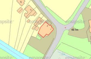
Location plans show roads that are nearby, other buildings, and other properties and parcels of land in the area. They’ll usually include the site at a scale of 1:1250 and the precise position of the building, any other structures inside the boundaries, other land owned by the same person, and details such as car parking.
OS MasterMap PDF Location Plan
A plan at 1:1250 scale in PDF format tailored for submitting to your local authority for a range of planning applications
More info >All Location Plans come complete with a north arrow and scale bar automatically. Your plan is free to edit after purchase.
Location Plans are processed automatically and a PDF plan is emailed within minutes.
Unusually large plans are made available to download, which also typically takes just a few minutes.
Location Plan PDFs are ready to send to your local authority electronically and ready to print.
Licence: PDF
Technical Details
- Supplier
- Ordnance Survey
- Update Cycle
- 6 weekly
- Coverage
- GB
- Scale
- 1:1250
- Formats Available
- PDF, PNG
- Stated Accuracy
- Stated Accuracy
- Stated Accuracy
- Licence Options
- Perpetual
- Delivery Timescale
- Within minutes
Related Products
OS MasterMap Topography Layer, Aerial Photography
Download Samples
OS MasterMap PDF Site/Block Plan
A colour plan at 1:500 scale in PDF format tailored for submitting to your local authority for a range of planning applications.
More info >All Site/Block Plans come complete with a north arrow and scale bar. Your plan is free to edit after purchase.
Site/Block Plans process automatically and are ready within minutes.
Unusually large plans are made available to download, which also typically takes just a few minutes.
Site/Block Plans are ready to send to your local authority electronically and ready to print.
Licence: PDF
Technical Details
- Supplier
- Ordnance Survey
- Update Cycle
- 6 weekly
- Coverage
- GB
- Scale
- 1:500
- Formats Available
- PDF, PNG
- Stated Accuracy
- Stated Accuracy
- Stated Accuracy
- Licence Options
- Perpetual
- Delivery Timescale
- Within minutes
Related Products
OS MasterMap Topography Layer, Aerial Photography
Download Samples
OS MasterMap 1:500 Scale Block/Site Plan in Colour (A4): PDF
(Black & White also available)