Mapping & Data for EV Charging

Emapsite offers a unique combination of self-service mapping, contracted mapping & data and web services. 

We understand not all EV charging companies work in the same way, or need the same data. Through our unique combination of data and services we can save you both money and time. From constraint modelling to site finding, through to planning permission and construction.

Why do EV Charging businesses choose Emapsite?

We have the full suite of OS background mapping including OS MasterMap, 1:25,000, 1:50,000 and Terrain data in the Mapshop, but we are finding increasingly EV charging planners and builders are coming to us for extra data, where there are holes in what your client can provide, especially public sector work, or where extra information can help with planning challenges.

We have over 100 data sets in our self service mapshop, and more than double that available offline.

We are always happy to discuss your project and help you get the right data.

• Easy to use self-service Mapshop.

• No MasterMap viewing charges.

• 30 day refund policy*

• Multiple CAD and GIS formats

• Land ownership data

• Underground utility data

• Business location data

• Predictive future flood modelling

• Free reprocessing to get the latest map version

• Access to mapping for Local Authority clients under their PSGA licence

• Competitive prices and pay-as-you-go, no monthly costs

This together with other data like Terrain, Aerial imagery, and groundwater all available when needed.

Mapping to support your project

The most used data sets by EV charging infrastructure designers and builders:

OS MasterMap

Available for you free to view; accurately select your site without incurring charges. Choose your preferred format/s and download in minutes. Including ready-made planning formats in PDF. OS MasterMap is updated every 6 weeks and you can reprocess your data free within the licence period, this means you’ll get the latest version.

LandPack Land Title and Tenure

Our LandPack Land Title and Tenure was developed in house to help you understand land ownership; enhanced with title numbers for all polygons, and full commercial ownership details, this data can be viewed or queried to help you understand your site, or find other land owned by the same company.

Business information

Points of interest is a data set that will allow you to see where existing business, or electrical features such as substations are located. It will give you the X,Y and business details for your specific preference, with over 4 million points and businesses listed throughout GB, we can help you drill down to the most useful data for your needs.

Flood Data and Reports

We have a full range of reports covering flood, environmental and geological information, future proof your site by using flood data modelled for climate change, and if you aren’t sure what you need, we will always be happy to advise and send samples for you to evaluate.

Utility Reports and Digitisation

Emapsite offer 5 different options for utility reports from single utilities, through to comprehensive reports that contact 140 providers for contribution. The initial report is a PDF but you have the option to have these digitised for CAD/GIS.

Aerial Imagery

Choose and compare imagery from 3 suppliers in one place. You can access imagery from 12.cm to 5M resolution with varying capture dates, enabling you to get what is most appropriate for that particular scheme.

Historical Mapping / Historical Land Use 

Choose from a range of historical mapping and historic land use. A range of digitised maps are available from 1805 onwards, with large scale mapping from 1:2500 scale. These maps can give insight into historic land use that could affect your project.


Reasons to work with Emapsite

Aside from our consultative approach, and no MasterMap viewing fees, if you or your client changes the project scope, and you have already purchased OS data, just buy the new area and, providing it’s within 30 days of purchase, we will refund you the first invoice, no quibble.

Conveniently and confidently share data 

Our unique platform allows you to share data, free, straight from your account, no need to package up mapping or data into WeTransfer etc. By sharing data through us the receiving consultant must tick to agree to the licencing terms, this protects you should they use the data out of licence, without this step you could be liable.

By using our platform the consultant receiving the data can also reprocess the data into their preferred format, and clearly see when the data licence is due to expire.


Local Authority client struggling to get you mapping? 

If you are working on a project for a Local Authority, Parish Council, NHS Trust, or the MOD, you can access the latest OS mapping, through our Contractor-Link application, on their behalf. In fact, you can access PSGA data for any of the just over 6,000 government organisations that are entitled to mapping through the Public Sector Geospatial Agreement (PSGA). Pay a tiny processing fee to have access to the latest versions of 19 different OS data set, in the format you want; everything from an entire county to just your site.

Products

These are just some of the most popular products that EV Charging businesses use countrywide.

OS MasterMap Detailed Mapping

OS MasterMap Topography Layer

OS MasterMap Topography Layer is the most detailed and accurate view of Great Britain's landscape – from roads to fields, to buildings and trees, fences, paths and more.

Product Details

OS MasterMap is the most detailed, current and comprehensive map dataset of Great Britain, enabling you to make better decisions and manage your assets more effectively. Working with the other mapping layers in the suite, OS MasterMap Topography Layer gives you the visual context to help interpret addresses, routes and imagery. OS MasterMap is the approved dataset for planning applications and land registration.

Continually updated, OS MasterMap contains 450 million geographic features found in the real world, from detailed building and road outlines to water features, pathways, bus shelters and letter boxes.

Licence: PDF

OS MasterMap is ideal for:

  • Use in CAD or GIS
  • Planning
  • Site location and evaluation
  • Risk management
  • Transport and infrastructure
  • Asset management
  • Environmental analysis

Technical Details

Supplier
Ordnance Survey
Update Cycle
6 weekly
Coverage
GB
Scale
1:1250
Formats Available
DWG, SHP, GML, TAB, DXF, GDB, KML, TIFF
Stated Accuracy
Urban +/- 1m
Stated Accuracy
Rural +/- 8m
Stated Accuracy
+/- 8m
Licence Options
12, 24 or 36 months
Delivery Timescale
Within minutes

Related Products

PDF Plans, Aerial PhotographyOS MasterMap Highways Layer, OS Mastermap ITN, OS Mastermap Imagery Layer, Lidar, AddressBase Plus

Download Samples

OS MasterMap Imagery

OS MasterMap Imagery Layer

The OS MasterMap Imagery Layer comprises the best available aerial images, edge-matched and orthorectified to align with other OS MasterMap layers.

Product Details

The aerial images give added context to features which exist within other (vector) OS MasterMap layers and allow interpretation of other features not identified within the vector datasets. The data is rigorously checked for quality to maintain a consistent standard of both positional accuracy and image quality.

Additionally Ordnance Survey processing software produces true-orthorectified imagery, removing building lean from aerial imagery to give you a consistent top-down view.

Aerial imagery is ideal for checking road markings, tree canopies or site entrances, cutting down the need for site visits, so you can save money and manage time more efficiently.

Purchasable as both a traditional raster cut-out of a user defined area or as web services.

OS MasterMap Imagery layer is ideal for:

  • Planning
  • Site location and evaluation
  • Land use classification and analysis
  • Transport and infrastructure
  • Asset management
  • Environmental analysis
  • Flood mapping
  • 3D visualisation

.

Technical Details

Supplier
Ordnance Survey
Update Cycle
Quarterly
Coverage
GB
Scale
25cm resolution
Formats Available
TIFF, JPG, PNG, BMP
Licence Options
Perpetual or Annual
Delivery Timescale
Within minutes

Related Products

Aerial ImageryOS Mastermap


Download Samples

emapsite Land Title and Tenure mapping data

Emapsite LandPack Title and Tenure

​OS MasterMap enriched with HM Land Registry Polygons, along with additional property information such as property type, construction age and EPC data.

Product Details

​Emapsite LandPack Title and Tenure provides Emapsite LandPack Polygons plus OS MasterMap Topography Layer for a customer's area of interest.  The product indicates freehold and leasehold polygons and areas where no data is held (perhaps because ownership information is held in paper deeds, by a mortgage provider/solicitor or there is no owner) along with property information such as property type, built form and construction age plus current energy consumption, rating, efficiency and carbon dioxide (CO2) emissions.

There may be more than one polygon per Title (e.g.  where a house with a garden has a garage located separately).  

You can purchase emapsite Land Title and Tenure through our online mapshop, where you can define your area of interest and purchase in a range of GIS formats.

Licence: PDF

Common uses:

Ideal for project and site specific users in a variety of sectors where land parcel information is required, including planning, site development and asset management.

Technical Details

Update Cycle
6-weekly
Coverage
England and Wales
Scale
1:1250
Formats Available
SHP, GDB, DWG
Licence Options
Annual

Related Products

OS MasterMap Topography LayerAddressBase Plus

Download Samples

Image showing where might flood on the landscape

Twinn FloodMap Climate

5m resolution, climate-adjusted, fluvial, pluvial and tidal flood mapping for GB from Twinn (formerly Ambiental). Updated annually.

Product Details

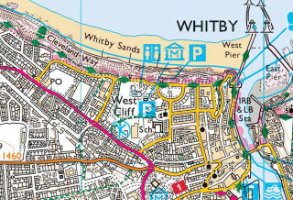
Provides a view of current and future flood hazards (fluvial, pluvial and tidal) for three return periods, three epochs and three emissions scenarios to estimate potential impact on asset portfolio and satisfy ESG disclosure requirements.

Product Details

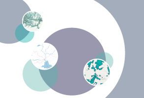
FloodMap Climate is a high-resolution, climate adjusted flood map using local hydrological data, high-resolution terrain models, and climate uplift data to create a view of current and future hazards (fluvial, pluvial and tidal).  FloodMap Climate replaces the previous FloodFutures product (which is no longer updated).  

The impact of global warming and rising sea levels is intensifying, and every one of us will need to adapt and plan in the face of uncertainty. The UK is witnessing higher temperatures and changing rainfall patterns with unprecedented combinations of drought and flood conditions caused by more intense storms .  The frequency of such extreme weather events and the probability of them coinciding is increasing, resulting in an intensification of severe consequences.

If you are working on a project or your organisation needs a long term view of flooding hazards to protect property and infrastructure assets or satisfy ESG disclosure requirements, then FloodMap Climate can help.

Data Specification

Modelled:

1-in-30 years, 1-in-100 years and 1-in-500 years return periods, undefended.

Climate Epochs & Emissions Scenarios

2020’s, 2050’s and 2080’s

RCP2.6, RCP4.5 and RCP8.5

Layers:

  • Fluvial (river) flooding
  • Pluvial flooding (surface water, flash flooding)
  • Tidal flooding (sea, estuary and coastal)
  • Sea-level rise (shows low and high tide lines)
  • Sea-level rise inundation areas – zones that are subject to inundation due to sea-level rise rather than as a result of a specific flood event
  • River-bank and bed erosion potential for each 100-metre river segment’


Technical Details

Supplier
Twinn (formerly Ambiental)
Update Cycle
Annually (April)
Coverage
GB
Formats Available
TIF, SHP
Licence Options
Annual
Delivery Timescale
Same day (depending on extent ordered)

Related Products

Groundsure Flood Insight, OS VectorMap Local Raster

Download Samples

Underground Utilities map

Utility Premium

Provides comprehensive information about all services affecting your site including Gas and Oil pipelines, mains Water and Sewage, Telecoms and fibre-optic cables.

Product Details

Provides comprehensive information about the services affecting your site including main and tertiary gas and electricity supplies, mains water and sewage, oil and fuel pipelines, telecoms and fibre-optics, and transportation networks.

Information is gathered, collated and supplied as a single report within 10 working days*.

This report is ideal when comprehensive information is required for your site, ensuring you are managing your risk and avoiding expensive delays.

*Due to the extensive nature of some searches, the number of utilities searched, and the response timescales imposed by some utility suppliers, it can happen that not all responses are received within the relevant timeframe. When this does occur, your report will be delivered with all available content as requested, and a final report will be delivered as soon as the outstanding information has been received.

Technical Details

Supplier
Technics
Coverage
GB
Formats Available
PDF
Licence Options
Perpetual
Delivery Timescale
10 working days

Related Products

Download Samples

PointX Points of Interest data

OS Points of Interest (PointX)

GB coverage of categorised points of interest - commercial, industrial, retail, tourism, leisure, government - including addresses and coordinates.

Product details

OS Point of Interest (PointX) contains over four million records, sourced and quality-checked from over 100 leading listing suppliers. Locations and organisation names as well as several levels of classification enable selections of points to be fine tuned down to type of establishment or organisation - for example, retail, leisure, education, transport and public services.


Technical Details

Supplier
Ordnance Survey
Update Cycle
Quarterly
Coverage
GB
Formats Available
SHP, GML, TAB
Licence Options
Annual
Delivery Timescale
Typically within 4 working hours

Related Products

OS MasterMap Topography Layer

Download Samples

emapsite Enviro Insight Product Banner by Groundsure

Groundsure Enviro Insight

Detailed, accurate and extensive - covering environmental permits, contaminative processes and registers, waste, hydrogeology and geology.

Product Details

The Enviro Insight accesses Groundsure’s unique Historic Land Use Database (HLUD) which features the most accurate and reliable information available on the market. Our HLUD is derived from historic Ordnance Survey mapping dating back to the 1840s, features over 7000 land use classifications and is scanned in at over 500dpi – setting a new industry standard.​

Enviro Insight offers environmental professionals condensed data in an easy to use report format combined with aerial photographs. This enables quick identification of potential risks helping to give an immediate site overview. It features current aerial photographs, an advanced graphical representation of each data element and data specific radial searches.

Enviro Insight includes:

  • A clear summary that highlights key features of the report
  • Aggregated historic land use information
  • Detailed flood mapping from EA & Ambiental
  • Enhanced planning and development designations
  • Pollution inventory data
  • Waste exemptions


Report is available for England, Wales and Scotland. Data sources may differ in Scotland.

Technical Details

Supplier
Groundsure
Coverage
England and Wales
Scale
1:10,000
Formats Available
PDF
Licence Options
Perpetual
Delivery Timescale
4 working hours

Related Products

PDF Plans, OS MasterMap Topography Layer

Download Samples

OS 25k Explorer Digital Mapping

OS 1:25,000 Raster

​Ordnance Survey's 1:25,000 scale mapping of GB is the digital version of OS Explorer - ideal for analysing the environment in a rural area.

Product Details

The Ordnance Survey's well-known Explorer series of mapping, familiar to walkers and outdoor enthusiasts. Ideal for analysing the environment across a district and in a rural areas, 1:25,000 raster data includes field boundaries, administrative boundaries, Rights of Way including access land, National Trust land, MOD land, selected cycle routes, national trails and points of interest for tourism. Contour lines are shown at 5m intervals (or 10m in some mountainous areas).

The maps can be ordered in a range of raster formats as well as the standard 10x10km TIFF tiles.

The pixel resolution of 1:25,000 data is 2.5m, and printing at 254dpi will print to the correct scale.

Licence: PDF

OS 1:25 000 Legend

Technical Details

Supplier
Ordnance Survey
Update Cycle
Bi-annual
Coverage
GB
Scale
1:25,000
Formats Available
TIFF, BMP, JPG, PNG
Licence Options
Annual
Delivery Timescale
Within minutes

Related Products

OS VectorMap District Raster, OS VectorMap Local, OS VectorMap Local Raster

Download Samples

OS 50k Landranger Digital Mapping

OS 1:50,000 Raster

The 1:50,000 Scale Raster dataset is the digital version of the familiar Ordnance Survey Landranger® map series.

Product Details

Familiar to many as the OS Landranger series of paper maps, OS 1:50,000 raster data is also useful for providing context across a wide area and using as a backdrop within GIS or CAD. The maps detail roads, public rights of way, woods, water features, important buildings and contour lines at 10m intervals, and can be ordered in a range of raster formats as well as the standard 20x20km TIFF tiles.

The pixel resolution of 1:50,000 data is 5m, and printing at 254dpi will print to the correct scale.

Licence: PDF

OS 1:50 000 Legend

Technical Details

Supplier
Ordnance Survey
Update Cycle
Bi-annual
Coverage
GB plus Isle of Man
Scale
1:50,000
Formats Available
TIFF, BMP, JPG, PNG
Licence Options
Annual
Delivery Timescale
Within minutes

Related Products

OS 1:25 000 Raster

Download Samples


Phone & Email

Address

The Hub Fowler Avenue
Farnborough
GU14 7JF
United Kingdom