
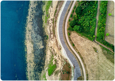
Aerial Imagery
High resolution aerial photos let you understand the landscape in detail – what’s in it, what’s on it, how it has changed. Identify sites, spot access points, and highlight areas of interest with ease with our wide range of aerial imagery.


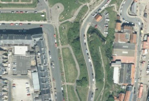
OS MasterMap Imagery Layer
The OS MasterMap Imagery Layer comprises the best available aerial images, edge-matched and orthorectified to align with other OS MasterMap layers.
Product DetailsThe aerial images give added context to features which exist within other (vector) OS MasterMap layers and allow interpretation of other features not identified within the vector datasets. The data is rigorously checked for quality to maintain a consistent standard of both positional accuracy and image quality.
Additionally Ordnance Survey processing software produces true-orthorectified imagery, removing building lean from aerial imagery to give you a consistent top-down view.
Aerial imagery is ideal for checking road markings, tree canopies or site entrances, cutting down the need for site visits, so you can save money and manage time more efficiently.
Purchasable as both a traditional raster cut-out of a user defined area or as web services.
OS MasterMap Imagery layer is ideal for:
- Planning
- Site location and evaluation
- Land use classification and analysis
- Transport and infrastructure
- Asset management
- Environmental analysis
- Flood mapping
- 3D visualisation
.
Technical Details
- Supplier
- Ordnance Survey
- Update Cycle
- Quarterly
- Coverage
- GB
- Scale
- 25cm resolution
- Formats Available
- TIFF, JPG, PNG, BMP
- Stated Accuracy
- Stated Accuracy
- Stated Accuracy
- Licence Options
- Perpetual or Annual
- Delivery Timescale
- Within minutes
Related Products
Download Samples
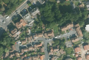
Aerial Imagery 12.5cm - 5m
Geo-referenced and geo-corrected aerial photography of Great Britain captured over a range of dates and supplied at a choice of resolutions.
Product DetailsAerial imagery provides that perfect real life context to the mapped environment we are all familiar with and is used in so many applications these days. We source our aerial imagery from a range of suppliers to offer you the widest choice of coverage and range of capture dates.
Using our online mapshop you are able to specify the area you require, view the range of resolutions and also dates captured. Please note that the imagery shown on screen is restricted to a resolution of 2m. Your data will be delivered at the resolution required.
Aerial Imagery is ideal for:
- Site analysis
- Asset management
- Land use classification
- Environmental assessment and monitoring
Technical Details
- Supplier
- Various
- Update Cycle
- Various
- Coverage
- GB
- Scale
- resolutions from 12.5cm to 5m
- Formats Available
- TIFF, JPG, BMP, ECW
- Stated Accuracy
- Stated Accuracy
- Stated Accuracy
- Licence Options
- Perpetual
- Delivery Timescale
- Within minutes
Related Products
OS Mastermap Imagery Layer, OS Mastermap
Download Samples
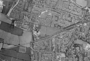
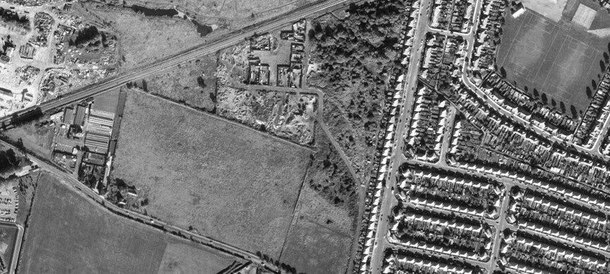
Historic Aerial Photography
Historic Aerial Photography from 1940s to 1990s sourced from range of suppliers.
Product DetailsThere is a wide range of historical aerial photography captured from WWII onwards.
emapsite has access to a wide range of suppliers of historical photography and sources according to your specific requirements.
Please contact us to let us know your individual requirements.
Technical Details
- Supplier
- Various
- Update Cycle
- Coverage
- GB - not continuous coverage
- Scale
- Resolutions vary
- Formats Available
- TIFF. JPEG
- Stated Accuracy
- Stated Accuracy
- Stated Accuracy
- Licence Options
- Perpetual
- Delivery Timescale
- On request
Related Products
Aerial Imagery, OS Mastermap, Historic mapping
Download Samples

Outstanding value
Your experience, plus our location data expertise, equals a powerful partnership that guarantees added value for your business.

Vision
emapsite creates the location data and mapping services you need for tomorrow's world, as well as today's.

Vitality
A team that loves going the extra mile to make sure you've got exactly the right mapping and location data for your needs.