LandPack GreenAccess

The government’s new aim is that everyone in the UK should have access to a green space or open water within 15 minutes' walk.

Emapsite's LandPack GreenAccess evaluates the quality of green space available to urban residential property across Great Britain. A score is given to each property, enabling you to see the variations of access to quality green space across an area, or of a portfolio of properties. 
Green spaces? GreenAccess

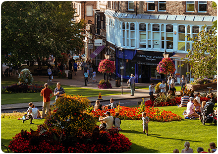
LandPack GreenAccess identifies areas of 'green' space and 'blue' space that are publicly accessible in the urban environment. These open areas offer vital access to opportunities for helping to improve health and well-being in an otherwise busy and noisy environment: 

  • Green space - areas of greenery larger than 15m2
  • Blue space - areas alongside rivers, lakes and ponds

Why choose GreenAccess?

LandPack GreenAccess is ideal for local authorities, property asset managers, facilities’ managers, and anyone who’s also developing a social responsibility agenda (Environmental, Social & Governance or ESG reporting).

What makes GreenAccess Different?

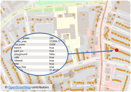
Crucially, LandPack GreenAccess is populated with Unique Property Reference Numbers (UPRNs), location coordinates (British National Grid X/Y), distances to greenspace and the area of greenspace within one kilometre (as the crow flies). 

We’ve also included data that reveals how many people in a surrounding area are likely to share an open area, with a greenspace-to-population ratio that’s defined by a walkable distance (based on 2 Step Floating Catchment Area method – 2SFCA).

image
image

What's in LandPack GreenAccess?

LandPack GreenAccess highlights which facilities are provided in green and blue areas, and where those POIs are – things like  playgrounds, refreshment facilities (such as cafés), toilets and items of general public interest, like public artworks or scenic viewpoints. In short, it’s an ideal dataset for anyone interested in these activities:

-  Identifying which areas fall inside or outside government targets

-  Prioritising resources to improve or update existing greenspace facilities

-  Understanding planning applications that might impact greenspace access

-  Developing an ESG programme that includes access to greenspace

LandPack GreenAccess is delivered as a file for ingestion to GIS, currently as a CSV.

Contact us about LandPack GreenAccess
Complete the form, below, or call us and we'll be happy to assist.


Phone & Email

Address

The Hub Fowler Avenue
Farnborough
GU14 7JF
United Kingdom