





Ground Stability - Geology, Soils & Trees
Ground stability is a serious problem for everyone operating across the land & property lifecycle, not just insurers.
The likelihood of ground movement at a site is defined by the geology and type of soil (and presence of trees), which all affect the amount of moisture in the soil. And with climate change projected by United Nations to produce ever more extreme weather (milder/wetter winters and hotter/drier summers), wider fluctuations in soil moisture are likely to increase the likelihood of soil shrink/swell increasing the ground movement hazard.
Having an insight into current conditions used to be sufficient. Now, customers have to be increasingly mindful of the effects of climate-change and implementing adaptation measures as a pre-requisite for investment funding (and insurance) under requirements from the Bank of England/Prudential Regulation Authority. Climate change is now a mainstream risk that all UK banks are implementing into their credit risk management policies and procedures. And the Law Society requires solicitors to warn their clients of potential risks related to climate-change.
These datasets will be useful for environmental consultants trying to identify and recommend an appropriate site, for lawyers/solicitors minimising risk in property transactions and for architects, design engineers, lenders, construction engineers, asset owners, operators and insurers alike. They all need to minimise the likelihood of creating, owning and operating assets susceptible to ground movement.
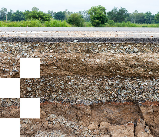
Emapsite provides a range of geospatial hazard data for geology, soils and trees from the leading providers:
-
• British Geological Survey (BGS)
-
• Cranfield Landis
-
• Bluesky International Ltd
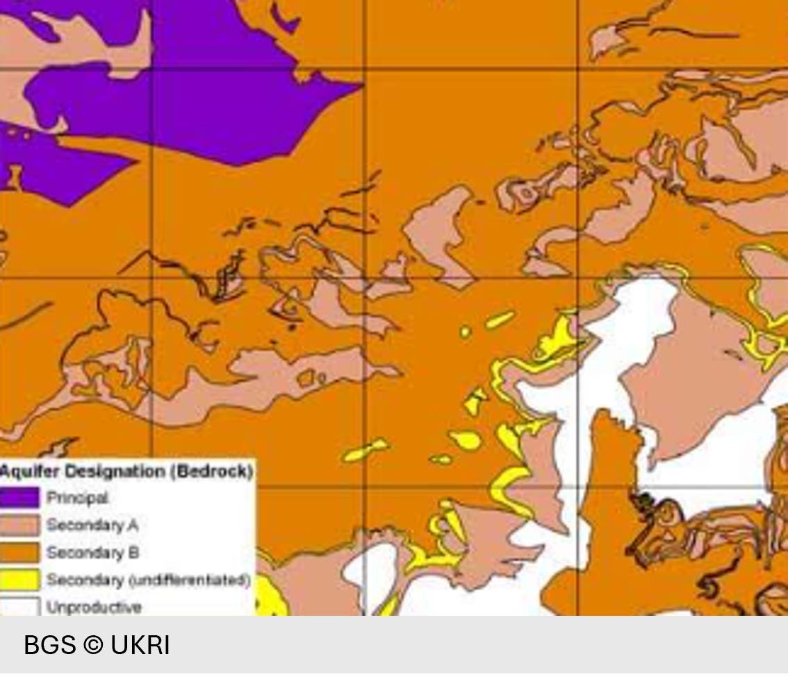
BGS Hydrogeology Products
BGS Hydrogeology products describe different types of aquifers in Great Britain and the vulnerability of these aquifers to pollutants discharged at ground surface.
Product DetailsBGS Aquifer Designations (England & Wales)
The 1:50,000 scale maps display the principal, secondary and unproductive aquifers in two different types of aquifer designations (i.e. superficial and bedrock) in England & Wales. Designations reflect the importance of aquifers as a source of drinking water and their role in supporting surface water flows and wetland ecosystems. Groundwater protection policy in England and Wales uses aquifer designations that are consistent with the Water Framework Directive.
Buy BGS Aquifer Designations (England)
Buy BGS Aquifer Designations (Wales)
BGS Groundwater Vulnerability (England & Wales)
Maps the vulnerability of groundwater to a pollutant discharged at the ground surface at 1:50 000 scale in England & Wales. The maps provide a separate assessment of the vulnerability of groundwater in overlying superficial rocks and those that comprise the underlying bedrock.Groundwater vulnerability for each aquifer type is expressed from high (where pollutants can easily be transmitted to groundwater) to unproductive (negligible significance for water supply or baseflow to rivers, lakes and wetlands).
Buy BGS Groundwater Vulnerability (England)
Buy BGS Groundwater Vulnerability (Wales)
BGS HydroScotland
The 1:100,000 scale maps display the principal, secondary and unproductive aquifers in two different types of aquifer designations (i.e. superficial and bedrock) in Scotland.
- Aquifer Productivity describes the potential of bedrock and superficial deposit aquifers to sustain various levels of borehole water supply, plus the dominant groundwater flow type in each aquifer.
- Groundwater Vulnerability provides an assessment of the vulnerability of groundwater in the uppermost water table to a pollutant discharged at the ground surface.
The dataset helps characterise groundwater bodies as required by the Water Framework Directive and are useful in policy development (e.g. in prioritising water supply and site investigations, informing planning decisions) and improving awareness of groundwater in general.
Technical Details
- Supplier
- BGS - British Geological Society
- Update Cycle
- Periodically
- Coverage
- England & Wales / Scotland
- Scale
- England & Wales 1:50 000 / Scotland 1:100,000
- Formats Available
- SHP
- Stated Accuracy
- Stated Accuracy
- Stated Accuracy
- Licence Options
- Annual
- Delivery Timescale
- Within 24 hours
Related Products
OS 1:50 000 Scale Colour Raster
Download Samples

BGS Soil ElectroChemistry
BGS Soil ElectroChemistry products estimate the ambient background concentrations of potentially harmful chemicals in urban topsoil and the electrical resistivity of near surface soils.
Product DetailsBGS Electrical Resistivity
Electrical resistivity of natural geological materials in Great Britain where earthing characteristics of the ground are required.
BGS Resistivity classifies resistivity of the ground using modelled values of electrical resistivity using data from BGS Soil Parent Material Model, National Geotechnical Property Database and Geophysical Laboratories Database.
The near surface electrical resistivity of the ground is dependent on a number of factors, including pore water resistivity, saturation and the clay content of the underlying geology. It is an important factor in engineering activities in use cases such as power distribution networks and earthing of electrical systems (e.g. electric vehicle charging facilities). This dataset is for desk studies which must be validated by physical soil sampling at a site of interest.
Buy BGS Electrical Resistivity
BGS Soil Chemistry
BGS Soil Chemistry provides estimated ambient background concentrations of Arsenic, Cadmium, Chromium, Nickel and Lead for rural topsoil and measured concentrations of these elements plus Copper, Tin and Zinc in urban topsoil sample collected from geochemical surveys in 23 major urban centres.
The dataset also includes estimated 'bioaccessible' data for Arsenic and Lead (released from the soil into solution in the gastrointestinal tract in a form that can potentially be absorbed into the bloodstream).
BGS Soil Chemistry can be used as part of land-quality assessments to provide context and establish if elevated local measurements in urban areas are the result of significant human-induced pollution or if they are representative of the estimated ambient background concentration. It is useful to inform planning decisions and to aid environmental consultants, developers, householders and their legal representatives prior to site investigation. This dataset is for desk studies which must be validated by physical soil sampling at a site of interest.
Technical Details
- Supplier
- BGS - British Geological Society
- Update Cycle
- Periodically
- Coverage
- Great Britain
- Scale
- 1:50 000
- Formats Available
- SHP
- Stated Accuracy
- Stated Accuracy
- Stated Accuracy
- Licence Options
- Annual
- Delivery Timescale
- Within 24 hours
Related Products
Download Samples

BGS Civils & Mining Products
Datasets indicating engineering properties of geological formations for use in construction, the presence of mineral resources and mining information for Great Britain.
Product DetailsBGS Civils (All Layers)
BGS Civils is a suite of maps of engineering properties based on the 1:50 000 scale Geology map of Great Britain. It comprises eight layers and provides the key engineering characteristics of the uppermost 2-metres of geology of Great Britain:
- • Bulking Volume (increase in volume when excavated)
- • Corrosivity (Ferrous)
- • Discontinuities
- • Engineered Fill
- • Foundation Conditions
- • Excavatability
- • Strength
- • Sulphate/Sulphide
The dataset is intended for professional user desk studies in engineering, environmental consultancy, planning, site development and asset management for daily planning activities and preventative maintenance or investigating costs for trench excavation.
BGS Mineral Resources
BGS Mineral Resources maps the geological distribution of all onshore, workable mineral resources in England, Wales and Scotland central belt at a scale of 1:50 000.
Great Britain has a wide range of minerals including construction minerals, industrial minerals and metals. BGS Mineral Resources brings together minerals, environmental and other land-use information in an integrated system. It is intended to inform desk studies and the development of more effective/sustainable management strategies for mineral extraction (subject to environmental and local authority planning constraints).
BGS Mining Hazards
BGS Mining Hazard provides a national-scale summary of the likely presence of mining in Great Britain and an indication of the level of hazard associated with old workings. Presented as a vector map of interlocking 1km hexagon cells (area c.2.6 km2) with four classes (localised, small-scale, significant and no record).
Note: The 'full' BGS mining hazard (not including coal) dataset is also available on request and provides further detail at a 1:50 000 scale, including information on the type of commodity extracted, mine names and any additional details where available.
Technical Details
- Supplier
- BGS - British Geological Survey
- Update Cycle
- Annually
- Coverage
- GB
- Scale
- 1:50 000
- Formats Available
- BGS Civils: SHP, DWG
- Stated Accuracy
- Stated Accuracy
- Stated Accuracy
- Licence Options
- Annual
- Delivery Timescale
- Within 24 hours
Related Products
Aerial Imagery products from Ordnance Survey, Getmapping or Bluesky.
Download Samples
BGS Geosure
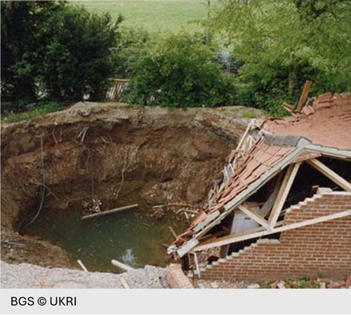
BGS Geosure identifies potential natural ground movement hazards in Great Britain in six categories.
Product DetailsBGS Geosure
BGS GeoSure provides geological information about potential ground movement in Great Britain. These are presented as polygon (area) layers and described using a simple potential hazard classification (A = Low, E = High).
Includes indicators for the following hazards and a debris flow susceptibility model (available separately):
• Collapsible deposits (volume reduction under load);
• Compressible ground (as water is squeezed out from peat, clay);
• Landslides (potential slope instability);
• Running sand (fluidised by water);
• Shrink swell (a major hazard in clay soils);
• Soluble rocks (rock-salt, gypsum and limestone, including chalk).
Some of these materials change in volume through seasonal wetting and drying whilst others undergo a rapid reduction in volume and can even collapse when a load is placed on them (such as a building) and/or when they become saturated with water. Volume reductions may happen uniformly or unevenly causing different hazards for developers, lenders, building owners and insurers alike.
BGS Geosure Debris Flow Susceptibility Model (DFSM)
BGS GeoSure DFSM provides information on the potential of the ground to form a debris flow (i.e. rapid, downslope flow of poorly sorted debris mixed with water). It is a 1:50 000 scale raster dataset of Great Britain providing 50m ground resolution information indicating the susceptibility/spatial likelihood, at a given location, to initiate a debris flow.
Debris flows are most commonly found in upland Scotland and occur in parts of Wales and the Lake District in GB. They are distinct from other types of landslides as they can occur periodically on established paths, gullies and drainage channels. Debris flows are potentially very destructive and can very quickly block infrastructure routes such as roads and railway lines. The dataset is primarily concerned with potential ground stability related to natural geological conditions (rather than human-induced conditions).
BGS GeoSure DFSM is available as a separate dataset or provided as an add-on to the BGS GeoSure Landslides dataset.
Technical Details
- Supplier
- Emapsite
- Update Cycle
- Annually
- Coverage
- GB
- Scale
- 1:50 000
- Formats Available
- SHP, TAB, GBD (NewGIP: CSV)
- Stated Accuracy
- 50 m ground resolution
- Stated Accuracy
- Stated Accuracy
- Licence Options
- Annual
- Delivery Timescale
- Within 24 hours
Related Products
Download Samples
BGS Geosure Insurance and Lending Product
An insurance-focused geological hazard dataset that provides postcode-level assessments of potential financial loss from natural ground movement across Great Britain.
Product DetailsBGS Geosure Insurance
The BGS GeoSure insurance product gives an index-level assessment of the potential for a geological deposit to create financial insurance loss due to natural ground movement in Great Britain. It incorporates the combined effects of the six BGS GeoSure hazards on (low-rise) buildings and links these to a postcode database (the derived postcode database).
• Collapsible deposits (volume reduction under load);
• Compressible ground (as water is squeezed out from peat, clay);
• Landslides (potential slope instability);
• Running sand (fluidised by water);
• Shrink swell (a major hazard in clay soils);
• Soluble rocks (rock-salt, gypsum and limestone, including chalk).
This database contains a normalised hazard rating for each of the six BGS GeoSure theme hazards (i.e. each BGS GeoSure theme has been balanced against each other) and a combined unified hazard rating for each postcode in Great Britain.
Note: Available for customers in Insurance and Lending businesses only.
Technical Details
- Supplier
- British Geological Survey (BGS)
- Update Cycle
- Periodic
- Coverage
- GB
- Scale
- Postcode level
- Formats Available
- Database/GIS formats
- Stated Accuracy
- Not stated
- Stated Accuracy
- Not stated
- Stated Accuracy
- Provides a postcode-level index of geological hazard potential for insurance and lending applications. It is intended for strategic risk assessment and should not be used as a substitute for site-specific investigations.
- Licence Options
- Annual
- Delivery Timescale
- Within 24 hours
Related Products
Download Samples
BGS Geoclimate Shrink Swell
Future projections of clay shrink–swell subsidence susceptibility across Great Britain, combining geology, groundwater and climate change modelling to support long-term resilience planning and risk assessment.
Product DetailsBGS GeoClimate Shrink-Swell models how susceptibility to clay shrink–swell subsidence may change under future climate conditions. The dataset combines geological mapping, groundwater modelling and CHESS-SCAPE climate projections to provide projections for 2030, 2050 and 2070 across RCP 2.6, 4.5 and 8.5 emissions scenarios. Outputs include susceptibility classifications, baseline conditions and change layers, supporting applications such as infrastructure planning, asset management, development assessment and climate risk analysis.
Technical Details
- Supplier
- British Geological Society
- Update Cycle
- Periodic
- Coverage
- GB (excluding Shetland and parts of Orkney)
- Scale
- Quasi-1:50 000
- Formats Available
- SHP, GDB
- Stated Accuracy
- Stated Accuracy
- Stated Accuracy
- Licence Options
- Annual
- Delivery Timescale
- Within 24 hours
Related Products
OS Terrain 50 Digital Terrain Model
Download Samples

Unrivalled resources
We simplify the supply and management of mapping products, plans and reports. Blending diverse datasets to uncover hidden commercial insights.

Business intelligence
Our spatial intelligence enables our clients to pinpoint areas of risk and reward, and to make better business decisions faster.

Proven partnership
We work in partnership, we're supportive, and we're committed to reducing our own and our clients' impact on the environment.