Emapsite Reports
All the environmental site intelligence and underground utilities you need, in easy to interpret reports.

Emapsite Reports
Emapsite Reports gives you access to a huge range of detailed (or overview) reports for site assessment and analysis.
We've spent many years evaluating these data sources on your behalf. By sourcing the most up-to-date, accurate site intelligence data from Emapsite, you're getting direct access to industry-leading suppliers' information, without the overhead of infrastructure or in-house reporting systems.
Accurately assess risk. Get insights. Analyse and provide provide a definitive opinions and onward reports for your own or your clients' projects.
Key Features
Comprehensive range of reports
- Rapid access to the data you need
- Ideal for site investigation
- Flexible options to support specific use
- Simple to buy online
- Reducing your risk
Trustworthy Sources of Data
- High quality, pre-evaluated information
- High resolution historic mapping
- Environmental hazards and data
- More geology mapped
- Every reported utility provided
Built for all professionals
- Environmental Consultancy
- Planning and development
- Risk management
- Due diligence
- Surveying
Our most popular products
Find out more about our best-selling site intelligence reports

Groundsure Insight
The three key Enviro, Geo and Map Insight reports, combining unique environmental and geological datasets with the highest resolution historic mapping available.
Product DetailsGroundsure Insight delivers detailed and accurate information using extensive and unique environmental and geological datasets as well as providing you with the highest resolution historic mapping available.
Groundsure’s Historic Land Use Database (HLUD) is the most accurate and reliable information available on the market. Our HLUD is derived from historic Ordnance Survey mapping dating back to the 1840s, scanned in at over 500dpi – setting a new industry.
This sharper imagery means you can see the information more clearly and benefit from greater confidence in your opinion. Each map is manually assessed by an in-house GIS consultant before we deliver it. The Full pack includes National Grid, County Series and Town Plans at scales: 1:10,000, 1:10,560, 1:2,500, 1:1,250, 1:1056 and 1:500.
The Geo Insight report provides all the geo-environmental data required to make informed decisions and identify potential ground stability problems that may affect ground investigation, foundation design or possible remediation options.
What does it cover?
- Historical Land Use information
- Environmental Permits, Incidents and Registers
- Hydrology and Hydrogeology data including abstractions, source protection zones (SPZ), now with SPZ within confined aquifers
- Basic flood data including EA Flood Zones, RoFRaS and groundwater
- Detailed BGS 1:50,000 scales geology
- Groundsure’s unique historical surface and underground workings database
- Groundsure’s mining and mineral extraction database
- BGS non-coal mining hazards data
- BGS BRITPITS current ground workings information
- BGS borehole records, hyperlinked to online BGS scans
- Estimated background soil chemistry information
Technical Details
- Supplier
- Groundsure
- Update Cycle
- Coverage
- Scale
- Formats Available
- Stated Accuracy
- Stated Accuracy
- Stated Accuracy
- Licence Options
- Delivery Timescale
Related Products
PDF Plans, OS MasterMap Topography Layer
Download Samples

Map Insight
The highest quality historic mapping on the market, setting a new standard in clarity and interpretability for the environmental professional.
Product DetailsMapinsight Packs are made up of A3 extracts of all available superseded Ordnance Survey maps (from the scales and maps as available to Groundsure from the copyright library used to scan the material) at a variety of scales (including 1:10000, 1:10560, 1:2500, 1:1250) supplied in PDF. These map packs give the user an historical review of mapping back to around 1840. With full colour scans of source material at 508dpi and PDF output at 600dpi these map packs set a new standard in quality, clarity and interpretability for the environmental professional. 1:10 000 / 1:10 560 scale - there are typically 7 editions for any area 1:2500 / 1:1250 scale - typically 6 editions
Urban areas are more frequently covered; 1:1250 scale only available for "urban" areas. Areas of greater population and change tend to have more mapping editions.
Technical Details
- Supplier
- GroundSure
- Update Cycle
- Coverage
- Scale
- Formats Available
- Stated Accuracy
- Stated Accuracy
- Stated Accuracy
- Licence Options
- Delivery Timescale
Related Products
PDF Plans, OS MasterMap Topography Layer
Download Samples

Enviro Insight
Detailed, accurate and extensive - covering environmental permits, contaminative processes and registers, waste, hydrogeology and geology.
Product DetailsThe Enviro Insight accesses Groundsure’s unique Historic Land Use Database (HLUD) which features the most accurate and reliable information available on the market. Our HLUD is derived from historic Ordnance Survey mapping dating back to the 1840s, features over 7000 land use classifications and is scanned in at over 500dpi – setting a new industry standard.
Enviro Insight offers environmental professionals condensed data in an easy to use report format combined with aerial photographs. This enables quick identification of potential risks helping to give an immediate site overview. It features current aerial photographs, an advanced graphical representation of each data element and data specific radial searches.
Technical Details
- Supplier
- Groundsure
- Update Cycle
- Coverage
- Scale
- Formats Available
- Stated Accuracy
- Stated Accuracy
- Stated Accuracy
- Licence Options
- Delivery Timescale
Related Products
PDF Plans, OS MasterMap Topography Layer
Download Samples

Geo Insight
A highly detailed geological data report combining BGS data with unique geological and geo-hazard datasets developed by Groundsure.
Product DetailsThis report now includes the BGS 1:10,000 (DiGMapGB-10) scale geology data set as standard, where available.
Geo Insight is essential for geo-environmental professionals and their clients to make informed decisions and identify potential ground instability and other potentially costly problems that may affect ground investigation, foundation design or possible remediation options. The Geo Insight provides unique data on current and historical railways and tunnels – detail which isn’t available in any other desktop report. It also features BGS recorded boreholes, with hyperlinks to online digitised records.
Groundsure Geoinsight is designed for environmental consultants, engineers, developers, designers and other professionals involved within construction and ground workings to identify and interpret the potential for ground conditions to affect existing or proposed structures at an early stage.
Technical Details
- Supplier
- Groundsure
- Update Cycle
- Coverage
- Scale
- Formats Available
- Stated Accuracy
- Stated Accuracy
- Stated Accuracy
- Licence Options
- Delivery Timescale
Related Products
PDF Plans, OS MasterMap Topography Layer
Download Samples
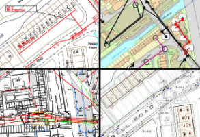
Utility Essentials
This report gives visibility of the 5 key services – Gas, Electric, Water, Sewage and British Telecom, supplied for areas of up to 25 hectares.
Product DetailsThe Essentials report is collated and delivered in 5 working days and is ideal for remote sites where only the main utilities providers are likely to be present or projects where the aim is merely to check the availability of the main utilities (water/sewer, gas, electric and BT) e.g. in the planning stages of a new development.
Due to the extensive nature of some searches and the number of utilities searched, it can happen that not all responses are received within the relevant timeframe. When this does occur your report will be delivered with all available content as requested, and a final report will be delivered as soon as the missing information has been received.
Please note, a search of GTT (previously known as Vtesse Networks Ltd) is not included in this report. If you require a GTT search this is available through our Utility Singles Telecoms report.
Technical Details
- Supplier
- Technics
- Update Cycle
- Coverage
- GB
- Scale
- Formats Available
- Stated Accuracy
- Stated Accuracy
- Stated Accuracy
- Licence Options
- Perpetual
- Delivery Timescale
- 5 working days
Related Products
Download Samples
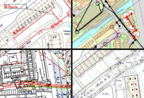
Utility Premium
Provides comprehensive information about all services affecting your site including Gas and Oil pipelines, mains Water and Sewage, Telecoms and fibre-optic cables.
Product DetailsSupplied for areas of up to 25 hectares the information is gathered, collated and supplied as a single report within 10 working days.
This report is ideal when comprehensive information is required for your site, ensuring you are managing your risk and avoiding expensive delays.
Due to the extensive nature of some searches and the number of utilities searched, it can happen that not all responses are received within the relevant time-frame. When this does occur your report will be delivered with all available content as requested, and a final report will be delivered as soon as the missing information has been received.
Please note, a search of Vtesse Networks Ltd is not included in this report. If you require a Vtesse Networks Ltd search this is available through our Utility Singles Telecoms report.
Technical Details
- Supplier
- Technics
- Update Cycle
- Coverage
- Scale
- Formats Available
- Stated Accuracy
- Stated Accuracy
- Stated Accuracy
- Licence Options
- Delivery Timescale
