





3D & Terrain Data
Get precise, high-resolution elevation insight with Emapsite’s 3D & Terrain Data.
Our datasets include OS Terrain 5 digital terrain models (DTM), digital surface models (DSM) and contour data - all ready for GIS and CAD workflows.
Trusted for engineering, planning, flood risk, visualisation and geospatial analysis across the UK.
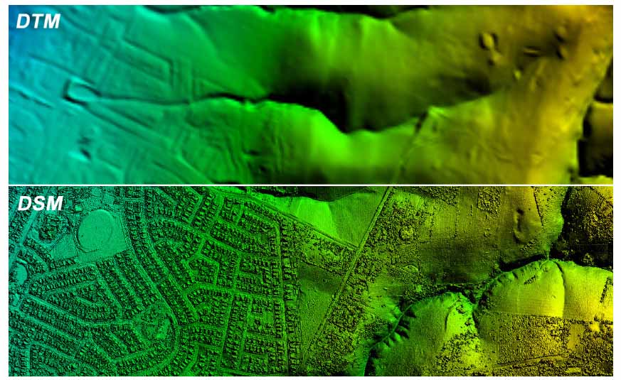
Modelling and planning with 3D Data
High-Accuracy Terrain Data for Modelling, Risk and Planning
Emapsite terrain datasets - derived from advanced LiDAR and aerial photogrammetry - offer vertical accuracy from ±15cm RMSE and are available in flexible formats for GIS, CAD and 3D visualisation tools.
Use these datasets for:
- • Flood risk and drainage modelling
- • Windfarm and renewable site evaluation
- • Urban planning, transport corridor design
- • Environmental impact and hydrology assessments
- • Telecom network propagation analysis
Point clouds and contour surfaces are supplied to customer-defined areas to minimise data processing overhead.
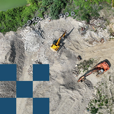
Why Choose Emapsite’s Terrain & 3D Data?
Emapsite offer Britain’s most reliable terrain data – supported by a licensing model that makes every purchase a good investment.
Whether you’re siting windfarms, analysing radio signals for telecom networks, or ensuring land suitability for development, Emapsite’s datasets provide the spatial accuracy and flexibility you need to make informed decisions with confidence.
As part of Idox Geospatial, you can rest assured, our 3D and Terrain products are all supported by a team that excels in helping customers to get the best from these datasets – working with clients in infrastructure, energy and utilities and more.
Explore OS Terrain 5 and our other 3D data today and elevate your projects.
Terrain and 3D Data Use Cases That Deliver Value - Provided By Emapsite:
• Flood Risk & Coastal Management - Model surface water movement and coastal change with high-resolution terrain elevation.
• Infrastructure & Urban Planning - Plan transport, utilities and land elevation design with accurate surface models.
• Environmental Assessment & Compliance - Inform impact studies with detailed topography and terrain analytics.
• 3D Visualisation & GIS Analysis - Generate city models, 3D terrain meshes and height maps for planning, design and stakeholder engagement.
• Telecommunications Network Modelling - Integrate elevation datasets to refine radio propagation and line-of-sight analysis.
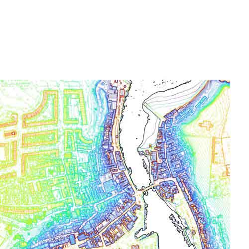
Idox LiDAR Products
Detailed terrain and digital surface models for Great Britain describing the Earth surface and the things on it, collated by Emapsite at 1-metre and 2-metre resolution.
Product DetailsEmapsite has collated LiDAR (Light Detection and Ranging) data for Great Britain from Environment Agency (EA), Natural Resources Wales (NRW) and Scottish Environment Protection Agency (SEPA). Data is available for customer-defined areas to simplify data acquisition and minimise the data management burden.
Originally captured to support flood risk assessment, LiDAR elevation data is used in a variety of applications:
- • Environmental monitoring, wildlife habitat management, and analysis of forest health and gauge carbon storage in biomass by measuring the height and volume of forests.
- • Environmental Impact Assessments for major projects to analyse how changes in terrain or vegetation might impact local environment.
- • Assessing land suitability for development, ensuring that new structures are built in safe, appropriate locations.
- • Assisting in infrastructure design and management by providing precise topographical data for road layouts, rail networks, and utilities.
- • Flood risk assessment, helping authorities predict which areas might be vulnerable to flooding.
- • Coastal and river management to identify erosion and drainage patterns
- • Creating 3D models of cities showing building heights and architectural features used by urban planners use this for zoning, transportation planning, and visual impact studies
DSM data is produced from the first (or only) laser pulse returned to the sensor whilst DTM data is produced from the last (or only) pulse. The data is aligned to EPSG 27700 (British National Grid) with height relative to Ordnance Survey Newlyn Datum and has a vertical accuracy of /-15cm RMSE. It is a composite of flown years and all years within a customer area of interest will be supplied. It is available in a variety of formats as follows:
- • Contours in SHP, DWG
- • Point Cloud in ASC, XYZ, DXF
Buy Idox LiDAR DSM 1m resolution
Buy Idox LiDAR DSM 2m resolution
Technical Details
- Supplier
- Idox (Emapsite)
- Update Cycle
- Quarterly
- Coverage
- England and Wales (99%); Scotland (c. 50%)
- Scale
- Formats Available
- Contours in SHP, DWG; Point Cloud in ASC, XYZ, DXF
- Stated Accuracy
- +/-15cm Root Mean Square Error (RMSE)
- Stated Accuracy
- Stated Accuracy
- Licence Options
- Annual
- Delivery Timescale
- Within 24 hours
Related Products
Flooding products from JBA, Twinn (Ambiental)
Download Samples
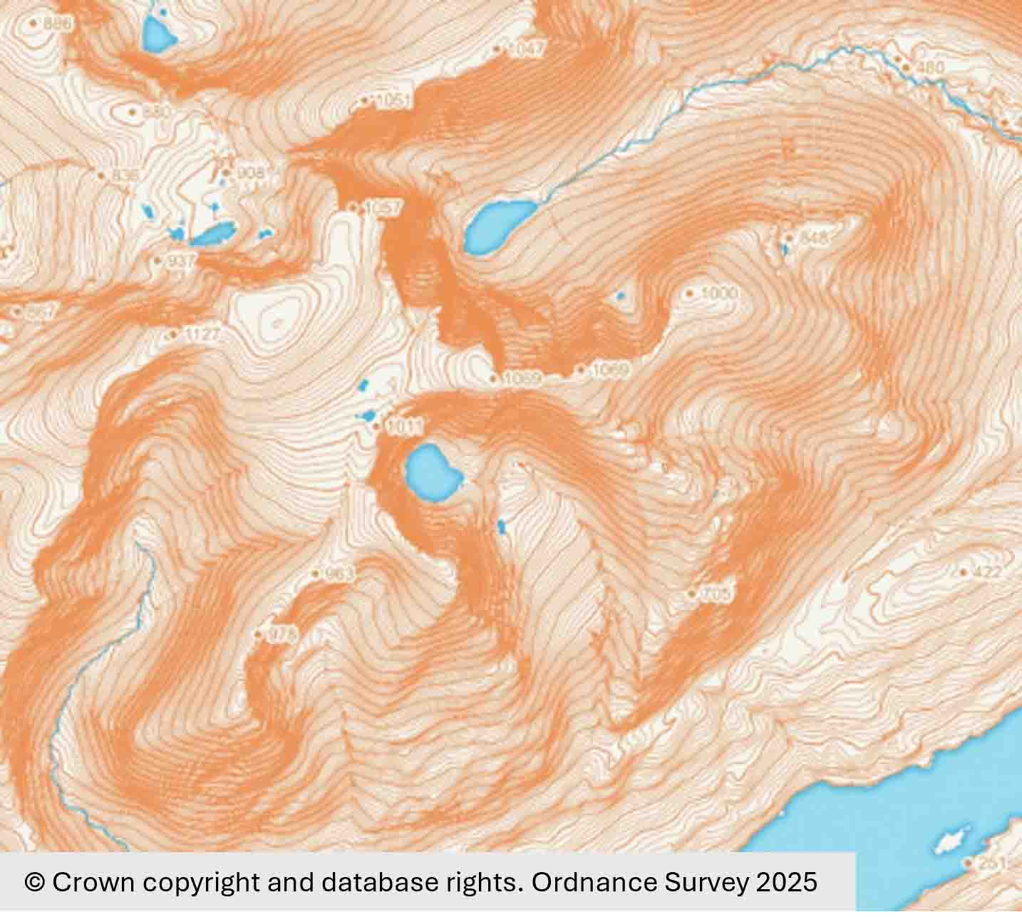
OS Terrain 5 DTM
OS Terrain 5 is a mid-resolution digital terrain model (DTM) for Great Britain derived from photogrammetry for 3D visualisation and modelling activities.
Product DetailsOS Terrain 5
OS Terrain 5 provides a three-dimensional representation of the earth surface without buildings or vegetation designed for use with OS large scale data (1:1250-1:10 000). It models significant landscape features including roads, railways, slopes, quarries and lakes for use in desk studies, minimising the need for site visits, particularly in early project stages.
OS Terrain 5 is available as a grid of heighted points with 5-metre spacing and as contour dataset of 5-metre interval contour polylines and spot height features (including mean high water and mean low water boundaries). The data is aligned to EPSG 27700 (British National Grid) with height relative to Ordnance Survey Newlyn Datum and has an accuracy of 1.5m RMSE in urban areas and major communication routes and 2.5m RMSE in rural and mountain/moorland areas.
Updated quarterly, OS Terrain-5 is available as vector contours at 2m intervals intervals and as a 5m grid of heighted points, supplied for bespoke area-of-interest:
- • 2m Contours in SHP, DWG
- • 5m Grid Data in ASC, TXT, XYZ, DXF
The product is particularly useful in environmental analysis, flood hazard modelling/assessment and landscape visualisation in planning and development activities (e.g. siting of windfarms) and for asset/site management.
Buy OS Terrain 5 for customer-defined areas
Buy OS Terrain 5 Contour Tiles
Buy OS Terrain 5 Grid Data Tiles
OS Terrain 50
OS Terrain 50 is a lower resolution digital terrain model (DTM) for Great Britain derived from photogrammetry for landscape visualisation and analysis over larger areas. It models landscape features and is designed to be interoperable with small-scale mapping products (1:50 000) for analytical, modelling, planning and visual purposes. OS Terrain 50 is available as a grid of heighted points at 50 metre post spacing and contours with 10m intervals and spot height features (including mean high water and mean low water boundaries). The data is aligned to EPSG 27700 (British National Grid) with height relative to Ordnance Survey Newlyn Datum and has an accuracy of 4-metre RMSE. Updated quarterly.
Technical Details
- Supplier
- Ordnance Survey
- Update Cycle
- Quarterly
- Coverage
- GB
- Scale
- 1:1250 - 10 000
- Formats Available
- Contours in SHP (0.5m, 2m & 5m), DWG (1m, 2m & 5m) and 5m Grid Data in ASC, TXT, XYZ, DXF
- Stated Accuracy
- 1.5m Root Mean Square Error (RMSE)
- Stated Accuracy
- 2.5m Root Mean Square Error (RMSE)
- Stated Accuracy
- Licence Options
- Annual
- Delivery Timescale
- Within minutes
Related Products
Flooding products from JBA, Twinn (Ambiental)
Download Samples
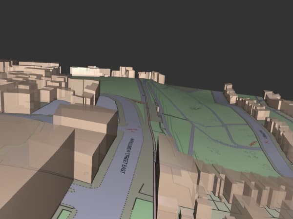
OSMM 3D
Three dimensional representation of OS Mastermap Topography Layer with building heights (LOD1).
Product DetailsOSMM 3D combines OS MasterMap Topography Layer large scale mapping with building heights and the OS 5-metre digital terrain model (OS Terrain 5) to create a simple, three-dimensional view of the landscape (Level of Detail; LOD1).
LOD1 focuses on the overall building volume and shape rather than detailed features. Buildings are represented as rectangular blocks with vertical walls and flat roofs, useful for visualising overall urban landscape and distribution of building in initial planning stages.
OSMM 3D is a fundamental building block for more detailed 3D city models and is suitable for analysis at 1:1,250 to 1:2,500 scales. The data available in a variety of format and processed on demand for customer-defined areas up to 4km2.
License: PDF
Technical Details
- Supplier
- Ordnance Survey
- Update Cycle
- Every 6 weeks
- Coverage
- Great Britain
- Scale
- 1:1250-1:2500
- Formats Available
- DWG, SHP, DWG without AutoCAD Standard, AR (fmear), PDF
- Stated Accuracy
- Stated Accuracy
- Stated Accuracy
- Licence Options
- Annual
- Delivery Timescale
- Within minutes
Related Products
Download Samples
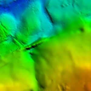
Getmapping DTM/DSM
Digital terrain model (DTM) and digital surface model (DSM) from Getmapping Ltd.
Product DetailsGetmapping pioneered the concept of nationwide coverage of aerial photography and is a leading provider of geospatial data. Getmapping has over 25 years expertise in capturing and delivering high-resolution aerial imagery and deriving digital terrain and digital surface models. Getmapping aerial imagery data is updated on a rolling, three-year cycle and the following products can be ordered in our mapshop:
Getmapping DTM 5m
Getmapping's digital terrain models (DTM) is derived from stereo aerial photography. It is a bare earth model, available for the whole of Great Britain as contours and as a grid of heighted points at 5-metre intervals. It is aligned to EPSG:27700 (British National Grid) and has a vertical accuracy of ± 1m root mean square error (RMSE). The data is useful for terrain analysis and environmental modelling.
Getmapping DSM 2m
Getmapping's digital surface model (DSM) is derived product from stereo aerial photography. It is available for the whole of Great Britain as a grid of heighted points at 2-metre intervals and includes surface features such as buildings and trees. It is aligned to EPSG:27700 (British National Grid) and has a vertical accuracy of ± 0.5m root mean square error (RMSE). The data is useful for precise surface elevation data and detailed analysis.
Technical Details
- Supplier
- Getmapping
- Update Cycle
- Quarterly
- Coverage
- GB and NI
- Scale
- 1:10 000
- Formats Available
- ASC, XYZ, TXT, DXF
- Stated Accuracy
- DSM ± 0.5m root mean square error (RMSE)
- Stated Accuracy
- DTM ± 1m root mean square error (RMSE)
- Stated Accuracy
- Licence Options
- Annual
- Delivery Timescale
- Within minutes
Related Products
Flooding products from JBA, Twinn (Ambiental)
Download Samples

Bluesky DTM/DSM
Digital terrain model (DTM) and digital surface model (DSM) from Bluesky International Ltd.
Product DetailsBluesky is a specialist in the acquisition and processing of aerial photography and in the creation of high-quality digital terrain products. Bluesky is the sole supplier of aerial photography and digital terrain models to public sector organisations in Great Britain, having been awarded the Aerial Photography for Great Britain contract (APGB) by the Geospatial Commission in 2024.
Bluesky data is updated on a rolling, two-year cycle. This increased capture frequency assists with growing concerns about tackling issues like climate change and achieving targets for carbon emission reduction.
Bluesky DTM 5m
Bluesky's digital terrain models (DTM) is derived product from stereo aerial photography. It is a bare earth model, available for the whole of Great Britain as contours and as a grid of heighted points at 5-metre intervals.
Bluesky DSM 2m
Bluesky's digital surface model (DSM) is derived product from stereo aerial photography. It is available for the whole of Great Britain as a grid of heighted points at 2-metre intervals and includes surface features such as buildings and trees.
Technical Details
- Supplier
- Bluesky
- Update Cycle
- Quarterly
- Coverage
- GB and NI
- Scale
- Formats Available
- CSV, SHP
- Stated Accuracy
- Stated Accuracy
- Stated Accuracy
- Licence Options
- Annual
- Delivery Timescale
- Within minutes
Related Products
Download Samples
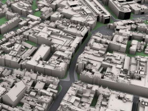
Bluesky 3D Building Models
Custom models created to order from high resolution stereo aerial photography (LOD1, 2, 3).
Product DetailsBluesky 3D Building Models is created to order and delivered as required in data formats for major CAD and visualisation software. It is derived from Bluesky's high resolution, stereo aerial photography for Great Britain.
Models are available in three levels of detail (LOD 1, 2 and 3).
• LOD1 focuses on the overall building volume and shape rather than detailed features. Buildings are represented as rectangular blocks with vertical walls and flat roofs, useful for visualising overall urban landscape and distribution of building in initial planning stages.
• LOD2 represents buildings with roof structure and different parts of the building (e.g., walls, roof) identified as separate elements, allowing for more accurate visualisation and analysis. it is used for representing 3D city models.
• LOD3 includes detailed representations of building elements such as roofs, walls, windows, doors, and other features of facades. It provides a more realistic and detailed representation of a building and are used in architectural design, visualisation and construction documentation.
Bluesky 3D Building Models are created to order.
Bluesky is a specialist in the acquisition and processing of aerial photography and in the creation of high quality digital imagery and terrain products.
By investing in the latest airborne camera technology, Bluesky ensures the quality, accuracy and consistency of its imagery to the highest standard. Bluesky is the sole supplier of aerial photography and digital terrain models to public sector organisations in Great Britain, having been awarded the Aerial Photography for Great Britain contract (APGB) by the Geospatial Commission in 2024.
Technical Details
- Supplier
- Bluesky
- Update Cycle
- Every two years
- Coverage
- Great Britain
- Scale
- Formats Available
- On demand
- Stated Accuracy
- Stated Accuracy
- Stated Accuracy
- Licence Options
- Perpetual
- Delivery Timescale
- Subject to Quote