
OS GB Postcodes
OS GB Postcodes is Ordnance Survey’s next generation postcode dataset for Great Britain. It provides postcode points and postcode areas, giving organisations a clearer, more consistent way to understand where postcodes are located, what area they cover and how they relate to real-world buildings and streets.
OS GB Postcodes replaces the existing OS Code-Point and Code-Point with Polygons products. For organisations already using Code-Point data, this is an important opportunity to review workflows, plan migration and take advantage of a more useful postcode geography dataset.
We recommend migrating to the improved datasets as soon as possible, to ensure continuity. For migration assistance or questions, contact us.
Why choose Emapsite for OS GB Postcodes
With its real-world alignment to buildings, OS GB Postcodes offers a far more useful and reliable view of postcode geography across Great Britain. It’s a valuable addition to the OS National Geographic Database – and we’ll make sure you’re getting the most from your migration.
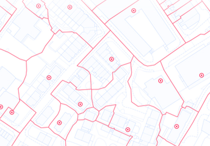
OS GB Postcodes is especially useful where postcode boundaries need to support decisions in the real world. Because the postcode areas are constructed with building outlines in mind, boundaries are designed to avoid cutting through buildings. That makes OS GB Postcodes more useful for identifying whether a property, asset, site or service location falls within a particular postcode area.
Whether you are working in GIS, planning, service delivery, routing, territory mapping or public-sector reporting, our team can help you understand which postcode product is right for your needs.
What can OS GB Postcodes do for me?
OS GB Postcodes helps you connect, analyse, and use postcode information, with the certainty that the datasets accommodate real-word geography. The product includes two key datasets:
OS GB Postcode Points
OS GB Postcode Points provides a representative location for each unit postcode. It replaces OS Code-Point and is useful for lightweight geocoding, routing, navigation, visualisation and postcode-based analysis.
OS GB Postcode Areas
OS GB Postcode Areas provides a postcode boundary for each unit postcode. It replaces Code-Point with Polygons and gives users a more meaningful way to understand the area covered by a postcode.
This is a considerable improvement for many GIS and analytical workflows. Instead of working only with a postcode point, users can work with the area that postcode represents. And because the boundaries are built with real-world building outlines in mind, they provide a stronger basis for assessing whether a specific location falls inside a postcode area.
Key Features of OS GB Postcodes
• Postcode points and areas: Use representative postcode point locations and postcode boundaries in the same product family.
• Improved postcode boundaries: OS GB Postcode Areas provides a clearer representation of the area covered by each unit postcode.
• Building-aware geography: Postcode areas are constructed with building outlines in mind, so boundaries are designed to avoid cutting through buildings.
• Monthly updates: OS GB Postcodes is updated monthly, helping organisations work with more current postcode geography.
• Great Britain coverage: The product covers England, Scotland and Wales.
• Flexible formats: Available in CSV and GeoPackage formats.
• Better migration path: OS GB Postcodes replaces OS Code-Point and Code-Point with Polygons, giving you a more current – and we believe, far more helpful – postcode product built for modern location data workflows.
Why should I choose OS GB Postcodes?
• Greater accuracy: With OS GB Postcodes, it’s easy to determine whether a property, asset, site or service location falls within a specific postcode.
• More useful postcode mapping: Visualise postcode geography as both points and areas, depending on the level of analysis required.
• Improved service eligibility checks: Use postcode boundaries to support eligibility, catchment and coverage analysis.
• Stronger territory mapping: Build and manage sales, service, operational or delivery territories using postcode areas you can rely on.
• Better statistical reporting: Aggregate and report information by postcode geography to support planning, policy and performance analysis.
• Useful for routing and navigation: OS GB Postcodes removes the uncertainty from routing, navigation and geocoding. No more doubts about buildings being inside or outside an area.
Clearer customer and asset analysis: Connect customer records, property records, assets or operational data to postcode geography.
OS GB Postcodes vs Code-Point Open – what’s the difference?
Code-Point Open is still available, providing postcode point information for Great Britain. It’s a good option for basic postcode mapping and lightweight analysis – but it doesn’t provide postcode polygons or include the same level of detail as the licensed OS GB Postcodes products.
For organisations that need postcode areas, service eligibility checks, territory mapping or more accurate location-in-postcode analysis, OS GB Postcode Areas is the stronger option. If in doubt, contact our team – we’d be happy to walk you through the options.

OS GB Postcodes – Technical Data
Data Structure: Vector.
Coverage: National (Great Britain).
Datasets: OS GB Postcode Points and OS GB Postcode Areas
(replacing OS Code-Point and Code-Point with Polygons)
Update Frequency: Quarterly.
Data Formats and Supply Options: OS Transport Network can be supplied in CSV and GeoPackage formats.