
Historic Mapping
Cassini and Ordnance Survey historic mapping at a range of scales.
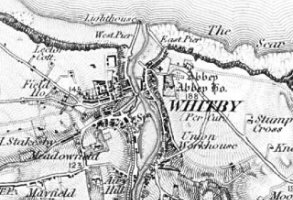
Cassini Old Series
Dating from 1805 -1874, georeferenced high quality reproduction of OS one-Inch ('Old series') maps, reprojected to match OS Landranger (1:50,000) series.
Product DetailsThe mapping used the Cassini projection, which was to be the projection most commonly employed by the Ordnance Survey until the 1940s. Due to the projection differences used across GB and the lower degree of accuracy thanks to the technology of the time, customers should expect that data will not always match up with contemporary mapping.
It soon became clear that the policy of using a meridian of 3ºW for the western maps and Greenwich's 0º for the eastern ones would lead to a convergence between the sheets that would increase as the survey progressed north. Map sheets in central England became progressively more trapezoid in shape as they progress north, rather than the usual rectangular shape. It was eventually decided to use new meridian through the origin of Delamere Forest in Cheshire. This convergence, and the new base line (the Preston to Hull line), which was perpendicular to the meridian through Delamere, can be seen on the Old Series index map.
Technical Details
- Supplier
- Cassini
- Update Cycle
- Coverage
- GB
- Scale
- 1:50,000
- Formats Available
- TIFF, PNG, BMP
- Stated Accuracy
- Stated Accuracy
- Stated Accuracy
- Licence Options
- Annual
- Delivery Timescale
- within minutes
Related Products
Groundsure Map Insight, OS 1:50 000 Raster
Download Samples
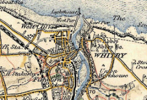
Cassini Revised New Series (1897-1904)
Dating from 1897-1904, georeferenced high quality reproduction of OS one-Inch ('Revised New Series') maps, reprojected to match OS Landranger series.
Product DetailsThe original paper maps were based on individual county projections and due to the projection differences used across GB and the lower degree of accuracy thanks to the technology of the time, customers should expect that data will not always match up with contemporary mapping.
Technical Details
- Supplier
- Cassini
- Update Cycle
- Coverage
- GB
- Scale
- 1:50,000
- Formats Available
- TIFF, PNG, BMP
- Stated Accuracy
- Stated Accuracy
- Stated Accuracy
- Licence Options
- Annual
- Delivery Timescale
- within minutes
Related Products
Groundsure Map Insight, OS 1:50 000 Raster
Download Samples
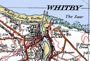
Cassini Popular Edition (1919-1926)
Dating from 1919-1926, georeferenced high quality reproduction of OS one-Inch ('Popular Edition') maps, reprojected to match OS Landranger series.
Product Details
The original paper maps were based on individual county projections and due to the projection differences used across GB and the lower degree of accuracy thanks to the technology of the time, customers should expect that data will not always match up with contemporary mapping.
Technical Details
- Supplier
- Cassini
- Update Cycle
- Coverage
- GB
- Scale
- 1:50,000
- Formats Available
- TIFF, PNG, BMP
- Stated Accuracy
- Stated Accuracy
- Stated Accuracy
- Licence Options
- Annual
- Delivery Timescale
- within minutes
Related Products
Groundsure Map Insight, OS 1:50 000 Raster
Download Samples
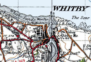
Cassini New Popular Edition (1945-1948)
Dating from 1945-1948, georeferenced high quality reproduction of OS one-Inch ('New Popular Edition') maps, reprojected to match OS Landranger series.
Product DetailsThe original paper maps were based on individual county projections and due to the projection differences used across GB and the lower degree of accuracy thanks to the technology of the time, customers should expect that data will not always match up with contemporary mapping.
Technical Details
- Supplier
- Cassini
- Update Cycle
- Coverage
- GB
- Scale
- 1:50,000
- Formats Available
- TIFF, PNG, BMP
- Stated Accuracy
- Stated Accuracy
- Stated Accuracy
- Licence Options
- Annual
- Delivery Timescale
- within minutes
Related Products
Groundsure Map Insight, OS 1:50 000 Raster
Download Samples

Groundsure Map Insight
Map Insight PDF map packs containing the full range of historic maps of your area of interest, at large scales.
Product DetailsMapinsight Packs are made up of A3 extracts of all available superseded Ordnance Survey maps (from the scales and maps as available to Groundsure from the copyright library used to scan the material) at a variety of scales (including 1:10000, 1:10560, 1:2500, 1:1250) supplied in PDF.
These map packs give the user an historical review of mapping back to around 1840. With full colour scans of source material at 508dpi and PDF output at 600dpi these map packs set a new standard in quality, clarity and interpretability for the environmental professional.
1:10 000 / 1:10 560 scale - there are typically 7 editions for any area
1:2500 / 1:1250 scale - typically 6 editions for any area
Urban areas are more frequently covered; 1:1250 scale only available for "urban" areas. Areas of greater population and change tend to have more mapping editions.
Technical Details
- Supplier
- GroundSure
- Update Cycle
- Coverage
- GB
- Scale
- 1:2500 and 1:10,000
- Formats Available
- PDF, TIFF
- Stated Accuracy
- Stated Accuracy
- Stated Accuracy
- Licence Options
- Perpetual
- Delivery Timescale
- within 4 working hours