
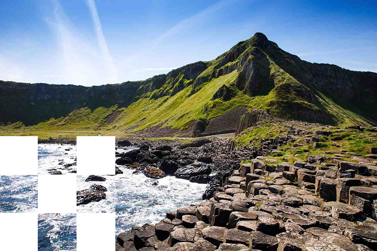
Northern Island Mapping
Ordnance Survey Northern Ireland (OSNI®) is the official national mapping agency for Northern Ireland. OSNI® is the authoritative source of geographic information and cartographic services for the region and is responsible for creating, maintaining and distributing mapping and spatial data.
OSN®I produces comprehensive mapping products at various scales, from large-scale detailed maps suitable for planning and engineering applications to smaller-scale regional maps for general reference. The organisation maintains databases of topographic features, administrative boundaries, property information, road and networks, ensuring that Northern Ireland's geographic information remains current and reliable.
OSNI® map data supports users in all market sectors including environmental management, land and property planning and development, construction, lending, insurance, government and emergency services. OSNI® and its parent government agency, Land & Property Services (LPS), plays a central role in supporting economic development, public service delivery, and property transactions across Northern Ireland.
The OSNI® range of data products includes vector and raster mapping at various scales as well as height data, aerial imagery and addressing data for use in GIS and CAD applications.
OSNI® Pointer®
OSNI® Pointer® is the authoritative address database for Northern Ireland maintained by the government agency, Land & Property Services (LPS).
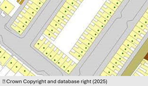
Product DetailsOSNI® Pointer® is the address database for addressable buildings in Northern Ireland with almost 1 million points. It is maintained by Land & Property Services (LPS), with input from local councils and Royal Mail.
Each building is assigned a postal address with a geographic position (EPSG: 29900 TM65 Irish National Grid coordinates). All buildings which are Primary Addressable Objects (PAO) have a unique building identifier and each addressable unit within a building which is a Secondary Addressable Unit (SAO) has a unique property reference number (UPRN). Buildings with several addresses have multiple UPRNs related to the unique building identifier. In some instances, buildings can have more than one PAO and in such cases each PAO will have a separate UPRN.
As well as address information, OSNI® Pointer® contains building and address status and building classification. Each record can be linked to other OSNI datasets such as OSNI® Fusion large scale vector mapping (via land parcel and building identifiers), boundary information and LPS Property Data (via UPRN) and Transport Network (via unique street reference number - USRN).
Ordnance Survey of Northern Ireland (OSNI®) is the official producer of geographic mapping for Northern Ireland. OSNI® is part of Land & Property Services (LPS) within the Department of Finance and collects, processes and manages land and property information in support of economic and social development in Northern Ireland.
Technical Details
- Supplier
- Ordnance Survey of Northern Ireland
- Update Cycle
- Daily with Quarterly updates
- Coverage
- Northern Ireland
- Scale
- 1:1250-1:2500
- Formats Available
- CSV, SHP
- Stated Accuracy
- Stated Accuracy
- Stated Accuracy
- Licence Options
- Annual
- Delivery Timescale
- Within 24 hours
Related Products
Download Samples
OSNI® Fusion
OSNI® Fusion is the new largescale vector product which replaces OSNI Largescale.
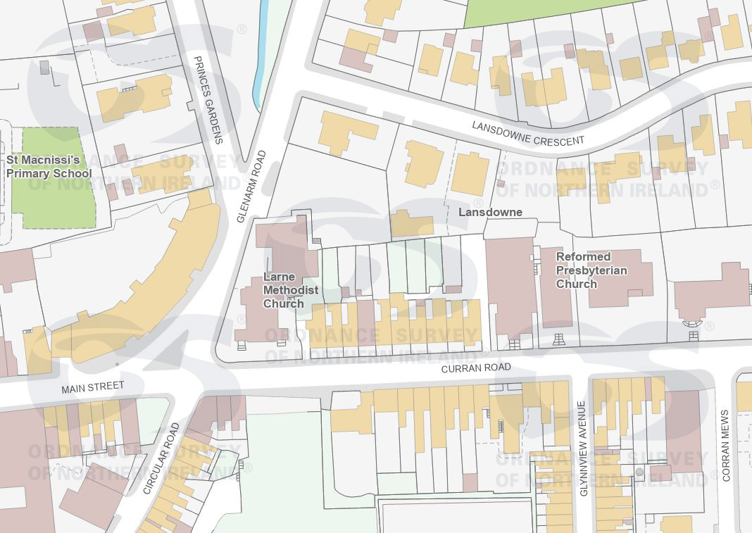
Product DetailsOSNI® Fusion is the new largescale vector product which replaces OSNI Largescale. It describes the form and location of features in Northern Ireland and adds additional information that describes how these are organised and relate to one another at 1:1250 - 1:2500 scale.
OSNI® Fusion contains OSNI® Largescale data migrated into a new structure categorised by 13 themes, layered by geometry type and enhanced with additional attribution, such as full feature lifecycle information and Unique IDs. The existing largescale feature types are held as attributes, making the data more user-friendly, linkable and easier to query.
The ground surface of Northern Ireland is described in three themes (Land, Transport and Water) overlaid with real-world features (Buildings, Ground Cover, Grid Extent, Land Intertidal Sea Theme, Perimeter and Structures). Additional descriptive features are provided for Sites and Text plus a temporary 'Legacy' theme (which will be retired in due course).
All features in OSNI® Fusion have life cycle information and unique identifiers including a 'Fusion-ID' for data linking with other datasets (e.g. OSNI® Pointer®). OSNI® Fusion is aligned to EPSG: 29902 (TM65 Irish National Grid) and is supplied for user-defined areas, tiles (urban: 0.4km x 0.6km and rural: 0.8km x 1.2km) and Full-NI coverage.
Ordnance Survey of Northern Ireland (OSNI®) is the official producer of geographic mapping for Northern Ireland. OSNI® is part of Land & Property Services (LPS) within the Department of Finance and collects, processes and manages land and property information in support of economic and social development in Northern Ireland.
Technical Details
- Supplier
- Ordnance Survey of Northern Ireland
- Update Cycle
- Periodic
- Coverage
- Northern Ireland
- Scale
- 1:1250-1:2500
- Formats Available
- GDB, DWG (Standard)
- Stated Accuracy
- Stated Accuracy
- Stated Accuracy
- Sub-metre
- Licence Options
- Annual
- Delivery Timescale
- Within minutes
Related Products
Download Samples
OSNI® Colour Orthophotography
High quality, georeferenced 3-band aerial photography at 10-cm resolution for a bird's-eye view of the landscape of Northern Ireland.
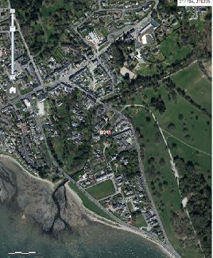
Product DetailsOSNI® Colour Orthophotography raster images offer a detailed bird’s-eye view of the landscape for the whole of Northern Ireland at 10-centimetre resolution. Features such as cars, trees and large shrubs as well as street furniture (benches, signs, lamp posts) and road markings are visible.
OSNI® Colour Orthophotography is ideal for background mapping, identifying development/change in the land, environmental analysis/assessment, right-of-way mapping, land use mapping and various engineering applications.
OSNI® Colour Orthophotography is georeferenced to EPSG: 29900 (TM65 Irish National Grid) and is updated on a three-year flying cycle. It has has a Root Mean Square Error (RMSE) of 0.262m in plan, based on a sample of 3,664 test points. From 2022 onwards, each pixel represents a real-world ground distance of 10cm (Note: images from 2012-2021 at 16-cm). Some water-based tiles along the coast and the southern shore of Lough Neagh may not be updated.
Ordnance Survey of Northern Ireland (OSNI®) is the official producer of geographic mapping for Northern Ireland. OSNI® is part of Land & Property Services (LPS) within the Department of Finance and collects, processes and manages land and property information in support of economic and social development in Northern Ireland.
Technical Details
- Supplier
- Ordnance Survey of Northern Ireland
- Update Cycle
- Every 3 years
- Coverage
- Northern Ireland
- Scale
- 10cm resolution from 2022 (16cm before)
- Formats Available
- TIF, PNG, JPG, BMP
- Stated Accuracy
- Stated Accuracy
- Stated Accuracy
- Sub-metre
- Licence Options
- Annual
- Delivery Timescale
- Within minutes
Related Products
OSNI Fusion, OSNI Enhanced DTM
Download Samples
OSNI® Enhanced Property Data
Property-related information for over 920,000 domestic and non-domestic properties in Northern Ireland.
Product DetailsOSNI® Enhanced Property Data provides property-related information for over 920,000 domestic and non-domestic properties in Northern Ireland. This includes domestic houses, apartments garage and stores and non-domestic retail, education and religious properties.
OSNI® Enhanced Property Data includes property value, building age, construction materials, size, number of storeys/floors, the number of bedrooms, bathrooms and habitable rooms and the rateable values of over 900,000 properties. It also provides address information from the OSNI® Pointer® address dataset including a unique property ID and the unique property reference number (UPRN) for data linking.
OSNI® Enhanced Property Data is updated monthly and supplied as a text file (csv) with full Northern Ireland coverage. Updates available as full data supply. Contains Royal Mail Intellectual Property.
Note:
The data in this product is collected for the purposes of valuing properties for the collection of Rates in Northern Ireland and was not originally intended to be a standalone data product. Consequently, some fields may not be fully populated and OSNI® has no requirement to do so for valuing properties. These fields are noted in the dataset as being not required.
Ordnance Survey of Northern Ireland (OSNI®) is the official producer of geographic mapping for Northern Ireland. OSNI® is part of Land & Property Services (LPS) within the Department of Finance and collects, processes and manages land and property information in support of economic and social development in Northern Ireland.
Technical Details
- Supplier
- Ordnance Survey of Northern Ireland
- Update Cycle
- Monthly (full supply)
- Coverage
- Northern Ireland
- Scale
- Formats Available
- CSV
- Stated Accuracy
- Stated Accuracy
- Stated Accuracy
- Licence Options
- Annual
- Delivery Timescale
- Within 24 hours
Related Products
OSNI® Fusion®, OSNI® Pointer®
Download Samples
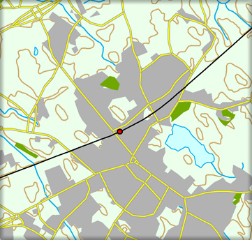
OSNI® Regional 50k Vector
OSNI® Regional 1:50,000 Scale Vector mapping of real-world features presented in seven themes.
Product DetailsOSNI® Regional 1:50,000 Scale Vector mapping provides clear, detailed information for roads, railways, airports, footpaths, woods, water features, important buildings, historical features and height. The product is derived from data used to create OSNI Discoverer Series and has a cartographic focus.
OSNI® Regional 1:50,000 Scale Vector contains points, lines, polylines and polygons representing real-world features presented in seven themes:
- • Settlements
- • Transport
- • Water
- • Vegetation
- • Relief (with 10-metre contour intervals)
- • Northern Ireland Outline
- • Supplemental Text
Typical use cases include environmental impact assessments, land use planning, development, engineering and vehicle routing.
The product is aligned to EPSG: 29900 (TM65 Irish National Grid) and updated on a three-year cycle.
Ordnance Survey of Northern Ireland (OSNI®) is the official producer of geographic mapping for Northern Ireland. OSNI® is part of Land & Property Services (LPS) within the Department of Finance which collects, processes and manages land and property information in support of economic and social development in Northern Ireland.
Technical Details
- Supplier
- Ordnance Survey of Northern Ireland
- Update Cycle
- 3 years
- Coverage
- Northern Ireland
- Scale
- 1:50,000
- Formats Available
- SHP, TAB
- Stated Accuracy
- Stated Accuracy
- Stated Accuracy
- Sub-metre
- Licence Options
- Annual
- Delivery Timescale
- Within minutes
Related Products
OSNI Fusion, OSNI Enhanced DTM
Download Samples

OSNI® Enhanced DTM
Digital terrain model indicating the bare earth surface with 60-metre heighted points with break-lines.
Product DetailsOSNI® Enhanced DTM is a point file of 60-metre heighted points for the whole of Northern Ireland. It also has break-lines (indicating linear features such as banks, ditches and rock faces) showing definite changes in height and giving a highly detailed representation of the Earth’s surface. The product is derived from aerial imagery with around one-third of the dataset (about 100 tiles) being updated annually.
OSNI® Enhanced DTM is suitable for creation of 3D mapping and is used in various use cases for planning, engineering and environmental impact analysis (e.g. data visualisation, height analysis, sight lines, wind flow, pollution dispersion, soil erosion modelling).
The product is aligned with EPSG: 29900 (TM65 Irish National Grid) and has an average accuracy of 1.0m RMSE (root mean square error) with all height measurements in metres mean above sea level at Belfast Lough. Ground heights within forested areas are estimated.
Ordnance Survey of Northern Ireland (OSNI®) is the official producer of geographic mapping for Northern Ireland. OSNI® is part of Land & Property Services (LPS) within the Department of Finance and collects, processes and manages land and property information in support of economic and social development in Northern Ireland.
Technical Details
- Supplier
- Ordnance Survey of Northern Ireland
- Update Cycle
- Every 3 years
- Coverage
- Northern Ireland
- Scale
- Formats Available
- ASC
- Stated Accuracy
- Stated Accuracy
- Stated Accuracy
- Sub-metre
- Licence Options
- Annual
- Delivery Timescale
- Within minutes
Related Products
OSNI Orthophotography (aerial imagery)
Download Samples
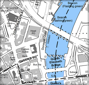
OSNI® Raster Products
OSNI® Raster maps for backdrop use cases at various scales from 1:10,000 to 1:250,000.
Product DetailsOSNI® Raster maps provide clear and detailed information of geo-referenced, topographical features including roads, settlement areas, sites of interest and more. Used for environmental analysis and land-use planning/development.
OSNI® 1:10,000 Scale Raster
OSNI® 1:10,000 Scale Raster mapping is derived from OSNI® Fusion and provides clear, detailed and textual information on roads, buildings, fields, administrative boundaries, water features and vegetation overlaid by contours at 10m intervals. The data is geo-referenced to EPSG 29900 (TM65 Irish National Grid) and be used with other OSNI® mapping, including OSNI® Pointer® address data.
OSNI® 1:10,000 Scale Raster is supplied for user-defined areas, tiles (sized 4.8km x 3.2km) and Full-NI coverage.
OSNI® 1:25,000 Scale Activity Raster
Mid-scale, georeferenced mapping of Northern Ireland tailored to outdoor leisure activities, indicating features such as tracks, walks, forests, place names and sites of interest with contours at 10m intervals. The Lough Erne map also shows hydrographic information.
OSNI® 1:25,000 Scale Raster is supplied in 6 maps for Causeway Coast & Raithlin Island, the Mournes, the Sperrins, Glens of Antrim, Strangford and Loch Erne.
OSNI® 1:50,000 Scale Raster
Mid-scale georeferenced mapping of Northern Ireland providing detailed georeferenced information on roads, footpaths, woods, water features, important buildings and height contours.
OSNI® 1:50,000 Scale Raster is is cartographically identical to the 1:50 000 Scale "Discoverer" paper map series and supplied in tiles (sized 20km x 20km) and Full-NI coverage. Each tile provides a full colour version (with grids), a low colour version and a townlands map. Relief shading has been reduced on the low colour raster to make it more suitable for GIS.
OSNI® 1:250,000 Scale Raster
Small-scale georeferenced mapping with complete coverage of Northern Ireland and the border counties of the Republic of Ireland. It shows A- and B-class numbered roads, railways, villages, towns, cities, county boundaries and selected points of interest. Also includes forests, rivers, place names, car parks, picnic sites, golf courses, caravan parks, and antiquity sites. Altitude tinting gives a clear indication of terrain height.
OSNI® 1:250,000 Scale Raster is cartographically identical to the “Holiday North” paper map and is supplied for Full-NI coverage.
Ordnance Survey of Northern Ireland (OSNI®) is the official producer of geographic mapping for Northern Ireland. OSNI® is part of Land & Property Services (LPS) within the Department of Finance and collects, processes and manages land and property information in support of economic and social development in Northern Ireland.
Technical Details
- Supplier
- Ordnance Survey of Northern Ireland
- Update Cycle
- Periodic
- Coverage
- Northern Ireland
- Scale
- 1:10,000 - 1:250,000
- Formats Available
- TIF, BMP, JPG, DWG
- Stated Accuracy
- Stated Accuracy
- Stated Accuracy
- Licence Options
- Annual
- Delivery Timescale
- Within minutes
Related Products
Download Samples

Unrivalled resources
We simplify the supply and management of mapping products, plans and reports. Blending diverse datasets to uncover hidden commercial insights.

Business intelligence
Our spatial intelligence enables our clients to pinpoint areas of risk and reward, and to make better business decisions faster.

Proven partnership
We work in partnership, we're supportive, and we're committed to reducing our own and our clients' impact on the environment.