Emapsite LandPack HMLR Land Ownership and Insight
Emapsite's LandPack Climate suite brings together HM Land Registry data (HMLR) a selection of property insights and EPC data, as standard. The combined datasets have been designed to save you time and money, giving you the right information in the right format.
All the HMLR data you need
Emapsite's LandPack Climate products - for more valuable HMLR insights
Whatever you’re working on – residential planning applications, climate or ESG reporting, site valuations – HMLR data is often the starting point.
Emapsite’s LandPack Climate products add value into HMLR data by introducing energy performance data as well as other property insights. Our combined datasets are ideal for risk work, site planning, ESG activities, asset management, analysis and business intelligence. It’s easy to download our HMLR products, or to access them in a hosted web service format.

Emapsite LandPack Climate gets you:
-
• Unique, combined datasets ready to use
-
• EPC data and property insights included
-
• Ongoing support from our data experts
-
• Hosted on a secure geo-cloud platform
-
• Reduce data licence administration
LandPack Climate gives you additional insight
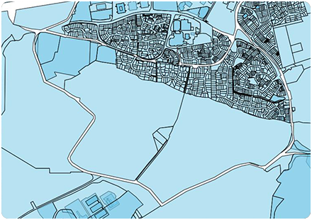
Emapsite LandPack Polygons – our comprehensive property dataset, providing details of residential and commercial property ownership for England & Wales. Emapsite Land Ownership Polygons includes HMLR ‘index’ IDs, geometry and title descriptor and current energy performance data (EPC). Available as a dataset, or via an API in a hosted web service.
[formerly HMLR National Polygon Dataset]
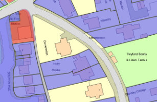
Emapsite LandPack Title and Tenure – this dataset blends Emapsite LandPack Polygons data with OS MasterMap to show land title, tenure, UPRN, and current energy performance (EPC). One purchase covers your large scale mapping requirements, which means no need for individual datasets.
Emapsite LandPack Commercial – a focussed dataset delivering energy performance data and ownership details for land and/or property in England & Wales that’s owned by UK and Overseas companies. Includes a subset of Emapsite LandPack Polygons for commercially owned land/property.
[formerly HMLR Commercial, Corporate and Overseas Ownership]
Emapsite LandPack Bundle (Polygons/Commercial) – a combined dataset, giving you access to Emapsite LandPack Polygons and Emapsite LandPack Commercial.
[formerly HMLR NSD Polygons and Commercial, Corporate and Overseas Ownership]
Why do I need Emapsite's LandPack Climate Data?
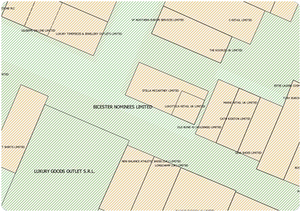
LandPack Climate includes HM Land Registry data and provides the information to support insights as to tenure, EPC progress, risk management, planning, asset management and development for commercial, corporate or privately owned titles in England and Wales.
For Development and Planning
- > Identify ownership of potential sites
- > Understand EPC progress/risks
- > Manage impact of your development
- > Get visibility of potential future development
- > Understand commercial opportunities
Manage assets more efficiently
- > Get visibility of your portfolio
- > Identify sites for investment
- > Better manage maintenance
- > Understand your environmental footprint
Why choose Emapsite for your HM Land Registry data?
Emapsite is the trusted source for the widest range of reliable mapping data. When it comes to HMLR data, we offer exceptional added value - a range of property insights and EPC data included as standard.
- > All the HMLR data you need, supplied direct for your assets alone or as an 'ad hoc' supply of HMLR data downloaded directly from our mapshop.
- > Climate-focussed – with EPC data included as standard in standalone and bundled datasets.
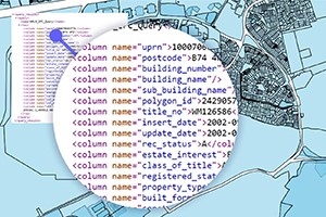
- > HMLR data delivered as a linked file - no need to worry about errors creeping in, correlating existing datasets to HMLR-sourced layers.
- > One source for your HMLR data means more consistency, more confidence in the underlying data that supports your results - it's as up-to-date as it can be, guaranteed.
- > Our cross-sector experience lets us help you innovate to get the most value from the datasets you're using. Challenge us to help overcome problems, using HMLR data.
- > If you're using OS MasterMap already, we can simply supply the HMLR polygons - or we can deliver the data as an overlay, with OS MasterMap included.
