
OS OpenData vs OS Licensed Data: What's the difference
If you’re buying or using UK mapping, OS OpenData and OS licensed data can sound like two versions of the same thing. They aren’t. They both come from Ordnance Survey - the difference lies in the licensing terms, permitted uses, level of detail, and update regimes.
The simplest way to think about it is this: OpenData is designed to be widely usable with lighter constraints, while licensed data is designed to support operational and commercial use cases where detail, update cycles, and rights matter.
Accuracy and detail
OS OpenData is often ideal when you need a reliable reference layer, general context, or broad-scale analysis, and can live with less feature richness or lower granularity.
OS licensed data is where you go when you need high detail, consistent feature attribution, and mapping that stands up in delivery workflows - planning, assets, customer services, operations, compliance, and anything that depends on being ‘current, and accurate enough to act on’.
Attribution requirements
Both routes typically require you to acknowledge the source - but the wording, placement, and ‘how’ you state ‘whose data is this?’ can differ. Attribution is part of your implementation though, it’s not an afterthought - especially if mapping appears in web apps, PDFs, dashboards, or public outputs.
Update frequency
Update expectations vary by product, but the pattern is consistent. OpenData can be perfectly adequate for slower-changing needs, prototypes, or projects where currency is not mission-critical.
Licensed data is often the option when update cadence and change management really matter - for example, when you need confidence that new streets, developments, or reclassified features are reflected in the dataset you’re using.
Commercial restrictions
There’s more to ‘commercial’ than commerce. If your location data supports revenue, client delivery, or contracted services, then you need to be sure you’ve got the right to use and share it in that context. OpenData may be viable in many scenarios, but licensed data gives clear, purpose-built rights for operational and commercial workflows, including publication and third-party access routes where required.
|
Need |
OS OpenData often fits |
OS licensed data often fits |
|
Quick basemap content |
Usually |
Usually |
|
Public-facing info at broad scale |
Usually |
Depends on detail levels |
|
Operational decision-making |
Sometimes |
Usually |
|
Asset management and service delivery |
Rarely |
Usually |
|
Client deliverables, contractor access |
Sometimes |
Usually |
|
High levels of detail, frequently updated and accurate layers |
Rarely |
Usually |
How Emapsite can help
Decide what you’re trying to do: a light-touch reference layer, or mapping that will drive operational decisions and external outputs. Then write down two facts - whether the use is internal or published, and who needs access, including contractors. If OpenData meets the accuracy and update need, it’s a clean win. If it doesn’t, moving to licensed data early prevents rework later.
For more information, reach out to our Customer Support team.

Latest News
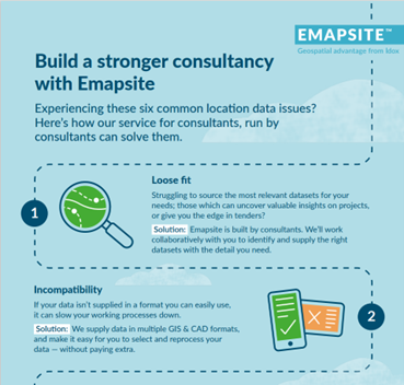
Six Location Data Challenges for Consultancies | Emapsite
Location data is critical to consultancy work, yet common issues like outdated datasets, licensing uncertainty, and incompatible formats can slow projects down and increase risk. This infographic explores six of the most frequent location data challenges faced by consultancies today — and how teams are overcoming them with reliable, compliant, and easy-to-use spatial data.
Read Full Article-
Future-proofing Assets Against Flooding in Britain
Read Full Article -
Why address data is the unsung hero in the UK’s new-build recovery
Read Full Article