




How can utilities improve visibility of their assets and infrastructure?
For a utility company, knowing where assets are is only one part of a much bigger picture. Better asset visibility comes from understanding what that asset is, what surrounds it, how it relates to the wider network and whether anything nearby could affect its operation.
Geospatial data provides the framework for bringing that information together.
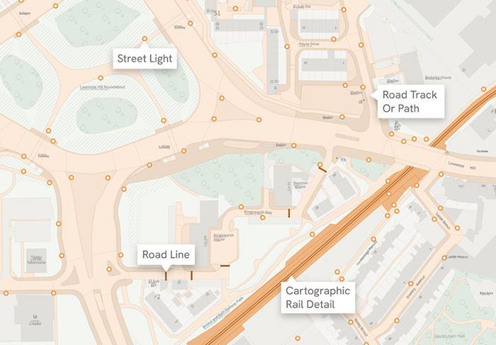
A utility might already hold coordinates for substations, pipes, cables, pumping stations or other infrastructure. Placing those assets against authoritative mapping immediately adds context: nearby buildings, roads, access routes, land, water and other physical features can all become part of the same view.
The OS National Geographic Database (OS NGD) can take this further. Its richer attribution allows organisations to interrogate features in greater detail, while more frequent updates can help GIS teams work with a more current representation of the world around their infrastructure. For utilities managing large and changing networks, that can support asset management, maintenance and risk analysis.
The next step is to combine that context with the utility’s own data. Asset condition, maintenance history, inspection records or network importance can be linked spatially, while environmental and other datasets can add information about external risks. Instead of asking, “Where is this asset?”, teams can ask, “What do we know about it, what does it serve, and what could affect it?”
Visibility also depends on who sees the information. This is incredibly important: asset intelligence loses value if it remains accessible only to GIS specialists. But cloud-based mapping platforms such as Idox Geospatial's groundMapper provide a shared geographic environment in which non-GIS project teams and other stakeholders can view and work with spatial information through a browser, without everyone needing specialist desktop GIS software.
For utilities, improving asset visibility therefore means creating a more complete and accessible picture of the network. Idox Geospatial can help bring existing asset information together with OS NGD and other authoritative data, then make that intelligence available through tools such as groundMapper – giving the people responsible for networks a clearer view of the assets they need to manage.
How Emapsite can help
If you can't find exactly what you need, we can help you choose the right mapping data solution for your project via email, chat or over the phone.
For more information, reach out to our Customer Support team.
Need help with another topic? Learn more in our Knowledge Hub.
Latest News
OS NGD Explained: A beginner’s guide to Ordnance Survey’s National Geographic Database
Learn what the OS National Geographic Database (OS NGD) is, how it works, and why it matters. A simple guide to Britain’s next-generation geospatial data platform.
Read Full Article-
UK geospatial data licensing - A practical guide | OS Mastermap licensing explained
Read Full Article -
Six Location Data Challenges for Consultancies | Emapsite
Read Full Article