





What is LIDAR?
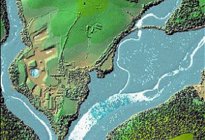
LiDAR stands for Light Detection and Ranging – it’s highly detailed height and surface data, which has been captured using laser scanning.
In simple terms, a sensor sends out laser pulses and measures how long they take to return. Those measurements offer the means to create detailed information about the shape and height of the land, buildings, trees and other surface features.
This makes LiDAR useful when you need to understand elevation, slope, visibility, flood risk, vegetation, building heights or ground conditions. It is widely used in planning, environmental analysis, infrastructure, engineering, forestry, archaeology and asset management.
LiDAR data can help answer practical questions such as:
How high is the land?
Where does water naturally flow?
How steep is the site?
What features stand above the surrounding ground?
How might terrain affect access, design or risk?
One of the most useful things about LiDAR is that it can support surface models and terrain models. A surface model includes features such as buildings and trees. A terrain model focuses more closely on the underlying ground.
In short, LiDAR data gives organisations a detailed way to understand height and shape. If you need elevation data for planning, analysis or decision-making, Emapsite - which is an Idox Geospatial website - can help you find the right dataset and make practical use of it.
How Emapsite can help
If you can't find exactly what you need, we can help you choose the right mapping data solution for your project via email, chat or over the phone.
For more information, reach out to our Customer Support team.
Need help with another topic? Learn more in our Knowledge Hub.
Latest News
OS NGD Explained: A beginner’s guide to Ordnance Survey’s National Geographic Database
Learn what the OS National Geographic Database (OS NGD) is, how it works, and why it matters. A simple guide to Britain’s next-generation geospatial data platform.
Read Full Article-
UK geospatial data licensing - A practical guide | OS Mastermap licensing explained
Read Full Article -
Six Location Data Challenges for Consultancies | Emapsite
Read Full Article