3D and Terrain Data
Digital Terrain and Surface Models (DTMs and DSMs), contours, LiDAR, IfSAR and more
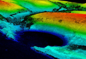
EA LiDAR Elevation Data
Detailed elevation data captured by aircraft, up to 25cm resolution
Product DetailsLidar Elevation data captured by aircraft is typically the most detailed elevation data available.
The Environment Agency captures Lidar Elevation databy aircraft on an ongoing basis for the purpose of creating up to date flood maps. The data is available with a resolution of up to 25cm depending on your study area (other Lidar resolutions include 2m, 1m and 50cm), and comes as both a DTM (Digital Terrain Model) - 'bald earth' - and a DSM (Digital Surface Model).
LIght Imaging Detection and Ranging (LIDAR) technology provides an extremely high vertical resolution for heights of buildings, vegetation and bare ground in open areas, as the surface detail within DSM has been left within the model. At such high resolutions it is possible to use this product for building heights modelling.
Open Government Licence: PDF
Technical Details
- Supplier
- Environment Agency
- Update Cycle
- Varies
- Coverage
- England and Wales (non-continuous coverage)
- Scale
- Resolutions from 0.25m to 2m
- Formats Available
- ASC, XYZ, TXT, DXF
- Stated Accuracy
- dependent on resolution
- Licence Options
- Open
- Delivery Timescale
- within minutes
Related Products
Aerial Photography, OS MasterMap Topography Layer
Download Samples
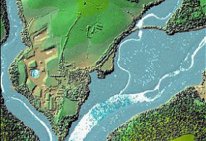
Other LiDAR Elevation Data
Detailed elevation data captured by aircraft, up to 25cm resolution
Product DetailsLidar Elevation data captured by aircraft is typically the most detailed elevation data available.
With a resolution of up to 25cm depending on your study area (other Lidar resolutions include 2m, 1m and 50cm) Lidar Elevation data captured by aircraft is typically the most detailed elevation data available.
emapsite supplies Lidar data from a range of commercial Lidar capture programmes from across Great Britain as both a DTM (Digital Terrain Model) - 'bald earth' - and a DSM (Digital Surface Model).
Technical Details
- Supplier
- Various
- Update Cycle
- Ad-hoc
- Scale
- Resolutions from 0.5m
- Formats Available
- ASC, XYZ, TXT, DXF
- Stated Accuracy
- Dependent on resolution
- Licence Options
- Perpetual
- Delivery Timescale
- On request
Related Products
Aerial Photography, OS MasterMap Topography Layer
Download Samples
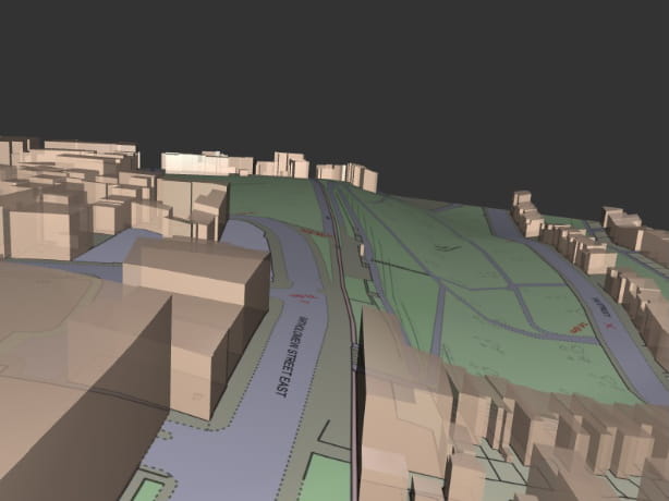
OS MasterMap 3D - Building Heights and OS Terrain 5
OS MasterMap is the most detailed & accurate view of Great Britain's landscape – with roads, fields, buildings, trees, fences & more. Combined with OS Terrain 5 as a single file, saving time & money.
Product DetailsOS MasterMap is the most detailed, current and comprehensive map dataset of Great Britain, enabling you to make better decisions and manage your assets more effectively. Working with the other mapping layers in the suite, OS MasterMap Topography Layer gives you the visual context to help interpret addresses, routes and imagery. OS MasterMap is the approved dataset for planning applications and land registration.
Continually updated, OS MasterMap contains 450 million geographic features found in the real world, from detailed building and road outlines to water features, pathways, bus shelters and letter boxes.
OS MasterMap is ideal for:
- Use in CAD or GIS
- Planning
- Site location and evaluation
- Risk management
- Transport and infrastructure
- Asset management
- Environmental analysis
OS Terrain 5 is ideal for:
OS Terrain 5 is particularly valuable for large scale development projects, planning, impact assessment
OS Terrain 5 offers detailed modelling of significant features such as road, rail, quarries and lakes allowing you to asses the lie of the land on-screen and reduce the need for site visits. OS Terrain 5 has a root mean square error (RMSE) value of 1.5 metres in urban areas and major communication routes.
OS Terrain 5 is maintained as part of the same revision process as the Ordnance Survey's large scale datasets and so adds a valuable third dimension to OS MasterMap Topography Layer.
Licence: PDF
Technical Details
- Supplier
- Ordnance Survey
- Update Cycle
- 6 weekly
- Coverage
- GB
- Scale
- 1:1250 (OS MasterMap) and 5m (Terrain 5)
- Formats Available
- DWG, SHP, PDF
- Stated Accuracy
- Urban +/- 1m (OS MasterMap)
- Stated Accuracy
- Rural +/- 8m (OS MasterMap)
- Stated Accuracy
- +/- 8m (OS MasterMap)
- Licence Options
- 12, 24 or 36 months
- Delivery Timescale
- Within minutes
Related Products
PDF Plans, Aerial Photography, OS MasterMap Highways Layer, OS Mastermap Imagery Layer, Lidar, AddressBase Plus
Download Samples
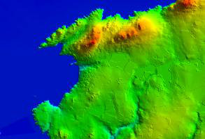
OS Terrain 5
OS Terrain 5 is a Digital Terrain Model (DTM) showing the bare surface of the ground, without vegetation or buildings and is ideal for 3D modelling.
Product DetailsIt offers detailed modelling of significant features such as road, rail, quarries and lakes allowing you to asses the lie of the land on-screen and reduce the need for site visits. OS Terrain 5 has a root mean square error (RMSE) value of 1.5 metres in urban areas and major communication routes.
OS Terrain 5 is maintained as part of the same revision process as the Ordnance Survey's large scale datasets and so adds a valuable third dimension to OS MasterMap Topography Layer.
Licence: PDF
OS Terrain 5 is ideal for:
OS Terrain 5 is particularly valuable for large scale development projects, planning, impact assessment
Technical Details
- Supplier
- Ordnance Survey
- Update Cycle
- 6 weekly
- Coverage
- GB
- Scale
- 5m resolution
- Formats Available
- ASC, XYZ, TXT, DXF
- Licence Options
- Annual
- Delivery Timescale
- Within minutes
Related Products
Aerial Photography, OS MasterMap Topography Layer, OS VectorMap Local
Download Samples
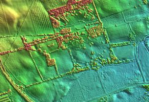
Aerial Photography Derived 2m DSM & 5m DTM
Available for much of Scotland and Wales, Aerial Photography Derived DSM & DTM provides the highest resolution data available in areas with no Lidar coverage
Product DetailsThe data is purchasable as a user defined area and gives access to the highest resolution terrain elevation data for areas where no Lidar data is available.
Aerial Photography Derived 2m DSM & 5M DTM can be downloaded in a range of formats.
Technical Details
- Supplier
- Getmapping.com
- Update Cycle
- Ad-hoc
- Coverage
- Much of Scotland and Wales
- Scale
- 2m & 5m resolution
- Formats Available
- ASC, XYZ, TXT, DXF
- Licence Options
- Perpetual
- Delivery Timescale
- Within minutes
Related Products
Aerial Photography, OS MasterMap Topography Layer, OS VectorMap Local
Download Samples

NextMap Britain 2m Contours (Based on 5m DTM)
RADAR derived DTM for the whole of Great Britain. emapsite have used this 5m DTM to create a 2m contour product.
Product DetailsThis data is derived from data captured using airborne RADAR technology which is then subsequently interpolated using the bespoke "TerrainFit" algorithm to derive the underlying ‘bald earth’ terrain model.
The 5m resolution products incorporate elevation point data every 5m and a vertical accuracy of +/- 60cm providing customers with a highly accurate Digital Elevation Model (DEM).
emapsite have then created this 2m contour product.
The data is purchasable as a user defined area and is available in a range of file formats
Technical Details
- Supplier
- InterMap Technologies
- Update Cycle
- None
- Coverage
- GB
- Scale
- 2m contour interval
- Formats Available
- DXF, SHP
- Licence Options
- Perpetual
- Delivery Timescale
- Within minutes
Related Products
Aerial Photography, OS MasterMap Topography Layer, OS VectorMap Local
Download Samples
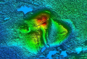
NextMap Britain DTM and DSM 5m & 10m
RADAR derived DTM and DSM for the whole of Great Britain
Product DetailsIntermap NextMap Britain 5m Digital Terrain Model data covers the whole of Great Britain, being interpolated from the Digital Surface Model which was derived from aerial radar surveys carried out during 2003/4. The DTM data is vertically accurate to within +/-1m in areas of minimal vegetation and where the slope is less than 20 degrees.
We recommend NextMap Britain 5m DTM data for projects in lowland parts of Great Britain, in particular open areas, as well as areas for where there is no Lidar coverage available at a finer resolution.
The 10m resolution products are formed by resampling the NextMap Britain 5m DTM. It is important to note however that this will not result in the same level of accuracy when used during visualisations, visual impact assessments, viewshed analyses and similar modelling tasks.
The data is purchasable as a user defined area and is available in a range of file formats
Technical Details
- Supplier
- InterMap Technologies
- Update Cycle
- None
- Coverage
- GB
- Scale
- 5m and 10m resolution
- Stated Accuracy
- Dependent on resolution
- Licence Options
- Perpetual
- Delivery Timescale
- Within minutes
Related Products
Aerial Photography, OS MasterMap Topography Layer, OS VectorMap Local
Download Samples
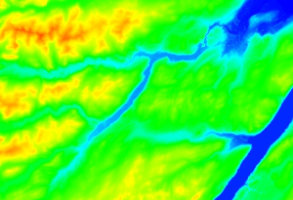
NextMap Britain 25m DTM and DSM
Created specifically to provide large areas of terrain mapping for ZVI use, NextMap25 is available for the whole of GB, or for England, Scotland or Wales.
Product DetailsExclusive to emapsite, we can offer a 25m terrain product from de-resolved NextMap Britain 5m data, which conveniently fills the "resolution gap" between OS Profile at 10m and the OS Opendata Panorama product at 50m. The NextMap25 product is available on a per country basis: for the whole of GB, and for England, Scotland and Wales.
Both the Digital Terrain Model (DTM) and Digital Surface Model (DSM) are available.
For more details, please contact us for information and pricing.
Technical Details
- Supplier
- InterMap Technologies
- Update Cycle
- None
- Coverage
- GB
- Scale
- 25m resolution
- Formats Available
- ASC
- Licence Options
- Perpetual
- Delivery Timescale
- On request
Related Products
Download Samples
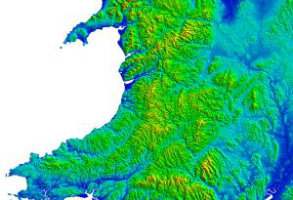
OS Landform Panorama
Land-Form PANORAMA® is a 1:50,000 scale terrain dataset covering the whole of Great Britain and is available as both a digital terrain model (DTM) and contours.
Product DetailsThe DTM data consists of a gridded array of heighted points at 50m intervals and is ideal for creating small scale 3D terrain models. The DTM dataset was derived from the Land-Form PANORAMA® Contours product, which was created using traditional photogrammetry techniques.
Users should note that this is a "frozen" dataset and for information on accuracy and usage should consult the Land-Form PANORAMA® product guide.
Licence: PDF
Technical Details
- Supplier
- Ordnance Survey
- Update Cycle
- None
- Coverage
- GB
- Scale
- 50m resolution
- Formats Available
- XYZ, ASC, DXF
- Stated Accuracy
- Vertical accuracy +/- 3m
- Licence Options
- Open
- Delivery Timescale
- Within minutes
Related Products
OS 1:25 000 Raster, OS 1:50 000 Raster
Download Samples
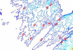
OS Landform Panorama Tiles
Land-Form PANORAMA® is a 1:50,000 scale terrain dataset covering the whole of Great Britain and is available as both a digital terrain model (DTM) and contours.
Product DetailsThe DTM data consists of a gridded array of heighted points at 50m intervals and is ideal for creating small scale 3D terrain models. The DTM dataset was derived from the Land-Form PANORAMA® Contours product, which was created using traditional photogrammetry techniques.
Users should note that this is a "frozen" dataset.
Licence: PDF
Technical Details
- Supplier
- Ordnance Survey
- Update Cycle
- None
- Coverage
- GB
- Scale
- 10m contour interval
- Formats Available
- DXF, NTF
- Stated Accuracy
- Vertical +/-3m
- Licence Options
- Open
- Delivery Timescale
- Within minutes
Related Products
OS 1:25 000 Raster, OS 1:50 000 Raster
Download Samples
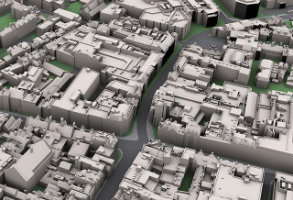
3D Building Models
Building models are created photogrammetrically from accurate, high resolution stereo aerial photography.
Product DetailsThe level of detail on each model can vary according to the application and models can be rendered using existing vertical, oblique or ground photography, giving a real world Cityscape model. Models can be delivered in all major CAD and visualisation software formats, including 3DS.
-Level of Detail 1 - 3D Buildings (simple flat roofed building blocks)
-Level of Detail 2 - 3D Buildings (3D buildings with accurate pitched or flat roof shape)
-Level of Detail 3 – 3D Buildings (3D buildings with accurate pitched or flat roof shape plus roof details such as dormer windows, chimneys and lift shafts)
-Additional Details Layer to include roads, footpaths, trees, water and rail features.
There is full coverage for England and Wales as well as major cities in Scotland. To request a quote please contact us at sales@emapsite.com specifying your area of interest. Most data is created to order, but in areas where data has already been processed turnaround times are greatly reduced.
Technical Details
- Supplier
- Bluesky
- Update Cycle
- Ad-hoc
- Coverage
- England and Wales, plus major cities in Scotland
- Formats Available
- DWG, 3DS and others on request
- Licence Options
- Annual
- Delivery Timescale
- On request
Related Products
Download Samples
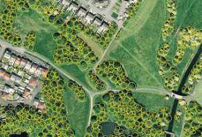
National Tree Map
The National Tree Map (NTM™) provides a detailed assessment of tree heights and canopy cover, using aerial photography, infrared, and high-res DSM data.
Product DetailsNational Tree Map includes a Tree Crown layer showing crown coverage and maximum, minimum and mean height. The attribution allows a variety of visualisations to be carried out, including classifying tree cover by height or canopy size, filtering out of trees under a certain height, etc.
This ‘off the shelf’ baseline tree inventory cuts out costly and time-consuming field data collection. Although not intended to replace field work, NTM™ will allow field assessors to spend less time collecting the base data and more time collating additional, valuable information on the ground that is not so readily observed from aerial photography.
This dataset is available for the whole of England and Wales.
N.B. Aerial Imagery not included.
Technical Details
- Supplier
- Bluesky
- Update Cycle
- Ad-hoc
- Coverage
- England and Wales.
- Formats Available
- SHP, DXF, KML
- Licence Options
- Annual
- Delivery Timescale
- 1-4 working hours depending on size
Related Products
Download Samples
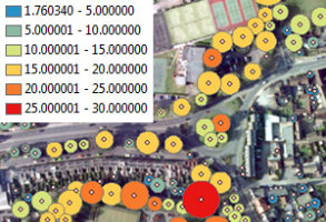
ProximiTREE™
ProximiTREE™ is a digital map layer accurately showing the location and extent of trees and their proximity to buildings.
Product DetailsDesigned as a tool to aid local authority officers, insurance assessors and utility companies, ProximiTREE™ details the exact spatial location and height of individual trees, together with the circumference of the canopy. From this information the potential impact can be assessed.
Aerial photos are used to identify the height of all crowns and canopies visible within each photo. Once the highest point of each tree’s crown has been measured, actual tree heights are determined using an existing Digital Terrain Model.
Licence: PDF
Features:
• Base height, crown height & actual tree height attributes in urban areas
• Crown area attribute measured by m² for each tree in urban areas
• Each tree allocated a unique identity number in urban areas
• Woodlands/clusters of trees in rural areas depicted as merged polygons where similar height
• Derived from up-to-date aerial imagery, independent of Crown copyright
Proximitree is useful for:
Asset management, risk assessment, impact assessment.
Technical Details
- Supplier
- Bluesky
- Update Cycle
- Ad-hoc
- Coverage
- Created on request
- Formats Available
- SHP
- Licence Options
- Annual
- Delivery Timescale
- On request
Related Products
Download Samples
Obstructions 25 Bundle
Both Forest and Urban Height data taken from the 25m DSM grid - Exclusive to emapsite and unique to the market with full UK coverage.
Product DetailsA simple model consisting of point clusters showing heights above ground for all points falling within either woodland areas or buildings. The gridded heights can sit on top of any other terrain data to provide a basic model for use in ZVIs and line of sight modelling over wide areas.
This simple and cost effective dataset is the only available product on the market with complete GB and NI* coverage.
Please note that NI coverage is limited to built-up areas only (not building specific areas).
Technical Details
- Supplier
- emapsite
- Update Cycle
- None
- Coverage
- GB plus NI
- Scale
- 25m resolution
- Formats Available
- ASC
- Licence Options
- Perpetual
- Delivery Timescale
- On request
