
Backdrop Raster Mapping
Mid and small scale mapping including OS 1:25,000 Landranger and OS 1:50,000 Explorer
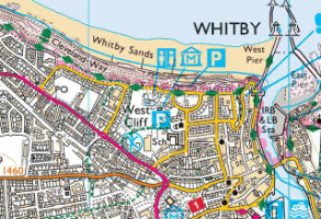
OS OpenMap Local Raster
OS OpenMap Local Raster is a raster version of the most detailed, street-level mapping product available as open data. It's a great backdrop over which to display your data. 1:10,000 scale
Product DetailsOS OpenMap Local Raster is the most detailed, street-level mapping product available as open data. It's a great backdrop over which to display your data.
Open Government Licence: PDF
Technical Details
- Supplier
- Ordnance Survey
- Update Cycle
- Coverage
- GB
- Scale
- 25cm resolution
- Formats Available
- Stated Accuracy
- Stated Accuracy
- Stated Accuracy
- Licence Options
- Delivery Timescale
Related Products
OS MasterMap Topography Layer, OS VectorMap Local, OS VectorMap Local Raster
Download Samples
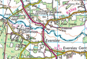
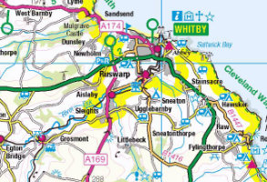
OS 1:25,000 Raster
Ordnance Survey's 1:25,000 scale mapping of GB is the digital version of OS Explorer - ideal for analysing the environment in a rural area.
Product DetailsThe Ordnance Survey's well-known Explorer series of mapping, familiar to walkers and outdoor enthusiasts. Ideal for analysing the environment across a district and in a rural areas, 1:25,000 raster data includes field boundaries, administrative boundaries, Rights of Way including access land, National Trust land, MOD land, selected cycle routes, national trails and points of interest for tourism. Contour lines are shown at 5m intervals (or 10m in some mountainous areas).
The maps can be ordered in a range of raster formats as well as the standard 10x10km TIFF tiles.
The pixel resolution of 1:25,000 data is 2.5m, and printing at 254dpi will print to the correct scale.
Licence: PDF
Technical Details
- Supplier
- Ordnance Survey
- Update Cycle
- Bi-annual
- Coverage
- GB
- Scale
- 1:25,000
- Formats Available
- TIFF, BMP, JPG, PNG
- Stated Accuracy
- Stated Accuracy
- Stated Accuracy
- Licence Options
- Annual
- Delivery Timescale
- Within minutes
Related Products
OS VectorMap District Raster, OS VectorMap Local, OS VectorMap Local Raster
Download Samples
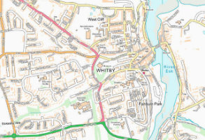
OS 1:50,000 Raster
The 1:50,000 Scale Raster dataset is the digital version of the familiar Ordnance Survey Landranger® map series.
Product DetailsFamiliar to many as the OS Landranger series of paper maps, OS 1:50,000 raster data is also useful for providing context across a wide area and using as a backdrop within GIS or CAD. The maps detail roads, public rights of way, woods, water features, important buildings and contour lines at 10m intervals, and can be ordered in a range of raster formats as well as the standard 20x20km TIFF tiles.
The pixel resolution of 1:50,000 data is 5m, and printing at 254dpi will print to the correct scale.
Licence: PDF
Technical Details
- Supplier
- Ordnance Survey
- Update Cycle
- Bi-annual
- Coverage
- GB plus Isle of Man
- Scale
- 1:50,000
- Formats Available
- TIFF, BMP, JPG, PNG
- Stated Accuracy
- Stated Accuracy
- Stated Accuracy
- Licence Options
- Annual
- Delivery Timescale
- Within minutes
Related Products
Download Samples
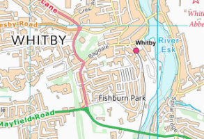
OS VectorMap District Raster
Mid-scale mapping for viewing at town and neighbourhood level, this is the raster version of OS VectorMap District.
Product DetailsMid-scale mapping for viewing at town and neighbourhood level, this is the raster version of OS VectorMap District. Showing all roads and labelling the main urban routes as well as classified roads, the product also outlines built-up areas and highlights local points of interest.
Licence: PDF
Technical Details
- Supplier
- Ordnance Survey
- Update Cycle
- Bi-annual
- Coverage
- GB
- Scale
- 1:15 000 to 1:30 000
- Formats Available
- TIFF, BMP, JPG, PNG
- Stated Accuracy
- Stated Accuracy
- Stated Accuracy
- Licence Options
- Open
- Delivery Timescale
- Within minutes
Related Products
OS VectorMap Local, OS VectorMap Local Raster
Download Samples
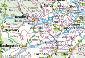
OS 1:250,000 Colour Raster
1:250,000 Scale Colour Raster can provide the ideal small scale mapping backdrop upon which to overlay your business information.
Product DetailsAll the features associated with a car road atlas level of detail, including all the railways, cities, motorways, A and B roads and minor country lanes.
1:250 000 raster data has a pixel resolution of 25 metres and will print to scale if printed at 254dpi.
Licence: PDF
Technical Details
- Supplier
- Ordnance Survey
- Update Cycle
- Annual
- Coverage
- GB plus Isle of Man
- Scale
- 1:250,000
- Formats Available
- TIFF, BMP, JPG, PNG
- Stated Accuracy
- Stated Accuracy
- Stated Accuracy
- Licence Options
- Open
- Delivery Timescale
- Within minutes
Related Products
Collins Bartholomew GB 1:200,000
Download Samples
OS MiniScale™
OS MiniScale™ is a 1:1million small-scale map of Great Britain designed for use in 'desktop graphic' applications.
Product DetailsOS MiniScale is ideal for internet mapping, backdrop mapping, magazine and brochure illustrations, and overview and index mapping. The product can be ordered online via our Mapshop if a small "cut-out" is required. Miniscale is also available in Adobe Illustrator format covering the whole of GB and divided into layers so is fully customisable.
Open Government Licence: PDF
Technical Details
- Supplier
- Ordnance Survey
- Update Cycle
- Coverage
- GB
- Scale
- 1:1,000,000
- Formats Available
- TIFF, PNG, BMP, Adobe Illustrator
- Stated Accuracy
- Stated Accuracy
- Stated Accuracy
- Licence Options
- Open
- Delivery Timescale
- within 4 working hours