
Commercial Searches
We offer multiple reports to support your commercial activities. Sector specific data to enable better decision making. Delivered as a pdf report.
CON29M Official Coal Mining Search
The CON29M is a legal form set out by the Law Society to provide information on past, present and future underground and surface coal mining activity for individual properties or sites in England and Wales. It is requested by solicitors on behalf of their clients as part of the conveyancing searches purchased in a coal mining or past coal mining area.
Groundsure Groundscreen
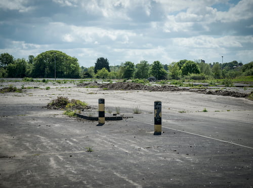
Provides and early view of development risks, along with remedial cost ranges relating to the presence of ground and groundwater contamination and geotechnical issues on brownfield sites.
Agricultural
Provides a detailed assessment of contaminated land risk, alongside a comprehensive review of agricultural features, flood, ground stability, radon, current and planned energy features and transportation, planning constraints and 10 years of planning data.
Review Report
A comprehensive environmental search report for commercial property transactions. Offers unrivalled data analysis to deliver expert insight and understanding.
Screening Report
The ideal assessment for lower value commercial property transactions. Screening covers contaminated land, flood, ground stability, radon and energy risks.
Floodview Report
A comprehensive flood risk search for commercial properties, comprising of a flood risk assessment and the lively availability of flood risk insurance for the property.
Planview Report
Provides detailed planning application information, highlights house extensions, small and large developments, air quality management data and modelled data and planning constraints, such as listed buildings and conservation areas.
Siteguard
This report identifies major environmental risks that may affect a property's valuation and primarily focuses on contaminated land risk.

CON29M Official Coal Mining Search
The Groundsure CON29M Official Coal Mining Search – Commercial brought to you under Law Society licence using official Coal Authority data.
Product DetailsCON29M Official Coal Mining Search – Commercial
The professional opinion on commercial risk from coal mining activity
The Groundsure CON29M Official Coal Mining Search – Commercial brought to you by Groundsure under Law Society licence using official Coal Authority data.
The commercial report answers all of the official 14 questions requested in Law Society Guidance Notes (2018) and has additional information should the property fall within the Cheshire Brine Compensation area. The report offers extra peace of mind, protection and security via a comprehensive £100k Coal Search Report Insurance Policy.
You no longer need to buy the Mine Entry Report as a separate report. A mine entry interpretive assessment is included in the CON29M report, where required, as standard for no extra charge.*
What is the CON29M? The CON29M is a legal form set out by the Law Society to provide information on past, present and future underground and surface coal mining activity for individual properties or sites in England and Wales. It is requested by solicitors on behalf of their clients as part of the conveyancing searches purchased in a coal mining or past coal mining area.
Key features
- It includes a front page summary of the 14 question responses set out by the Law Society, with clear signposting to detailed information, answers and expert opinion
- The report uses official data licensed from the Coal Authority, interpreted and analysed by industry experts Mining Searches UK
- Offers protection and security via a comprehensive £100k Coal Search Report Insurance Policy
- It gives unrivalled data analysis delivering expert insight and understanding for you and your clients
- A unique additional alert highlights the Cheshire Brine Compensation Area – where applicable
- Clear and focused risk advice and next step recommendations supporting transaction progression and completion
- Easy to understand client ready copy – accessible to everyone involved in the transaction
- Uses an OS MasterMap plan of the site and an additional coal mining risk map identifying hazards in relation to the property
- The report uses the now established Groundsure formula for best in class layout and navigation – designed for quick and easy interpretation, getting you to the information you and your clients need, faster
- Streamlined layout compared to other available reports enabling a clearer workflow resulting in smarter and faster decisions
- Supports your professional requirements and is accepted by all major UK lenders
- £10m Professional Indemnity Insurance** (any one claim).
Benefits to the end user
- Pass/potential risk rating
- Professional opinion
- Overview of findings and recommendations
- In depth and detailed search results
- Further notes and guidance
- Coal mining map
- £100,000 Coal Search Report Insurance
- OS MasterMap site plan
- Cheshire brine alert
*Mine entry interpretive assessment
The content of the Groundsure interpretive Mine Entry Report is fully incorporated into the Groundsure CON29M Official Coal Mining Search (both the Residential and Commercial versions) for no extra charge, as standard.
Previously, where mine entries were identified the CON29M would recommend they be investigated further through an additional interpretive report. From the 16th March the valuable additional content and risk assessment provided in that follow-up search will be embedded into the standard CON29M.
Key benefits
- No need to delay the transaction for a follow-up report
- A calculated zone of influence (ZOI) for each mine entry (the physical extent to which they could pose a risk) included as standard
- This ZOI data is built into the report intelligence, risk calculation intelligence and recommendations of the report
- The assessment goes above and beyond official Law Society CON29M guidance and will flag a risk whenever a mine entry ZOI encroaches on a property - even when there is no mine entry within 20m
- Helpful next steps included for all potential mine entry scenarios
- Where appropriate connecting underground roadways are included
- Guidance on next steps in the event of subsidence damage
- The design and format remains largely unchanged
Coal reporting in Scotland
In Scotland this is a ‘Regulated’ search rather than ‘Official’. This is because the Law Society (of England and Wales) and their CON29M form and Guidance Notes do not apply in Scotland. If the property is located in Scotland you will still be able to order the CON29M product (for either Residential or Commercial transactions) and the Groundsure team will generate the appropriate version for Scottish transactions.
The same 11 questions are answered in the Scottish version and the product is identical in terms of the in-depth information included. Key differences:
The Scottish version will not have the question text and numbered format (as licensed and requested by the Law Society)
The Cheshire brine alert is removed for Scotland.
For more information on this product, contact us.
Technical Details
- Supplier
- Groundsure
- Update Cycle
- Coverage
- England, Wales and Scotland*
- Scale
- Formats Available
- Stated Accuracy
- Stated Accuracy
- Stated Accuracy
- Licence Options
- Perpetual
- Delivery Timescale
- <24 hours
Related Products
Download Samples
Groundsure Groundscreen
Provides an early view of development risks, along with remedial cost ranges relating to the presence of ground and groundwater contamination and geotechnical issues on 'brownfield' sites
Product DetailsProvides an early view of development risks, along with remedial cost ranges relating to the presence of ground and groundwater contamination and geotechnical issues on 'brownfield' sites
Groundsure Groundscreen is an early stage, decision support tool for the planning and redevelopment of brownfield sites. The product is intended for the investigation and assessment of ground hazards and provides estimates/ranges for land contamination and geotechnical remediation. It enables rapid identification of potential hotspots and problematic areas within sites that may require different remediation and containment approaches. It is a precursor to conducting detailed site investigations and risk assessment is not a substitute for National Planning Policy Framework compliant desk studies or site investigation, or detailed viability studies.
The product supports the bidding and tendering process, identifying development sites that match risk appetite. It enables easier and clearer comparison of different sites using a standardised approach (Spon's Book pricing) to help focus resource on the areas of greatest risk. Ratings are provided in a hexagonal grid for every 0.25 hectare in England and Wales.
The product builds upon BGS Brownfield Ground Risk Calculator using 57 datasets from Groundsure, BGS, Coal Authority, Ordnance Survey, Environment Agency and National Resources Wales to provide a rating between 0 and 1 along with associated mitigation cost estimates for contamination and geotechnical considerations in three output scenarios:
- Scenario S1 - Higher Sensitivity
Residential with private gardens. Schools for younger children with pitches and play areas. Allotments and growing areas in developments; - Scenario S2 - Medium Sensitivity
Public open space. Residential without private gardens (flats and apartments), universities and colleges; and - Scenario S3 - Lower Sensitivity
Employment or commercial with limited soft landscaping, business parks and data centers.
Groundsure Groundscreen serves as a desk tool that complements early stage activities to comply with industry best practice for the investigation and assessment of ground hazards.
Technical Details
- Supplier
- Groundsure
- Update Cycle
- Annual
- Coverage
- England, Wales
- Scale
- Formats Available
- GPKG
- Stated Accuracy
- Stated Accuracy
- Stated Accuracy
- Licence Options
- 12 months
- Delivery Timescale
Related Products
Download Samples

Agricultural Search Report
Groundsure Agricultural search report has been redeveloped with new and in-depth datasets, unique features, improved layout and navigation, and a refreshing design.
Product DetailsNew and improved Agricultural Report: Now Live
Following an extensive research project with Property Lawyers and PSLs from leading law firms across the UK, the Groundsure Agricultural search report has been redeveloped with new and in-depth datasets, unique features, improved layout and navigation, and a refreshing design. The outcome – a streamlined workflow presenting all the information that you and your clients need faster via a much more user-friendly design and navigation. With several new intelligently filtered datasets, only relevant results are returned, making for concise and easy to follow results and recommendations.
Agricultural provides a detailed manual assessment of contaminated land risk, alongside a comprehensive review of agricultural features, flood, ground stability, radon, current and planned energy features and transportation, planning constraints and 10 years of planning data.
Key features
- Satisfies Law Society Practice Notes on Contaminated Land and Flood Risk and enhanced guidance on Section B8 of the Law Society Conveyancing Handbook
- Comprehensive contaminated land assessment, with detailed commentary on working farmyards, utilising the most comprehensive data available including Groundsure’s Historical Land Use Database, environmental permits, active and historic landfill and waste sites and current industrial sites
- Flood risk assessment covering river, coastal, surface water, groundwater and FloodScore™
- National Grid gas pipeline and electricity transmission lines
- Hydrology and Hydrogeology
- NEW Historic and Current Rights of Way – Open Access Land
- NEW Agricultural Land Classification, indicating the land’s potential productivity
- Planning Constraints including ancient or protected woodland.
- Assessment of archaeological sites of interest.
- NEW Timber felling licenses
- NEW Waste exemptions
- NEW Environmental and Countryside Stewardship Schemes
- Discharge consents
- Nitrate Vulnerable Zones
- Natural and non-natural ground stability assessment including natural ground subsidence, cavities and non-coal mining
- Coal mining screening
- Detailed radon potential data
- Energy data covering existing and proposed oil and gas sites, including fracking, wind installations, solar farms, power stations, and major energy infrastructure
- Comprehensive transportation information provides detail on major rail projects including HS2, Crossrail 1 & 2, active and historic railways and tunnels and underground systems, including the London Underground
Benefit to the end user
- Practical expertise: in-house environmental consultants offer pragmatic and agricultural focused expert insight
- Transaction support: easy to understand client ready copy, accessible to everyone involved in the transaction
- All in one report: now include relevant peripheral infrastructure and planning information in one report
- Enhanced guidance on Section B8 of the Law Society Conveyancing Handbook
If a Groundsure Agricultural report identifies ‘Action Required’, it is often due to current permits or other potentially contaminative activities having been identified. We are able to provide a focused Environmental Audit to address these issues. For further information please contact us.
Technical Details
- Supplier
- Groundsure
- Update Cycle
- Coverage
- England and Wales
- Scale
- Formats Available
- Stated Accuracy
- Stated Accuracy
- Stated Accuracy
- Licence Options
- Perpetual
- Delivery Timescale
- 3 working days
Related Products
Download Samples

Review Report
Review offers commercially focused expert insight, deal orientated recommendations & guidance on high value property transactions, complex industrial sites & redevelopments.
Product DetailsExpert Geo-Risk Analysis and Transaction-Led Advisory
Unrivalled data analysis delivering expert insight and understanding
Commercially focused risk advice supporting transaction progression and completion
Review is not just data – the report’s value rests on unrivalled data analysis delivering expert insight and understanding. Each report is written and reviewed by our in-house team of environmental specialists who can be contacted in the event of a query.
Review is the most comprehensive environmental search report for commercial property transactions. Alongside an intuitive design and plain English explanations, the results are intelligently filtered to clarify risks and next steps quickly and clearly.
The unique and powerful Groundsure IQ engine analyses over 106 million data points to produce every Review report. It provides a detailed manual assessment of contaminated land risk, alongside a comprehensive review of flood, ground stability, radon, current and planned energy features and transportation, planning constraints and optional 10 years of planning data at no extra cost.
Key features
- Satisfies Law Society Practice Notes on Contaminated Land and Flood Risk
- Comprehensive contaminated land assessment utilising the most comprehensive data available including Groundsure’s Historical Land Use Database, environmental permits, active and historic landfill and waste sites and current industrial sites
- Manual review of high detail historical Ordnance Survey mapping in all cases
- Operational environmental risk – our in-house team of environmental experts who specialise in commercial property, are able to provide a desktop assessment of ongoing contamination risk at the site
- Flood risk assessment covering river, coastal, surface water and groundwater
- FloodScore™ and NPPF Flood Risk Assessment indicator
- Energy data covering existing and proposed oil and gas sites, including fracking, wind installations, solar farms, power stations, and major energy infrastructure
- Comprehensive transportation information provides detail on major rail projects including HS2, Crossrail 1 & 2, active and historic railways and tunnels and underground systems, including the London Underground
- Planning constraints such as Green Belt, Conservation Areas and Listed Buildings inform about environmental and cultural designations in the area that could impact on planning proposals
- Natural and non-natural ground stability assessment including natural ground subsidence, cavities and non-coal mining
- Coal mining screening
- Detailed radon potential data
- All higher flood risk reports manually assessed by our expert in-house environmental consultants
Benefits to the end user
- Where issues are identified, our in-house environmental consultants offer pragmatic and commercially focused expert insight, deal orientated recommendations and guidance on next steps
- Named consultant can be contacted in case of follow up questions and queries
- All in one report – no need to buy another report for flood, transport or energy
- Streamlined workflow enabling smarter and faster decisions
- Time and money savings with every transaction
- Easy to understand client ready copy, Review is accessible to everyone involved in the transaction
- Supports your professional requirements and is accepted by all major UK lenders
- Fewer pages showing the key data
For more information on this product contact us.
*Reliance: £10m Professional Indemnity Insurance (any one claim). Can be relied upon by all professional parties within a property transaction, first purchasers / tenants and their advisers. Please refer to Groundsure terms & conditions.
Technical Details
- Supplier
- Groundsure
- Update Cycle
- Coverage
- England and Wales
- Scale
- Formats Available
- Stated Accuracy
- Stated Accuracy
- Stated Accuracy
- Licence Options
- Perpetual
- Delivery Timescale
- 3 working days
Related Products
Download Samples

Screening Report
Screening is the ideal report for lower value less complex commercial property transactions and multi-site portfolios.
Product DetailsThe ideal report for lower value less complex commercial property transactions and multi-site portfolios
Screening provides the ideal assessment for lower value commercial property transactions. Alongside an intuitive design and plain English explanations, the results are intelligently filtered to clarify risks and next steps quickly and clearly.
Screening covers contaminated land, flood, ground stability, radon and energy risks. Each report is written and reviewed by our in-house team of environmental consultants who can be contacted in the event of a query.
Groundsure is the preferred supplier to the UK commercial property secured lending market. Screening has been developed in conjunction with leading UK banks and meets lending security compliance.
Key features
- Satisfies Law Society Practice Notes on Contaminated Land and Flood Risk
- Contaminated land assessment utilising the most comprehensive data available including Groundsure’s Historical Land Use Database, environmental permits, active and historic landfill and waste sites and current industrial sites
- Flood risk assessment covering river, coastal, surface water and groundwater
- FloodScore™ and NPPF Flood Risk Assessment indicator
- Energy data covering existing and proposed oil and gas sites, including fracking, wind installations, solar farms, power stations, and major energy infrastructure
- Planning constraints such as Green Belt, Conservation Areas and Listed Buildings inform about environmental and cultural designations in the area that could impact on planning proposals
- Natural and non-natural ground stability assessment including natural ground subsidence, cavities and non-coal mining
- Coal mining screening
- Detailed radon potential data
- Enhanced transportation screening provides detail on major rail projects including HS2, Crossrail 1 & 2, active and historic railways and tunnels and underground systems, including the London Underground
Benefits to the end user
- Improved accuracy using Land Registry polygons
- Plain English making this report easier to read and understand
- Site boundary on MasterMap
- Intuitive layout and page flow
- Fewer pages - but the same high level quality data that you are used to
For more information on this product, download our comprehensive product card.
* Reliance: £10m Professional Indemnity Insurance (any one claim). Can be relied upon by all professional parties within a property transaction, first purchasers/tenants and their advisers. Please refer to Groundsure terms & conditions.
Technical Details
- Supplier
- Groundsure
- Update Cycle
- Coverage
- England and Wales
- Scale
- Formats Available
- Stated Accuracy
- Stated Accuracy
- Stated Accuracy
- Licence Options
- Perpetual
- Delivery Timescale
- 2 working days
Related Products
Download Samples

Floodview Report
Groundsure Floodview is a comprehensive flood risk search for commercial properties, comprising a fully interpreted flood risk assessment.
Product DetailsReviews all major sources of flooding
Floodview is a comprehensive flood risk search for commercial properties, comprising a fully interpreted flood risk assessment and a view on the likely availability of flood risk insurance for the property. The report's user friendly layout and design provides clearer navigation improving workflow for Property Lawyers.
Utilising Land Registry polygons to ensure a comprehensive accurate assessment of all flood risks, reducing the need for further searches.
Floodview uses a detailed water and drainage risk model devised by industry experts, and provides detail on all potential flood hazards – not just river and tidal. The report includes unique Groundsure risk analysis as well as a view on flood risk insurance and offers access to our expertly qualified environmental consultants for further advice and support.
Key features
- Satisfies Law Society Practice Notes on Flood Risk
- River and Coastal flood risk data from the Environment Agency including RoFRaS, flood defences, areas benefiting from flood defences and proposed flood defence schemes
- 5m surface water (pluvial) flood risk data from Ambiental
- 5m groundwater flooding data from Ambiental
- Environment Agency recorded historic flood events
- Ambiental FloodScore™
- NPPF Flood Risk Assessment indicator
Benefit to the end user
- Improved accuracy using Land Registry polygons
- Plain English making this report easier to read and understand
- Site boundary on MasterMap
- Intuitive layout and page flow
- Fewer pages - but the same high level quality data that you are used to
For more information about this product contact us.
* Reliance: £10m Professional Indemnity Insurance (any one claim). Can be relied upon by all professional parties within a property transaction, first purchasers/tenants and their advisers. Please refer to Groundsure terms & conditions.
Technical Details
- Supplier
- Groundsure
- Update Cycle
- Coverage
- England and Wales
- Scale
- Formats Available
- Stated Accuracy
- Stated Accuracy
- Stated Accuracy
- Licence Options
- Perpetual
- Delivery Timescale
- 1 working day
Related Products
Download Samples

Planview Report
The Planview Report provides a comprehensive planning overview for your client’s commercial property transaction.
Product DetailsProvides a comprehensive planning overview for your client's commercial property transaction
Planview provides detailed planning application information highlighting likely planning and development changes within the vicinity of the property, information not commonly included in the standard suite of searches. It's user friendly layout and design provide clear navigation for property lawyers.
Planview highlights house extensions, small and large developments within the last 10 years, data on Air Quality Management Areas and modelled data and planning constraints such as Listed Buildings and Building Conservation Areas. Our intelligent locality information allows for variable search distances depending on the property's location:
Planning applications fall under 3 categories:
Mega urban areas – 250m for large projects, 50m for small projects and house extensions
Urban areas – 500m for large projects, 125m for small projects and 50m for house extensions
Rural areas – 750m for large projects, 500m for small projects and 125m for house extension.
Key features
- House extension and project planning applications from the last 10 years
- Current and planned Ofcom mobile phone mast locations
- Planning constraints including Green Belt, National Parks, Conservation Areas and Listed Buildings
- Detailed radon potential data
- Local information including education, transport, recreation, retail and entertainment
- Local Authority data including Council Tax bands and police force
- Air Quality Management Areas and modelled data
Benefit to the end user
- Improved accuracy using Land Registry polygons
- Plain English making this report easier to read and understand
- Site boundary on MasterMap
- Intuitive layout and page flow
- Fewer pages - but the same high level quality data that you are used to
For more information on this product, contact us.
Technical Details
- Supplier
- Groundsure
- Update Cycle
- Coverage
- England and Wales
- Scale
- Formats Available
- Stated Accuracy
- Stated Accuracy
- Stated Accuracy
- Licence Options
- Perpetual
- Delivery Timescale
- 1 working day
Related Products
Download Samples

Siteguard Search Report
Groundsure’s Siteguard Search provides the definitive opinion for valuers on lending security.
Product DetailsProvides the definitive opinion for valuers on lending security
Siteguard is designed to identify major environmental risks that may affect a property’s valuation and primarily focuses on contaminated land risk.
The Groundsure Siteguard report was developed in association with a major UK lenders and fully meets the RICS Appraisal and Valuation Standards, providing a four tier risk assessment summary with explicit opinions on environmental liability, loan security risks and potential property value impacts.
Key features
- Four-tier environmental risk assessment
- Opinion on banking security from an environmental risk perspective
- Meets full requirements for the RICS Appraisal and Valuation Standards
For more information on this product, download our comprehensive product card.
*£55+VAT (up to 5ha), 5-15ha £95, 15-50ha £150, 50-100ha £220, 100+ha POA. Reliance: £10m Professional Indemnity Insurance (any one claim). Can be relied upon by all professional parties within a property transaction, first purchasers / tenants and their advisors. Please refer to Groundsure terms & conditions.
Technical Details
- Supplier
- Groundsure
- Update Cycle
- Coverage
- England and Wales
- Scale
- Formats Available
- Stated Accuracy
- Stated Accuracy
- Stated Accuracy
- Licence Options
- Perpetual
- Delivery Timescale
- 1 working day