Groundsure Insight Reports
Identify contaminated land issues and get geological data about your site
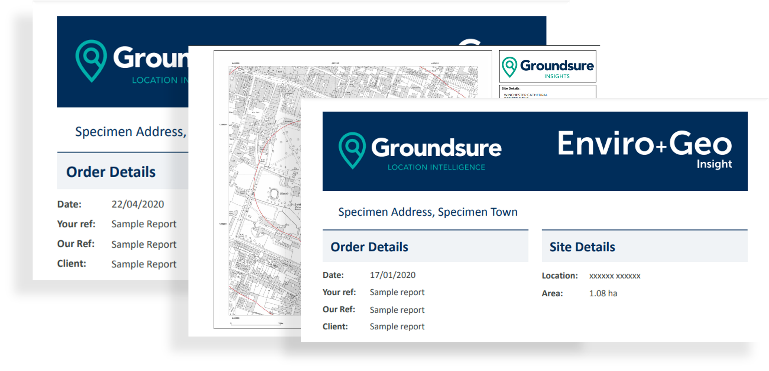
Emapsite supplies Groundsure Insight Reports - the best-in-class environmental and geological reports that are essential for a huge variety of projects.
The key reports: Groundsure Insight, Map Insight, Enviro Insight and Geo Insight are available as PDFs or as raw data for GIS. Groundsure Insight Reports help you provide definitive answers - quickly and easily.
Key Features
• 10k BGS geology data as standard
• Unique Groundsure made mining and sinkhole data
• OS MasterMap site plan (for sites <10ha)
• Water Framework Directive water quality data
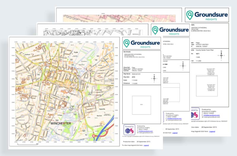
• Highest resolution & clarity Historical Maps, scanned in colour & grey scale
• National Brownfield Risk Model included free as standard
• Pollution inventory data
• Recent and historical aerial imagery
• Includes Fire Insurance Plans as standard, free of charge, where available
• Environmental Permits, Incidents and registers
• Hydrology and Hydrogeology data including abstractions, source protection zones (SPZ), now with SPZ within confined aquifers
• Detailed flood data
Groundsure Insight
The three key Enviro, Geo and Map Insight reports, combining unique environmental and geological datasets with the highest resolution historic mapping available.
Product DetailsGroundsure Insight delivers detailed and accurate information using extensive and unique environmental and geological datasets as well as providing you with the highest resolution historic mapping available.
Groundsure’s Historic Land Use Database (HLUD) is the most accurate and reliable information available on the market. Our HLUD is derived from historic Ordnance Survey mapping dating back to the 1840s, scanned in at over 500dpi – setting a new industry standard.
This sharper imagery means you can see the information more clearly and benefit from greater confidence in your opinion. Each map is manually assessed by an in-house GIS consultant before we deliver it. The Full pack includes National Grid, County Series and Town Plans at scales: 1:10,000, 1:10,560, 1:2,500, 1:1,250, 1:1056 and 1:500.
The Geo Insight report provides all the geo-environmental data required to make informed decisions and identify potential ground stability problems that may affect ground investigation, foundation design or possible remediation options.
What does it cover?
- Historical Land Use information
- Environmental Permits, Incidents and Registers
- Hydrology and Hydrogeology data including abstractions, source protection zones (SPZ), now with SPZ within confined aquifers
- Basic flood data including EA Flood Zones, RoFRaS and groundwater
- Detailed flood mapping – Previously only available in the Flood Insight product
- Groundsure’s unique historical surface and underground workings database
- Groundsure’s mining and mineral extraction database
- Detailed BGS data – 1:10,000 and 1:50,000 scale geology
- BGS non-coal mining hazards data
- BGS BRITPITS current ground workings information
- BGS borehole records, hyperlinked to online BGS scans
- Estimated background soil chemistry information and radon levels.
We can now offer data from your Groundsure Insight reports in vector formats for use in GIS. This gives you the benefit of being able to analyse the information provided in a standard Groundsure Insight PDF report alongside other spatial data. Pricing depends on your area of interest so please contact us for a quote.
Report is available for England, Wales and Scotland. Data sources may differ in Scotland.
Technical Details
- Supplier
- Groundsure
- Update Cycle
- Coverage
- England and Wales
- Scale
- 1:2500 and 1:10,000
- Formats Available
- Stated Accuracy
- Stated Accuracy
- Stated Accuracy
- Licence Options
- Perpetual
- Delivery Timescale
- 4 working hours
Related Products
PDF Plans, OS MasterMap Topography Layer
Download Samples
Map Insight
The highest quality historic mapping on the market, setting a new standard in clarity and interpretability for the environmental professional.
Product DetailsMapinsight Packs are made up of A3 extracts of all available superseded Ordnance Survey maps (from the scales and maps as available to Groundsure from the copyright library used to scan the material) at a variety of scales (including 1:10000, 1:10560, 1:2500, 1:1250) supplied in PDF.
These map packs give the user an historical review of mapping back to around 1840. With full colour scans of source material at 500dpi and PDF output at 600dpi these map packs set a new standard in quality, clarity and interpretability for the environmental professional.
1:10 000 / 1:10 560 scale - there are typically 7 editions for any area
1:2500 / 1:1250 scale - typically 6 editions for any area
Urban areas are more frequently covered; 1:1250 scale only available for "urban" areas. Areas of greater population and change tend to have more mapping editions.
Technical Details
- Supplier
- GroundSure
- Update Cycle
- Coverage
- GB
- Scale
- 1:2,500 and 1:10,000
- Formats Available
- Stated Accuracy
- Stated Accuracy
- Stated Accuracy
- Licence Options
- Perpetual
- Delivery Timescale
- 4 working hours
Related Products
PDF Plans, OS MasterMap Topography Layer
Download Samples

Enviro Insight
Detailed, accurate and extensive - covering environmental permits, contaminative processes and registers, waste, hydrogeology and geology.
Product DetailsThe Enviro Insight accesses Groundsure’s unique Historic Land Use Database (HLUD) which features the most accurate and reliable information available on the market. Our HLUD is derived from historic Ordnance Survey mapping dating back to the 1840s, features over 7000 land use classifications and is scanned in at over 500dpi – setting a new industry standard.
Enviro Insight offers environmental professionals condensed data in an easy to use report format combined with aerial photographs. This enables quick identification of potential risks helping to give an immediate site overview. It features current aerial photographs, an advanced graphical representation of each data element and data specific radial searches.
Enviro Insight includes:
- A clear summary that highlights key features of the report
- Aggregated historic land use information
- Detailed flood mapping from EA & Ambiental
- Enhanced planning and development designations
- Pollution inventory data
- Waste exemptions
Report is available for England, Wales and Scotland. Data sources may differ in Scotland.
Technical Details
- Supplier
- Groundsure
- Update Cycle
- Coverage
- England and Wales
- Scale
- 1:10,000
- Formats Available
- Stated Accuracy
- Stated Accuracy
- Stated Accuracy
- Licence Options
- Perpetual
- Delivery Timescale
- 4 working hours
Related Products
PDF Plans, OS MasterMap Topography Layer
Download Samples

Geo Insight
A highly detailed geological data report combining BGS data with unique geological and geo-hazard datasets developed by Groundsure.
Product DetailsGeo Insight is essential for geo-environmental professionals and their clients to make informed decisions and identify potential ground instability and other potentially costly problems that may affect ground investigation, foundation design or possible remediation options. The Geo Insight provides unique data on current and historical railways and tunnels – detail which isn’t available in any other desktop report. It also features BGS recorded boreholes, with hyperlinks to online digitised records.
Groundsure Geoinsight is designed for environmental consultants, engineers, developers, designers and other professionals involved within construction and ground workings to identify and interpret the potential for ground conditions to affect existing or proposed structures at an early stage.
Geo Insight includes:
- BGS Geology 1:10,000 scale (provided where available)
- BGS Geology 1:50,000 scale
- BGS Boreholes
- Natural ground subsidence from BGS Geosure
- Estimated background soil chemistry information and radon levels
Report is available for England, Wales and Scotland. Data sources may differ in Scotland.
Technical Details
- Supplier
- Groundsure
- Update Cycle
- Coverage
- GB
- Scale
- 1:10,000
- Formats Available
- Stated Accuracy
- Stated Accuracy
- Stated Accuracy
- Licence Options
- Perpetual
- Delivery Timescale
- 4 working hours
Related Products
PDF Plans, OS MasterMap Topography Layer
Download Samples
Groundsure Insight: GIS Products
The three key Enviro, Geo & Map Insight reports, combining unique environmental & geological datasets with the highest resolution historic mapping available. Now available as raw data for GIS.
Product DetailsGroundsure's unique reports for desktop environmental assessment - the Enviro Insight and Geo Insight - have been updated to provide a new level of environmental data access. These updated reports, alongside the Map Insight, our best-in-class historical Ordnance Survey map product, make up the Groundsure Insight; the new environmental data standard.
This unrivalled data content is now available as raw data for GIS.
Get your historical maps and environmental data straight into a GIS giving you complete control of the analysis. You decide how to investigate and interrogate the data, rather than relying on the ‘flat’ maps delivered within standard environmental reports.
Bespoke spatial analysis of this kind can unlock hidden relationships and detail and create workflow efficiencies for your business.
Data formatted for GIS is especially effective for large sites, where a PDF report is sometimes not an appropriate or feasible option.
These data products are exclusive to Groundsure and have been developed with the help of customers to provide a clear and concise way to organise and analyse environmental data in your GIS software.
The file is provided as a geodatabase compatible with ESRI’s ArcGIS software.
Key features:
- Unique and unrivalled data content
- Uses your existing ESRI and ArcGIS software
- Detailed metadata of content
- Follows the same section format of the PDF reports
- Universal styles across PDF reports and GIS data for seamless switching
Technical Details
- Supplier
- Groundsure
- Update Cycle
- Coverage
- England and Wales
- Scale
- 1:2500 and 1:10,000
- Formats Available
- Enviro & Geo Insights: GDB MapInsight: GeoTiffs
- Stated Accuracy
- Stated Accuracy
- Stated Accuracy
- Licence Options
- Annual licence
- Delivery Timescale
- 1 working day up to 1000ha
Related Products
PDF Plans, OS MasterMap Topography Layer
Download Samples
Enviro and Geo Insight: GDB