Marine Mapping and Data
We provide marine raster charts and marine theme vector datasets from OceanWise, the renowned authority in the field of marine mapping data and comprehensive solutions for the marine and coastal environment. We work with national hydrographic offices and other key agencies to offer you the widest range of authoritative marine data.
Accurate, up-to-date, and delivered the way you need it: this is everything you need in a comprehensive marine data package, with the support of experts to guarantee you’ll be getting the most value from the information you’re using.
Data products are available for UK & Irish waters and beyond and are supplied as half-degree 'tiles' for bespoke or complete chart areas.

What kind of data is available for Marine Mapping?
Raster Charts
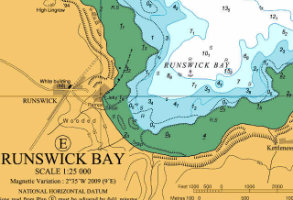
Raster Charts provide electronic versions of familiar nautical paper charts and are derived under licence from the UK, and other, Hydrographic Offices. They can be opened using any image viewer software and are geo-referenced for use in geographical information systems (GIS).
Raster Charts are ideal for applications where a set of familiar features and related symbology is required for reference or as a backdrop to other data.
Raster Charts are available at Large Scale for estuaries and harbours (greater than 1:30 000), Medium Scale for coastal waters (1:30 000 to 1:150 000) and Small Scale for sea areas (Less than 1:150 000).
Raster Charts XL (Excluding Land)
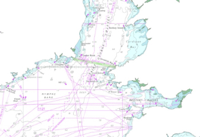
Raster Charts XL (Excluding Land) are Raster Charts with the usual mustard-shaded land areas removed so that customers can pair charts with land mapping of their choice.
Marine Theme Vector
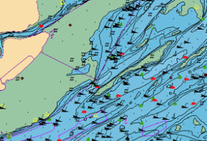
Marine Theme Vector products are provided as individual themed layers and contains feature attributes designed with analysis and querying in mind. Chart boundaries have been removed to create a seamless, simplified dataset with unique identifiers for data linking. There are eight layers describing geographical regions, administrative areas, transport routes, industrial facilities, obstructions and shipwrecks, elevation, sea-bed geology and tides and tidal currents.
Marine Themes Digital Elevation Model (DEM)
Marine Themes Digital Elevation Model (DEM) is a separate, seabed surface model, comprising detailed and accurate data of the seabed. The dataset utilises the most recent, commercially available single and multi-beam survey and LiDAR data, assessed and carefully selected in a deconfliction process. A coverage layer is also available to ensure the source of the data is always clearly defined.
International Marine Mapping
International Marine Mapping is also available for selected regions worldwide depending on international agreements. Please contact us to confirm availability for your area-of-interest.


