
Northern Ireland Mapping
Land and Property Services' complete range of mapping, available in a range of formats via Emapsite's delivery platform.
LPS NI - PointerPLUS
LPS Northern Ireland - PointerPLUS - address data for Northern Ireland.
Product DetailsPointer is the address database for Northern Ireland and is maintained by Land & Property Services (LPS), with input from local councils and Royal Mail.
It is the common standard address for every property in Northern Ireland.
Technical Details
- Supplier
- Land and Property Services Northern Ireland
- Update Cycle
- Coverage
- Northern Ireland
- Scale
- Sub-metre accuracy
- Formats Available
- CSV, SHP
- Stated Accuracy
- Stated Accuracy
- Stated Accuracy
- Licence Options
- Annual
- Delivery Timescale
- within 4 working hours
Related Products
Download Samples
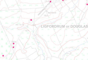
LPS NI - 1:10,000 Colour Raster
Site specific LPS Northern Ireland - 1:10 000 colour raster mapping. Ideally suited as a backdrop image for engineering, environmental and agricultural projects.
Product DetailsThe 1:10,000 scale mapping is derived directly from the OSNI Largescale database. This mapping provides clear, detailed and textual information on roads, buildings, fields, administrative boundaries, water features and vegetation overlaid by contours at 10m intervals.
The 1:10,000 scale raster is available as regular tiles or a bespoke site-centred area.
Technical Details
- Supplier
- Land and Property Services Northern Ireland
- Update Cycle
- Annual
- Coverage
- Northern Ireland
- Scale
- 1:10,000
- Formats Available
- TIFF, PNG, BMP
- Stated Accuracy
- Stated Accuracy
- Stated Accuracy
- Licence Options
- Annual
- Delivery Timescale
- within 4 working hours
Related Products
Download Samples
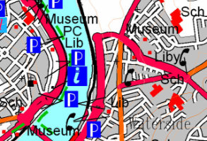
LPS NI - 1:50 000 Colour Raster
Site specific LPS Northern Ireland - 1:50 000 colour raster mapping.
Product DetailsThis series is the raster equivalent to the paper Discoverer series (1:50,000), covering the whole of Northern Ireland. Features include clear detailed information on roads, footpaths, woods, water features, important buildings and height contours.
Technical Details
- Supplier
- Land and Property Services Northern Ireland
- Update Cycle
- Annual
- Coverage
- Northern Ireland
- Scale
- 1:50,000
- Formats Available
- TIFF, PNG, BMP
- Stated Accuracy
- Stated Accuracy
- Stated Accuracy
- Licence Options
- Annual
- Delivery Timescale
- within 4 working hours
Related Products
Download Samples
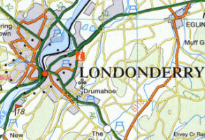
LPS NI - 1:250,000 Colour Raster
Site specific LPS Northern Ireland -1:250 000 colour raster mapping.
Product DetailsComplete coverage of Northern Ireland and border counties of the Republic of Ireland. Shows roads, with A and B class roads numbered, railways, villages, towns, cities, county boundaries and selected points of interest.
The mapping also shows forests, rivers, place names, car parks, picnic sites, golf courses, caravan parks, and antiquity sites; altitude tinting gives a clear indication of terrain height.
Technical Details
- Supplier
- Land and Property Services Northern Ireland
- Update Cycle
- Annual
- Coverage
- Northern Ireland
- Scale
- 1:250,000
- Formats Available
- TIFF, PNG, BMP
- Stated Accuracy
- Stated Accuracy
- Stated Accuracy
- Licence Options
- Open
- Delivery Timescale
- within 4 working hours
Related Products
Download Samples
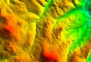
LPS NI - Enhanced DTM
Enhanced DTM derived from aerial imagery using 3D software.
Product DetailsOrdnance Survey of Northern Ireland (OSNI®) is part of Land & Property Services (LPS) operating within the Department of Finance. LPS collects, processes and manages land and property information in support of economic and social development in Northern Ireland, whilst OSNI® is the official producer of high quality, accurate and current geographic mapping data for Northern Ireland.
The dataset consists of a point file of 60 metre heights, along with break-lines (representing linear features such as banks, ditches and rock faces) showing definite changes in height and giving a highly detailed representation of the Earth’s surface.
Provides full coverage of Northern Ireland (TM75 Irish National Grid) with around one-third of the dataset updated annually (i.e. 100 tiles). Tile Size: 9.6km x 6.4km.
The product has an accuracy of 1.0m RMSE (root mean square error), where 65 per cent of data has an accuracy of 1.0m, 90 per cent has an accuracy of 2.0m, and 99 per cent of the data has an accuracy of 3.0m. Ground heights within forest areas is estimated.
Particularly suited for:
- Creation of 3D mapping (e.g. slope and aspect maps)
- Thematic maps, grids and contour maps
Technical Details
- Supplier
- Land and Property Services Northern Ireland
- Update Cycle
- 3-years
- Coverage
- Northern Ireland
- Scale
- Formats Available
- DXF, TIF
- Stated Accuracy
- Stated Accuracy
- Stated Accuracy
- 1.0m RMSE
- Licence Options
- Annual
- Delivery Timescale
- within 4 working hours
Related Products
OSNI/LPS Fusion, OSNI Large Scale Vector Mapping
Download Samples
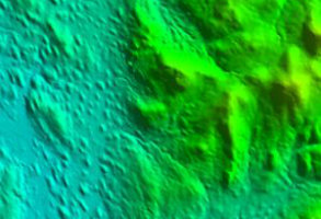
LPS NI OpenData Digital Terrain Models
OpenData digital terrain models at 10m and 50m resolution created from stereo imagery in the orthophotography production process.
Product DetailsOrdnance Survey of Northern Ireland (OSNI®) is part of Land & Property Services (LPS) operating within the Department of Finance. LPS collects, processes and manages land and property information in support of economic and social development in Northern Ireland, whilst OSNI® is the official producer of high quality, accurate and current geographic mapping data for Northern Ireland.
Digital Terrain Model (10m resolution)
10m resolution grid DTM data created from stereo imagery in the orthophotography production process. Supplied in 9.6km x 6.4km tiles for the whole of Northern Ireland with accuracy 1.0m RMSE (root mean square error). All height measurements refer to elevation in metres above mean sea level at Belfast Lough.
Digital Terrain Model (50m resolution)
50m resolution grid DTM data created from stereo imagery in the orthophotography production process. Supplied as 20km x 20km tiles for the whole of Northern Ireland with accuracy 1.0m RMSE (root mean square error). All height measurements refer to elevation in metres above mean sea level at Belfast Lough
Technical Details
- Supplier
- Land and Property Services Northern Ireland
- Update Cycle
- Coverage
- Northern Ireland
- Scale
- Formats Available
- ASC, XYZ
- Stated Accuracy
- Stated Accuracy
- Stated Accuracy
- Licence Options
- Open
- Delivery Timescale
- within 4 working hours
Related Products
OSNI/LPS Northern Ireland Enhanced DTM
Download Samples
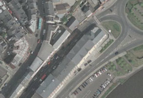
LPS NI - 25cm Ortho Photography
Ortho photography, 25cm. Northern Ireland coverage.
Product DetailsComplete coverage of Northern Ireland orthophotography is flown in three year cycles, and provided at a resolution of 25cm. There are some water-based tiles along the coast and the southern shore of Lough Neagh which aren't updated.
Technical Details
- Supplier
- Land and Property Services Northern Ireland
- Update Cycle
- Ad-hoc
- Coverage
- Northern Ireland
- Scale
- 25cm resolution
- Formats Available
- TIFF, JPEG
- Stated Accuracy
- Stated Accuracy
- Stated Accuracy
- Licence Options
- Perpetual
- Delivery Timescale
- within 1 working day
Related Products
Download Samples

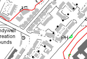
LPS NI - 1:50,000 Scale Vector
Site specific LPS Northern Ireland - vector 1:50,000 data.
Product DetailsOSNI 1:50,000 vector is made up of distinct datasets covering relief, water, settlements and vegetation. The datasets give full coverage of Northern Ireland.
Technical Details
- Supplier
- Land and Property Services Northern Ireland
- Update Cycle
- Coverage
- Northern Ireland
- Scale
- 1:50,000
- Formats Available
- SHP, TAB
- Stated Accuracy
- Stated Accuracy
- Stated Accuracy
- Licence Options
- Open
- Delivery Timescale
- within 4 working hours