
Open Data
Get quick and easy access to the open data you need in formats you can use.
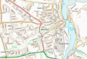
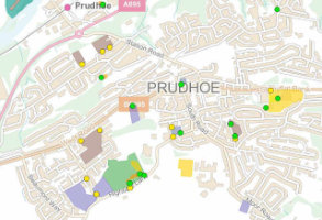
OS OpenMap Local
OS OpenMap – Local is the most detailed, street-level mapping product available as open data. It's a great backdrop over which to display your data. 1:10,000 scale
Product DetailsOS OpenMap – Local is the most detailed, street-level mapping product available as open data. It's a great backdrop over which to display your data.
Open Government Licence: PDF
Technical Details
- Supplier
- Ordnance Survey
- Update Cycle
- Coverage
- GB
- Scale
- 25cm resolution
- Formats Available
- Stated Accuracy
- Stated Accuracy
- Stated Accuracy
- Licence Options
- Delivery Timescale
Related Products
OS MasterMap Topography Layer, OS VectorMap Local, OS VectorMap Local Raster
Download Samples

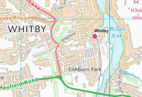
OS OpenMap Local Raster
OS OpenMap Local Raster is a raster version of the most detailed, street-level mapping product available as open data. It's a great backdrop over which to display your data. 1:10,000 scale
Product DetailsOS OpenMap Local Raster is the most detailed, street-level mapping product available as open data. It's a great backdrop over which to display your data.
Open Government Licence: PDF
Technical Details
- Supplier
- Ordnance Survey
- Update Cycle
- Coverage
- GB
- Scale
- 25cm resolution
- Formats Available
- Stated Accuracy
- Stated Accuracy
- Stated Accuracy
- Licence Options
- Delivery Timescale
Related Products
OS MasterMap Topography Layer, OS VectorMap Local, OS VectorMap Local Raster
Download Samples
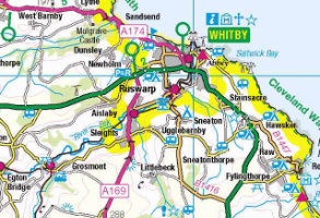
OS VectorMap District Raster
Mid-scale mapping for viewing at town and neighbourhood level, this is the raster version of OS VectorMap District.
Product DetailsMid-scale mapping for viewing at town and neighbourhood level, this is the raster version of OS VectorMap District.
Open Government Licence: PDF
Technical Details
- Supplier
- Ordnance Survey
- Update Cycle
- Coverage
- GB
- Scale
- 1:25,000
- Formats Available
- TIFF, PNG, BMP
- Stated Accuracy
- Stated Accuracy
- Stated Accuracy
- Licence Options
- Open
- Delivery Timescale
- within 4 working hours
Related Products
OS VectorMap Local, OS VectorMap Local Raster, OS 1:25 000 Raster
Download Samples
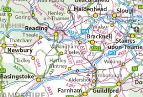
OS 1:250,000 Colour Raster
1:250,000 Scale Colour Raster can provide the ideal small scale mapping backdrop upon which to overlay your business information.
Product DetailsThe product contains all the features associated with the Road Map series, including all the railways, cities, motorways, A and B roads and minor country lanes.
1:250,000 raster data has a pixel resolution of 25 metres and will print to scale if printed at 254dpi.
Open Government Licence: PDF
Technical Details
- Supplier
- Ordnance Survey
- Update Cycle
- Coverage
- GB
- Scale
- 1:250,000
- Formats Available
- TIFF, PNG, BMP
- Stated Accuracy
- Stated Accuracy
- Stated Accuracy
- Licence Options
- Open
- Delivery Timescale
- within minutes
Related Products
Collins Bartholomew GB 1:200,000
Download Samples
OS MiniScale
OS MiniScale™ is a 1:1million small-scale map of Great Britain designed for use in 'desktop graphic' applications.
Product DetailsOS MiniScale is ideal for internet mapping, backdrop mapping, magazine and brochure illustrations, and overview and index mapping. The product can be ordered online via our Mapshop if a small "cut-out" is required. Miniscale is also available in Adobe Illustrator format covering the whole of GB and divided into layers so is fully customisable.
Open Government Licence: PDF
Technical Details
- Supplier
- Ordnance Survey
- Update Cycle
- Coverage
- GB
- Scale
- 1:1,000,000
- Formats Available
- TIFF, PNG, BMP
- Stated Accuracy
- Stated Accuracy
- Stated Accuracy
- Licence Options
- Open
- Delivery Timescale
- within 4 working hours
Related Products
Download Samples
OS Open Greenspace
Britain’s most comprehensive Open dataset of greenspace.
Product DetailsUnderstand the location of public parks, playing fields, sports facilities, play areas and allotments, along with access points for entering and exiting urban and rural greenspaces.
Open Government Licence: PDF
Technical Details
- Supplier
- Ordnance Survey
- Update Cycle
- Coverage
- GB
- Scale
- Formats Available
- SHP, TAB
- Stated Accuracy
- Stated Accuracy
- Stated Accuracy
- Licence Options
- Open
- Delivery Timescale
- within 4 working hours
Related Products
OS VectorMap Local Raster, OS VectorMap District Raster
Download Samples

OS Code-Point Open
Postcode centroid coordinates for every postcode unit in GB and Northern Ireland.
Product DetailsCode-Point Open precisely locates 1.7 million postcode units in Great Britain and Northern Ireland, with coordinates provided for the centroid of each unit.
Code-Point Open includes NHS region and area codes, local government county, district and ward codes.
For the full product including the number of addresses and split between residential and on-residential addresses per postcode, choose the non-open version of Code-Point.
Open Government Licence: PDF
Technical Details
- Supplier
- Ordnance Survey
- Update Cycle
- Coverage
- GB
- Scale
- Formats Available
- CSV, SHP
- Stated Accuracy
- Stated Accuracy
- Stated Accuracy
- Licence Options
- Open
- Delivery Timescale
- within 4 working hours
Related Products
Download Samples

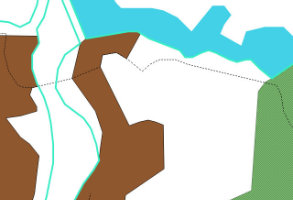
OS Meridian 2
OS Meridian 2 is a vector dataset designed for use in GIS software, ideal for creating small scale maps.
Product DetailsComprised of a number of polyline, polygon and point layers OS Meridian 2 illustrates a number a features at a scale of 1:50,000:
• Coastlines
• Administrative boundaries
• The national road network - Motorways, A-roads & B-roads
• Railway lines & stations
• Settlements
• Hydrological features (at a scale of 1:250,000)
• Major woodlands (at a scale of 1:250,000)
Open Government Licence: PDF
Technical Details
- Supplier
- Ordnance Survey
- Update Cycle
- Coverage
- GB
- Scale
- 1:50,000
- Formats Available
- SHP, TAB
- Stated Accuracy
- Stated Accuracy
- Stated Accuracy
- Licence Options
- Open
- Delivery Timescale
- within 4 working hours
Related Products
OS VectorMap District Raster, OS 1:50,000 colour raster
Download Samples
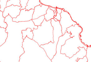
OS Boundary-Line
Boundary-Line™ provides a full hierarchy of boundaries, from district, wards and civil parishes up to parliamentary, assembly and European constituency.
Product DetailsPurchasable as a user defined area and deliverable as both a direct download or web service, Boundary-Line™ provides a full hierarchy of boundaries, from district, wards and civil parishes (or communities) up to parliamentary, assembly and European constituency. Layers include:
• Parliamentary electoral areas
• Westminster constituencies
• Regional government (including Welsh, Scottish & GLA)
• Welsh Assembly
• Scottish Parliament
• GLA
• European Regions
• County, district, metropolitan and London borough wards
• Electoral districts
• Civil Parish and community
• District, metropolitan and London boroughs
• Mean High Water
• Unitary authorities and county boundaries
Open Government Licence: PDF
Technical Details
- Supplier
- Ordnance Survey
- Update Cycle
- Coverage
- GB
- Scale
- 1:10,000
- Formats Available
- SHP, TAB
- Stated Accuracy
- Stated Accuracy
- Stated Accuracy
- Licence Options
- Open
- Delivery Timescale
- within 4 working hours
Related Products
OS MasterMap Topography Layer, OS VectorMap District Raster
Download Samples
OS Strategi
OS Strategi is a vector dataset at 1:250,000 scale designed for use in GIS software
Product DetailsOS Strategi is a vector dataset designed for use in GIS software, is ideal for creating small scale maps and does not need to be re-licensed on a yearly basis.
Comprised of a number of polyline, polygon and point layers OS Strategi illustrates a number a features at a scale of 1:250,000:
• Coastlines
• Administrative boundaries
• The national road network - Motorways, A-roads & B-roads
• Railway lines & stations
• Settlements
• Hydrological features
• Major woodlands
Open Government Licence: PDF
Technical Details
- Supplier
- Ordnance Survey
- Update Cycle
- Coverage
- GB
- Scale
- 1:250,000
- Formats Available
- TIFF, PNG, BMP
- Stated Accuracy
- Stated Accuracy
- Stated Accuracy
- Licence Options
- Open
- Delivery Timescale
- within minutes