
UK geospatial data licensing - A practical guide
This practical, plain-English guide to UK geospatial data licensing explains how mapping/data licences work, including costs, compliance risks, and the differences between Ordnance Survey licensing, open data, and Google Maps.
Whether you're building a mapping application, producing client reports, or supporting operational decisions, understanding your mapping data licence in the UK is essential to staying compliant and controlling costs.
What is a geospatial data licence?
A geospatial data licence is a legal agreement that defines how mapping data can be used, shared, stored, and published. The terms of use are set out by a data supplier eg. Ordnance Survey.
It typically sets out:
• Who can access the data
• Where and how it can be used
• Whether it can be shared with third parties (clients, contractors)
• What happens when the licence term ends
• Any restrictions on copying, modifying, or redistributing data
In simple terms, your licence determines what you are allowed to do with your mapping data.
Why geospatial data licensing matters for UK organisations
Licensing applies to most business and organisational use cases, including:
• Internal operational systems
• Client reports and deliverables
• Websites and public dashboards
• Apps and digital products
• Data shared with contractors, partners, or other key stakeholders
Licensing problems are rarely deliberate. They usually happen because:
• Use cases evolve over time
• Data is reused in new contexts
• Teams share data informally
• Licensing terms were not fully understood upfront
• Copyright statements aren’t displayed on outputs
• Data is used after the term of a data licence has expired
If mapping data breaches the terms and conditions of a data licence, organisations may face compliance issues or enforcement action.
Discover more about geospatial data licensing
Ordnance Survey licensing vs other mapping providers
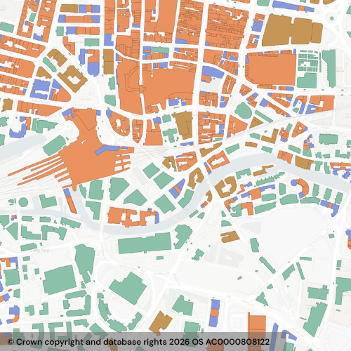
Ordnance Survey (OS) is the UK’s national mapping authority and is widely used across government, infrastructure, utilities, and environmental sectors.
OS data is known for:
• High positional accuracy (down to sub-metre level in products such as OS MasterMap, OS NGD)
• Detailed, structured datasets (buildings, roads, terrain, boundaries)
• National consistency across Great Britain
• Being compliant with geospatial standards
• Trusted, authoritative status
A key strength of Ordnance Survey licensing is its clarity. Licences are typically structured around:
• Internal vs external use
• Commercial vs non-commercial use
• Use in applications, reports, or print
• Third-party access
• Duration and renewal
This structured approach provides strong governance and compliance, particularly for organisations managing data at scale.
Find out more about licensing Ordnance Survey data
Derived data: a common compliance risk
Derived data is data created using existing mapping datasets - for example, analysing or transforming Ordnance Survey data to produce new outputs.
This is one of the most misunderstood areas of geospatial data licensing in the UK.
Key considerations include:
• How the new dataset is created
• Whether the original data can still be inferred
• How the derived data is used, shared, or published
Even if the output looks different, it may still be subject to the original licence terms. Misunderstanding the rules for derived data is a common cause of non-compliance.
Open data vs licensed data
Not all geospatial data requires a commercial licence. Some datasets are released as open data.
For example, OS OpenData provides datasets that are:
• Free to use
• Openly licensed
• Suitable for many general applications
However, there are important differences between open data and licensed geospatial data:
Open data typically offers:
• Lower cost
• Easier access
• Fewer usage restrictions
Licensed data typically offers:
• Higher accuracy and detail
• Greater consistency and coverage
• Stronger guarantees and support
In practice, many organisations start with open data but move to licensed datasets as their requirements become more complex.
Find out more about open data versus commercial data
How much does UK mapping data cost?
The cost of geospatial data requires several considerations beyond the type of data product.
Key cost factors of commercially licensed datasets include:
• Internal vs external use
• Number of users
• Type of use (visualisation, analysis, or product integration)
• Delivery method (download vs API)
• Geographic coverage
• Level of detail and positional accuracy
APIs and usage-based pricing
Many providers offer mapping data via APIs. These:
• Scale easily
• Enable rapid development
• Reduce in-house data management
However, APIs often introduce usage-based pricing, meaning costs can increase quickly without monitoring.
Organisations can also end up overpaying by licensing more geographic coverage or detail than they actually need.
Find out more about the cost of digital mapping
Google Maps vs Ordnance Survey for UK business use
Alternative providers such as Google Maps are popular because they:
• Are quick to implement
• Offer global coverage
• Provide simple, developer-friendly APIs
• Bundle multiple services together
However, they often come with restrictions around:
• Data storage and caching
• Offline use
• Reuse of mapping content
• Combining with other datasets
In many cases, you are licensing access to a service rather than the underlying data.
Choosing the right mapping data for your project
There is no single “best” option - the right choice depends on your specific use case.
Some mapping/data products offer:
• Lower upfront cost
• Global coverage
• Fast deployment
• Simple contextual mapping visualisation
Ordnance Survey data is often a good choice when you need authoritative mapping that provides:
• High accuracy (detail and currency)
• Rich, structured data
• Long-term data governance
• Clear and structured licensing
In simple terms:
• Ordnance Survey typically offers structure and certainty
• Other providers can offer flexibility, lower cost and convenience
Use our checklist to help identify the type of data you need in your business
Latest News
UK geospatial data licensing - A practical guide | Emapsite
Whether you're building a mapping application, producing client reports, or supporting operational decisions, understanding your mapping data licence in the UK is essential to staying compliant and controlling costs.
Read Full Article-
Six Location Data Challenges for Consultancies | Emapsite
Read Full Article -
Future-proofing Assets Against Flooding in Britain
Read Full Article