





How do I create a Location Plan?
What is a location plan?
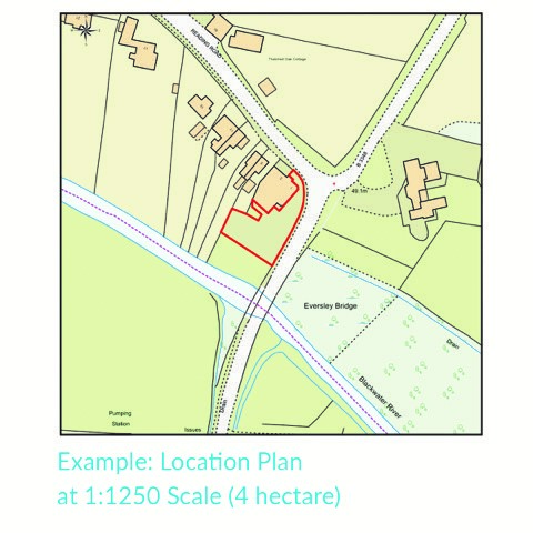
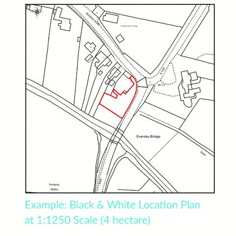
A location plan is the “WHERE” aspect of your planning application. It shows where you are proposing your development and will include a fairly large area around the development site.
It is typically submitted at a scale of 1:1250.
What is the purpose of a location plan?
It helps to show wider impact on the location. If your planning authority requests both a block plan and a site plan they will require more detail of the area around the proposed development, details further out than your boundaries.
What should a location plan show?
It depicts:
- Nearby roads, buildings and other properties.
- Block plan and site plan The block plan site plan shows the development site at a scale of 1:500 and includes the precise position of:
- The building
- Any other structures inside the boundaries
- Access Roads
- Car Parking
- The land you own.
All these plans are necessary to make an application in the planning process.
Need to buy a location plan?
You can easily create your own location plan and all other required plans on plans.emapsite.com. Our plans are 100% compliant with planning portal guidelines.
Still need help?
Download our 'Quick guide to location plans' guide.
Latest News
OS NGD Explained: A beginner’s guide to Ordnance Survey’s National Geographic Database
Learn what the OS National Geographic Database (OS NGD) is, how it works, and why it matters. A simple guide to Britain’s next-generation geospatial data platform.
Read Full Article-
UK geospatial data licensing - A practical guide | OS Mastermap licensing explained
Read Full Article -
Six Location Data Challenges for Consultancies | Emapsite
Read Full Article