
Getting Fresh With Location Data
Everyone knows this is true: the landscape doesn't move very much. Or does it? Here in the UK, we're rarely affected by momentous tectonic movements. It's climate change and political momentum that's literally, if slowly, moving the goalposts.
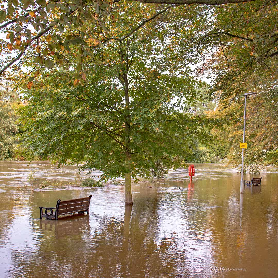
Climate change is never out of the news these days, nor are the decisions being made in the corridors of power that affect our everyday lives, and our civil and industrial infrastructure. You don't need us to provide a long list of stakeholders – housing developers, consumer-focused organisations, utility firms – we're all living and working on the same list, we're all experiencing the same weather, and we're all aware money is tight but those extreme weather events are having an impact.
Weather is getting more unpredictable. Floods, storms — these aren’t isolated events anymore, they’re part of the new normal. In short, it's never been more important to have high quality, verified location data at your fingertips, whenever you're making decisions that include an element of 'where?' Regularly updated datasets are crucial to ensure whatever you're working on will be compliant, safe, resilient, and future-proofed.
Why Keeping Your Location Data Up to Date is Critical
This isn't a lesson in 'location data is useful': you're all experts in your own field. But think about the recent flooding and the weather patterns we've seen just this year and then consider the plans or reports you produced in November or even December. Are they still accurate?
If you're working anywhere in the renewables, energy or infrastructure environment for example, you know that one of the largest stress-points for your industry is disruption to the network. If a fibre exchange cabinet gets flooded, that could mean thousands of homes suffer an outage. The knock-on effects for maintenance schedules and overtime are terrifying. Everyone needs access to the most up to date, accurate information – what’s being built, where new permissions have been granted, and what the flood risks are to those properties and their associated network infrastructure.
If you're in any way connected to newbuilds, construction, or housing of any kind, then you know efficiency has always been a watchword: knowing who's working where, when, and how, is the key to keeping productivity up and overtime and disruption down. An unexpected flood or an unpredicted area of subsidence can upset even the best laid plans. But it's not just the housing industry that needs fresh data – homeowners are getting in on the act, too. Purchasers, in particular, expect to be better-informed about the risk of flooding and subsidence-risk for properties they're considering, and they want that detail early on during the conveyancing process. Spurred on by government, the planning ecosystem and the legal industry are trying to conduct major reform to speed up those transactions, saving time and money for all concerned. That means more data. Better data, better-connected, and fresher data throughout the property lifecycle.
And of course, if you're working in any part of the insurance industry, you know the impact of climate change is not new-news. Multiple data sources are the way forward, and the risk profiles aligning with that information about what's happening where, can only improve with granular detail.
If you're relying on older flood maps in particular, then you might have missed recently-recorded evidence of flooding. Similarly, not factoring in temperature shifts could mean overlooking new heat risks or failing to optimize energy efficiency for designs. To ensure projects stay on track, your team needs location data that reflects current conditions, not what was true a few years - or months - ago.
"A few years ago, months' old location data was adequate. Today, the more accurate your data, the better your projections; the better your projections, the lower your costs... and the more you can focus on increasing the value of your customer proposition. Housing, accommodation, services."
Location Data From the Ground Up
Whatever you're using them for, if your location datasets aren't regularly updated, then you’re making decisions based on outdated assumptions that might not hold true anymore. For instance, a region that was once considered safe from flooding might now be at higher risk due to changing rainfall patterns or new development in upstream areas. Keeping your location and weather data current gives you a clearer picture of real-time risks.
The Benefits of Fresh Location Data
Proactive risk management, future-proofing, long-term business strategies ... these may sound trite, but that doesn't make them less relevant. The more up-to-date your data is, the more accurately you can assess risks that may affect your project. With everything else going on, you may not have thought about checking your datasets 'use-by' date in a while - which is where we can help, of course.
Regulatory compliance is another, often overlooked area in which outdated data has an impact. Local governments and regulators are increasingly taking climate change into account, and expect to see evidence that you're up-to-date with underlying information, feeding into your services. Keeping your data fresh ensures you stay on the right side of regulations and avoid costly delays.
How to Keep Your Location Data Up to Date
In short, we believe that web-hosted location data removes doubt, reduces risks and costs, and ensures currency - that's our recommendation to most, enterprise-sized location data consumers. However, not everyone needs to ingest gigabytes of refreshed location data each year: sometimes you need data from a comparatively small area, or insights that are specific to your development site alone and not the surrounding area. Again, this is where we can help.
Latest News
OS NGD Explained: A beginner’s guide to Ordnance Survey’s National Geographic Database
Learn what the OS National Geographic Database (OS NGD) is, how it works, and why it matters. A simple guide to Britain’s next-generation geospatial data platform.
Read Full Article-
UK geospatial data licensing - A practical guide | Emapsite
Read Full Article -
Six Location Data Challenges for Consultancies | Emapsite
Read Full Article