
Decoding the OS National Geographic Database – the opportunity for Utilities
Containing half a billion data insights on Britain’s landscape, the Ordnance Survey’s National Geographic Database (OS NGD) could be nothing short of a game-changer for utility companies… but uptake has been sluggish. We explain what it is, why your organisation needs it and how to migrate at pace.
Launched in 2022, the intention of the OS National Geographic Database is to bring together every piece of authoritative geographic data for Great Britain in one location. Data that has been redesigned and reengineered so it’s easier to access and easier to understand. Data built for better analysis.
As a single store of all Ordnance Survey (OS) data, it contains over half a billion geographical features and descriptive information – for Buildings, Addresses, Land, Land Use, Structures, Transport and Water networks. Information includes building use, land use, building age, construction materials, building description, basement presence, enhanced land cover… and with 20,000 updates submitted every day, the list really does go on.
Plus, as well as being more current, more consistent and more accurate than any previous dataset, it also provides greater flexibility in data use. OS has described it as “the biggest step change in access to OS data in a generation.”
Empowering utilities
Simple and direct access was one key aim of the OS NGD’s conception; another was making insights and information more discoverable.
Hence, the OS NGD data structure and categorisation makes the data you need easy to search, find and analyse. Which can empower utilities companies in three ways: it can streamline the efficiency of managing assets, biodiversity and carbon offsetting; it can improve the identification of network disruption and potential risk, and of customer base profiling; and it can optimise land estate, network planning and adapting for climate change. Business model futureproofing, in other words.
Piqued your interest already? Skip ahead to our full Idox Geospatial report: Navigating the National Geographic Database
Weeks to hours
“Currency is another major benefit of the NGD,” says Dean Paulley, OS Head of Product. “From our surveyors and other data sources, we make about 20,000 updates to our database every day. You can imagine, if you are on the old, six weekly update cycle, just how far out of date your data has become in those six weeks.”
All the above sounds incredible, obviously, but what does it mean for your utility company?
The OS NGD’s data allows utilities to derive opportunity from and understand more about risk to their building and infrastructure assets, their networks, and their customers. As Daniel Slater, Commercial Director of Idox’s Geospatial division points out, “For utility companies, it’s an enhancement for their base map. The OS NGD provides an analytical database that allows them to do more. A lot more.”
Mapping risks and opportunity
Utility companies map their own networks. But often, not the things that have an impact on those networks. Understanding more about risk to building and infrastructure assets, their networks or indeed their customers, is transformative.
As Idox Geospatial’s Daniel Slater notes, those are all areas where OS NGD can provide invaluable insight, “Utility companies need to map their assets in the ground, they need to map risk, and they need to know where their existing customers are, and new customers will be. To that end, all factors in the NGD will have a value to utility companies.”

Why the slow uptake?
Let’s address some elephants. Many utility companies find six weekly data updates hard enough to consume and – particularly – to federate across their employees. So why go to weekly or even daily updates? And then there are the twin issues of cost and change…
OS NGD data has been designed to be easy to analyse. Idox Geospatial make it easy to consume. As for cost, “We can solve that problem,” says Slater. “This is the opportunity to move to a managed, cloud-based solution — and remove the overhead for managing mapping data completely.”
The time and resources freed up can be redeployed towards achieving long-term strategic objectives – objectives which OS NGD can also help you with directly.
Getting to net zero
Six of the biggest infrastructure-focussed companies in the UK – Anglian Water, Heathrow, Lower Thames Crossing, National Highways, Northumbrian Water and Sellafield – have set phase-out dates for fossil fuel use. They’ll be diesel-free by 2027 and net neutral by 2050. The UK’s major fibre companies say the same thing. They’ve committed to net zero by 2028 -2050. It’s the same for water utilities. And, of course, for energy utilities.
Achieving net zero won’t be easy. Unlocking all the potential value won’t be easy, either. Data-driven insights will, again, be the difference. An organisation can only manage what it can measure, after all. To which, OS’s Jessica Gaskell says: “This new product [OS NGD] is providing data that we have never provided before. Consistently modelled and applied across Great Britain, to give users a comprehensive picture of the built environment in the country.”
Facilitation of access
Understandably, Ordnance Survey is careful about who it shares its data with. Therefore, utility companies that want to gain access, and to unlock the deeper levels of insight made possible, can do so with the assistance of location data specialists.
OS only provides direct access to the OS NGD to Public Sector Geospatial Agreement (PSGA) members and OS partners like Idox Geospatial. And because every utility company has a unique model, risk appetite and data needs, Idox Geospatial’s OS NGD products and services are flexible. Which doesn’t just mean around licensing and scale, but also how the data is provided and presented.
Says Idox Geospatial’s Product Director, Richard Barnes: “As a strategic partner of OS, our job is to provide clients with different ways to get to the data effectively. We make sure that it is delivered, how they want it and when they need it.”
Navigating the OS National Geographic Database
Find out more about how to migrate to the OS NGD at your own pace use it to uncover more of the location data insights that matter to you – read our in-depth report.
Latest News
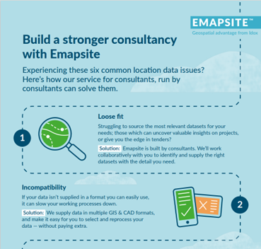
Six Location Data Challenges for Consultancies | Emapsite
Location data is critical to consultancy work, yet common issues like outdated datasets, licensing uncertainty, and incompatible formats can slow projects down and increase risk. This infographic explores six of the most frequent location data challenges faced by consultancies today — and how teams are overcoming them with reliable, compliant, and easy-to-use spatial data.
Read Full Article-
Future-proofing Assets Against Flooding in Britain
Read Full Article -
Why address data is the unsung hero in the UK’s new-build recovery
Read Full Article