
How to order a planning map on Emapsite
Maps for planning applications
A planning map is used for planning applications, listed building and conservation area consent, prior notification applications, land registration applications and sometimes used for connecting utilities and licence applications. When you purchase a planning map it is automatically processed and emailed to you within minutes. We have a customer support team who can help if you’ve made a mistake on your order.
Emapsite makes ordering a planning map straightforward. You can create custom planning applicationplanning mapsfrom £9.99 + VAT that are 100% compliant with the planning portal though our ordering platform. If you’re a regular buyer too you may qualify for a discount.
Can I view my planning map before purchase?
We make it easy to see what you are buying before your purchase. You can view your planning map first before download. Don’t worry if your map is unusually large, you’ll be able to download that too.
Can I edit my planning map?
You can edit your map at a later date for no extra cost for up to 12 months. You can also make annotations and mark up a site plan before you download.
What's the difference between a lite and a professional user on your planning application app?
Professional account holders can add their own reference and PO number before checking out, and may qualify for frequent buyer discounts.
Our planning maps are 100% compliant with current government planning guidelines.

How to order your planning map.
The ordering process is simple.
1. Go to plans.emapsite.com
2. Enter your postcode or title number and select your plan.
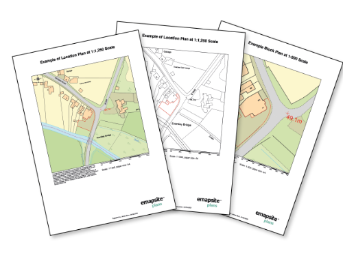
- a) A4 Location Plan 1:1250
- b) A4 Site / Block Plan 1:500
- You can choose one, or both and decide if you’d like colour or black and white
(there’s no additional charge for colour).
- You can annotate your plan by adding a title and notes. Your personalisation will automatically appear.
3. Edit your plan.
- Use our drawing tools, choose your colour and line thickness.
4. Add to basket and check out, or add another plan to your order.
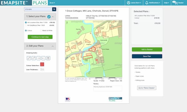
If you’re ready to check out you can check your product details, you can also edit your planning map too. Simply accept licences / licenses, review and place your order. Professional account holders can add your own reference and PO number before you check out too.
OS MasterMap PDF Location Plan
A plan at 1:1250 scale in PDF format tailored for submitting to your local authority for a range of planning applications
More info >All Location Plans come complete with a north arrow and scale bar automatically. Your plan is free to edit after purchase.
Location Plans are processed automatically and a PDF plan is emailed within minutes.
Unusually large plans are made available to download, which also typically takes just a few minutes.
Location Plan PDFs are ready to send to your local authority electronically and ready to print.
Licence: PDF
Technical Details
- Supplier
- Ordnance Survey
- Update Cycle
- 6 weekly
- Coverage
- GB
- Scale
- 1:1250
- Formats Available
- PDF, PNG
- Stated Accuracy
- Stated Accuracy
- Stated Accuracy
- Licence Options
- Perpetual
- Delivery Timescale
- Within minutes
Related Products
OS MasterMap Topography Layer, Aerial Photography
Download Samples
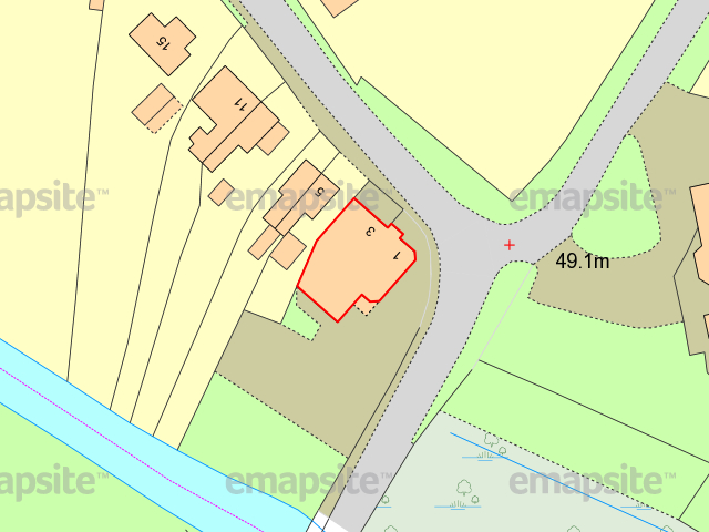
OS MasterMap PDF Site/Block Plan
A colour plan at 1:500 scale in PDF format tailored for submitting to your local authority for a range of planning applications.
More info >All Site/Block Plans come complete with a north arrow and scale bar. Your plan is free to edit after purchase.
Site/Block Plans process automatically and are ready within minutes.
Unusually large plans are made available to download, which also typically takes just a few minutes.
Site/Block Plans are ready to send to your local authority electronically and ready to print.
Licence: PDF
Technical Details
- Supplier
- Ordnance Survey
- Update Cycle
- 6 weekly
- Coverage
- GB
- Scale
- 1:500
- Formats Available
- PDF, PNG
- Stated Accuracy
- Stated Accuracy
- Stated Accuracy
- Licence Options
- Perpetual
- Delivery Timescale
- Within minutes
Related Products
OS MasterMap Topography Layer, Aerial Photography
Download Samples
OS MasterMap 1:500 Scale Block/Site Plan in Colour (A4): PDF
(Black & White also available)