![]()
Geospatial Data Solutions
to help solve your critical real-world challenges.
Get the insights you can trust.

Access a huge range of data
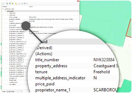
At Spatialise, we have access to a huge range of data. Everything ranging from well-known mapping data from leading suppliers, to disparate silos of geospatial data such as planning constraints and ownership.
Working together, we can select the data components and platform to create a solution that’s right for you. Supporting you to solve business challenges whilst driving towards Net Zero.