
Site Plans for planning applications explained
What is a site plan?
A site plan, also known as as a block plan, shows the land area involved in a planning application.
It’s concerned with the site and it shows the intended location of the development site in respect to the property boundary line.
Site Plans for planning applications explained
Site planning may also be used by surveyors and architects to show the details of a site, such as the location of a new building, and includes drainage, tree roots, etc. However, a site plan isn’t a document for those involved in the planning process, such as a planning officer.
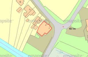
Site plans for planning applications show the property location outlined typically in red. It shows the boundaries of the site and the features immediately next to it, such as a road or a nearby building.
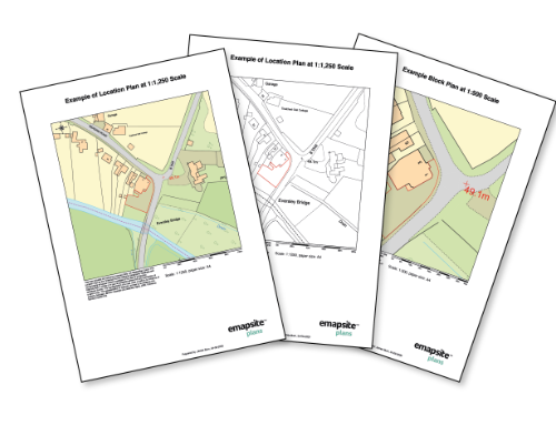
Site planning should be at an identified metric scale, government guidance outlines 1:200 or for larger sites 1:500 and must show the North direction too. If you seek clarification before you order your local planning authority will advise.

What’s the difference between a site plan and a location plan?
A location plan shows where your development is proposed in relation to surrounding properties. Just like site plans it has to be submitted at a defined scale (usually 1:1250) with the proposed development outlined in red. If you own any other land close or adjoining these are outlined in blue.
What’s the difference between a site plan and a floor plan?
A site plan is a view from above of the entire property, while a floor plan shows a building footprint and includes the interior walls and features.
How do I obtain a site plan of my property?
You can create and buy your site plan and location plan on plans.emapsite.com and attach them to your application.
Our plans are downloaded as a PDF and are compliant with government planning guidelines.
We are an Ordnance Survey Licensed Partner

OS MasterMap PDF Location Plan
A plan at 1:1250 scale in PDF format tailored for submitting to your local authority for a range of planning applications
More info >All Location Plans come complete with a north arrow and scale bar automatically. Your plan is free to edit after purchase.
Location Plans are processed automatically and a PDF plan is emailed within minutes.
Unusually large plans are made available to download, which also typically takes just a few minutes.
Location Plan PDFs are ready to send to your local authority electronically and ready to print.
Licence: PDF
Technical Details
- Supplier
- Ordnance Survey
- Update Cycle
- 6 weekly
- Coverage
- GB
- Scale
- 1:1250
- Formats Available
- PDF, PNG
- Stated Accuracy
- Stated Accuracy
- Stated Accuracy
- Licence Options
- Perpetual
- Delivery Timescale
- Within minutes
Related Products
OS MasterMap Topography Layer, Aerial Photography
Download Samples
OS MasterMap PDF Site/Block Plan
A colour plan at 1:500 scale in PDF format tailored for submitting to your local authority for a range of planning applications.
More info >All Site/Block Plans come complete with a north arrow and scale bar. Your plan is free to edit after purchase.
Site/Block Plans process automatically and are ready within minutes.
Unusually large plans are made available to download, which also typically takes just a few minutes.
Site/Block Plans are ready to send to your local authority electronically and ready to print.
Licence: PDF
Technical Details
- Supplier
- Ordnance Survey
- Update Cycle
- 6 weekly
- Coverage
- GB
- Scale
- 1:500
- Formats Available
- PDF, PNG
- Stated Accuracy
- Stated Accuracy
- Stated Accuracy
- Licence Options
- Perpetual
- Delivery Timescale
- Within minutes
Related Products
OS MasterMap Topography Layer, Aerial Photography
Download Samples
OS MasterMap 1:500 Scale Block/Site Plan in Colour (A4): PDF
(Black & White also available)