
OS MasterMap Products
Authoritative Large-Scale Mapping Data for Professional Use
OS MasterMap® is Ordnance Survey’s most detailed digital mapping dataset for Great Britain. It provides structured, feature-level geographic data for organisations that require accurate base mapping, network intelligence and terrain modelling.
Used across planning, infrastructure, utilities, environmental assessment and asset management, OS MasterMap datasets are vector-based and designed for integration within GIS and CAD systems.
Available in industry-standard formats, with expert licensing guidance from Emapsite.
How OS MasterMap Data Is Used
OS MasterMap datasets underpin critical geospatial workflows across public and private sectors.
They are widely used for:
- • Planning and development submissions
- • Infrastructure and utilities design
- • Asset and land management
- • Environmental modelling
- • Transport and network optimisation
- • Urban regeneration projects
Because datasets are structured and interoperable (via TOID and USRN identifiers), they integrate seamlessly into GIS, CAD and enterprise spatial systems.
For organisations requiring reliable, authoritative spatial data, OS MasterMap provides the foundation.
Choosing the Right OS MasterMap Product
Selecting the correct dataset depends on your objective:
- • Detailed feature-level base mapping → Topography Layer
- • 3D modelling or elevation analysis → 3D Building Heights and Terrain 5
- • Road network and routing intelligence → Highways Network
- • Watercourse and flood modelling → Water Network Layer
Many projects benefit from combining datasets to create a complete spatial framework.
Emapsite provides guidance on:
- • Product selection
- • Licensing requirements
- • Data formats
- • Integration into GIS and CAD systems
Speak to our team to ensure you source the right OS MasterMap dataset for your project.
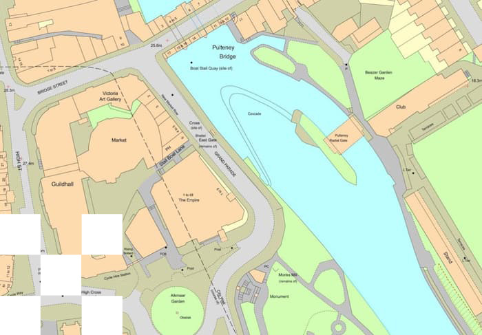
OS MasterMap Topography Layer
Detailed Mapping of Over 500 Million Features
OS MasterMap® Topography Layer provides a digital representation of 500+ million real-world features and intangible objects across Great Britain, surveyed at scales from 1:1,250 in urban areas.
It includes:
- • Building footprints
- • Roads and paths
- • Land parcels and property extents
- • Physical boundaries (walls, fences)
- • Water and rail features
- • Surface and functional site detail
Every feature is assigned a unique Topographic Identifier (TOID), enabling integration with other Ordnance Survey datasets such as Highways Network and AddressBase.

Ideal for:
- • Planning and development mapping
- • Infrastructure design
- • Asset management
- • Environmental analysis
- • Land referencing
Available in GIS and CAD formats from £19.99, this dataset forms the authoritative spatial framework for professional mapping projects.
OS MasterMap 3D Building Heights and Terrain 5
Elevation Data for Advanced Spatial Modelling
Enhance 2D mapping with vertical insight.
3D Building Heights
Provides height attributes for buildings derived from OS MasterMap Topography Layer. Suitable for:
- • 3D city modelling
- • Line-of-sight analysis
- • Solar and shadow studies
- • Telecommunications planning
- • Urban design simulations


Terrain 5
A 5-metre resolution Digital Terrain Model (DTM) representing the bare-earth surface across Great Britain.
Used for:
• Flood risk modelling
• Drainage and hydrological analysis
• Infrastructure route planning
• Environmental assessments
These datasets support more accurate modelling, visualisation and risk analysis in GIS environments.
OS MasterMap Highways Network
Road Geometry, Routing and Asset Responsibility Data
OS MasterMap® Highways Network provides detailed geometry and attribution for the entire GB road network.
It includes:
- • Road centrelines and classifications
- • Turn restrictions
- • Height, weight and width restrictions
- • Street naming
- • Asset management data (including responsible maintenance bodies)
Designed to integrate with:
- • Topography Layer (via TOID)
- • AddressBase datasets (via Unique Street Reference Number – USRN)

Supports:
- • Transport modelling
- • Street works coordination
- • Capital project planning
- • Logistics and doorstep delivery optimisation
- • Infrastructure maintenance planning
The Highways Network dataset delivers both spatial accuracy and routing intelligence for advanced network analysis.
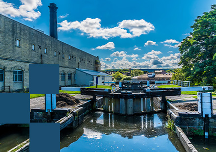
OS MasterMap Water Network Layer
Connected Watercourse Data for Environmental and Infrastructure Planning
OS MasterMap® Water Network Layer provides a structured and connected representation of rivers and watercourses across Great Britain.
It includes:
- • Watercourse centrelines
- • Flow direction
- • Connectivity between features
- • Unique water identifiers

Commonly used for:
- • Flood risk assessment
- • Catchment modelling
- • Environmental compliance
- • Infrastructure planning near water bodies
The dataset supports hydrological modelling and spatial analysis within professional GIS systems.