





Introduction
Ordnance Survey’s National Geographic Database (OS NGD) is changing how geospatial data is created, accessed, and used across Great Britain. But if you’re new to it, it can feel quite complex.
So what exactly is the OS NGD - and why does it matter?
In this guide, we explain everything in simple terms, from what it is to how organisations are already using it.
What is the OS NGD?
The OS National Geographic Database (NGD) is a single, unified database that contains detailed location data for Great Britain.
It brings together over 500 million geographic features - including buildings, roads, rivers, and addresses - into one consolidated system.
In simple terms, it’s like a live, digital map of Britain that you can search, analyse, and integrate within your GIS and CAD systems.
Key facts
• A single source of geospatial data for Great Britain
• Over 500 million mapped features
• Updated daily or near real-time
• Accessible via APIs and data downloads
• Designed for analytics, integration, scalability, and modern application
Why was the OS NGD created?
Before the NGD, Ordnance Survey data was delivered through multiple separate data products.
This created common challenges:
• Data stored and managed in different places
• Large downloads - even when only small amounts of data were needed
• Difficulty combining datasets (eg. variations in scale of capture across data products)
• Complex licensing and management
The OS NGD solves this by providing a single platform-based approach. This means you access just the data you need, when you need it.
What does the OS NGD replace?
OS NGD will take time to fully embed as it is a gradual rollout, so the NGD won’t immediately replace legacy Ordnance Survey data products. What it does is lay the foundations for their future evolution. As a result, there will be dual running with legacy datasets.
• Gradual migration away from traditional OS data products like OS MasterMap and OS AddressBase
• New products and services built directly on the NGD
• Legacy formats becoming less central
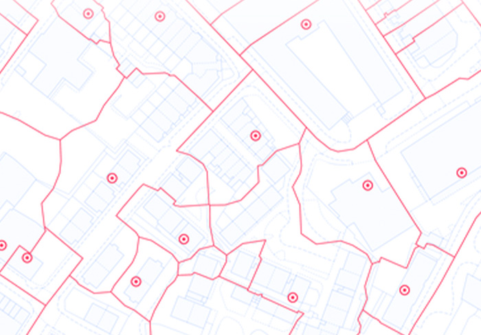
How the OS NGD works (a simple explanation)
The NGD organises data in a way that’s much easier to understand and use.
It uses three levels:
• Themes – broad categories (eg. Buildings, Land, or Transport)
• Collections – groups of related data within each theme
• Features – individual real-world objects (like a specific building or road)
Think of it like folders on your computer:
• Themes are the main folders
• Collections are the subfolders
• Features are individual files
This structure makes it easy to find and extract exactly what you need.
The nine OS NGD themes explained:
THEME | COLLECTIONS | EXAMPLE FEATURES |
Address | Comprehensive UK address data, including residential, commercial, postcodes, and pre-build properties | A point showing an address or an area indicating the extent of a postcode unit |
Administrative & Statistical Units | Boundaries and geographic areas such as electoral units, postcodes, and functional areas | An area showing a Local Authority boundary or a Census area |
Buildings | Detailed building footprints, individual parts, and access points | An area showing the extent of a building/property |
Geographical Names | Named locations including towns, villages, landmarks, and natural features | A point locating a place |
Land | Natural and man-made surfaces - land cover data showing natural features and man-made surfaces | An area showing the extent of a sports field |
Land Use | How land is used - information on how land is used, such as schools, hospitals, and commercial sites | Indicating industrial area land parcels or farmland |
Structures | Man-made features that are not buildings, including bridges, masts, and monuments | A line or points indicating the extent of a bridge over a canal |
Transport | Road, rail, and transport network features supporting routing and infrastructure analysis | A line showing the extent of a section of a motorway or a segment of a railway line |
Water | Rivers, lochs, lakes, canals, and other water features for hydrology and environmental insights | A polygon showing the extent of a loch, or a line showing a section of river |
What makes the OS NGD different?
1. A single source of data - all data sits in one system, improving consistency and accuracy.
2. More detailed data - each feature includes useful information (called attributes), such as:
• Building height and age
• Number of floors
• Construction materials
3. Near real-time updates - data is updated frequently (often daily), so it’s always current.
4. Flexible access - you can access data in different ways:
• APIs (for apps and live systems)
• Downloads (for GIS and analysis)
• Modern formats like GeoJSON
5. Query only what you need - instead of downloading entire datasets, you can extract:
• A specific area
• A single feature type
• Selected attributes
What this means for your organisation or business
The OS NGD changes how organisations work with geospatial data.
Traditional approach:
• Download large datasets
• Store static files
• Update occasionally
With OS NGD:
• Access data via APIs
• Integrate with cloud systems
• Work with continuously updated data
• Faster, more flexible, and more scalable workflows
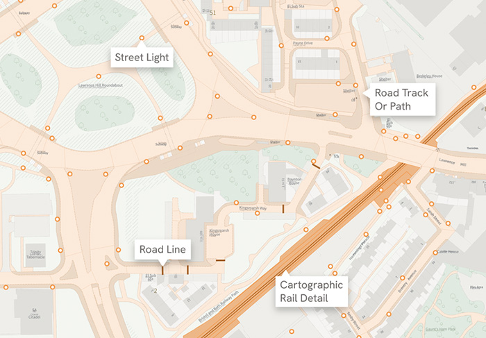
Common use cases across industries
The OS NGD supports a wide range of sectors:
• Urban planning – managing land use and development
• Transport & logistics – route optimisation and network planning
• Utilities & energy – asset management and risk analysis
• Emergency services – faster response with accurate location data
• Environmental analysis – flood modelling and land monitoring
• Property & real estate – site selection and valuation
• Telecommunications – network planning and coverage analysisRetail – choosing the best locations for stores
OS NGD data currently available from us
Join thousands of users who use our platform to make ordering and managing digital maps easier.
• OS GB Address
• OS Transport Network
• OS GB Postcodes
• OS Water Network
The latest releases of OS NGD are available to buy through Mapshop, giving you instant access to available OS NGD in the format you want, any time you need it.
Are there any challenges?
Moving to the OS NGD may require:
• Updating older GIS systems
• Learning new data structures
• Adapting to API-based workflows
These challenges should lead to long-term benefits.
Why the OS NGD matters
The OS NGD reflects a bigger shift in how geospatial data is used:
• From static datasets to live data platforms
• From siloed tools to connected systems
• From complex access to easy, flexible use
As organisations rely more on location data, platforms like the NGD are becoming essential.
The OS National Geographic Database is more than just a new dataset - it’s a new way of working with geospatial data.
For organisations, it means:
• Easier access to data
• Better data quality
• More powerful, real-time insights
Contact us
Those who adopt OS NGD early will be better positioned to build smarter, data-driven solutions.
We are here to support your adoption and use of the OS NGD and offer a range of services to help you.
Please contact hello-geo@idoxgroup.com for more information.